June, 1992

Sunday |
Monday |
Tuesday |
Wednesday |
Thursday |
Friday |
Saturday |
21 June |
22 |
23 |
24 |
25 |
26 |
27
|
28
|
29
|
30
|
1 July
|
2
|
3
|
4
|
5
|
6
|
7
|
8
|
9
|
10 |
11 |
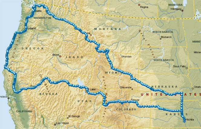
Being a trip of thirteen days on a great diagonal up to North Cascades National Park, down the coast, and across on a fairly direct return to Wichita (this uninspired last part done mainly on account of a pair of completely blown rear shocks that made riding wearing, at best).
 Kansas
I left Wichita sometime around 10:00, not being in any great hurry. In fact earlier that morning the weather was so bad that I wasn't sure if I would be going anywhere. Later in the morning it looked, at least, like it might clear up towards the north, so I headed that direction.
I shot straight up US-81 to York, Nebraska and then turned west on Interstate 80. This is all fairly routine area for me so I didn't take any photographs along the way, nor did I stop much.
 Nebraska
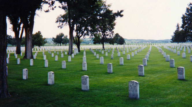
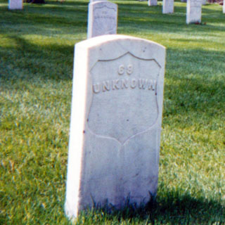
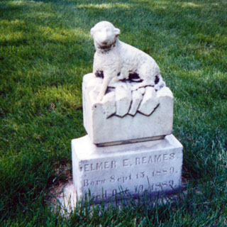
Just to the east of North Platte I stopped for a spell at Fort McPherson National Cemetery, which is about five miles south of the Platte River. I was amazed at the large number of stones that were marked "Unknown". The little sheep headstone for the infant Elmer Beames (1889) is the best one I've ever seen (I frequently stop at interesting cemeteries).
I then headed west to Ogallala where I turned north in order to stay on the route of the Oregon Trail.
The following two photographs were taken at Ash Hollow, a well known resting stop on the Oregon Trail (this was my fifth time through this area).
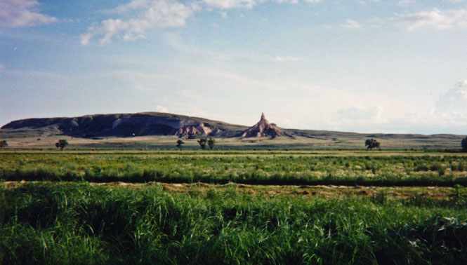
Just west of Scottsbluff is Chimney Rock, also a well known monument along the Oregon Trail.
I spent that night in at Scottsbluff. That evening I walked up main street watching the high-school age (I suppose) people cruising up and down the street. There were a lot of cars out there, and there were an equally large number of people doing just what I was doing-- watching.
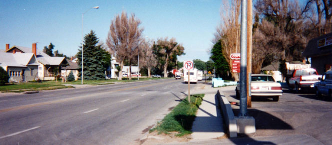
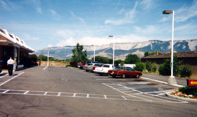
This is a rather pedestrian shot of the town of Mitchell, Nebraska. There's nothing really special about it except that it's where I filled up at the Conoco station, although really, I always thought that pictures like this would be much more interesting than ordinary scenery shots, in the future.
 Wyoming
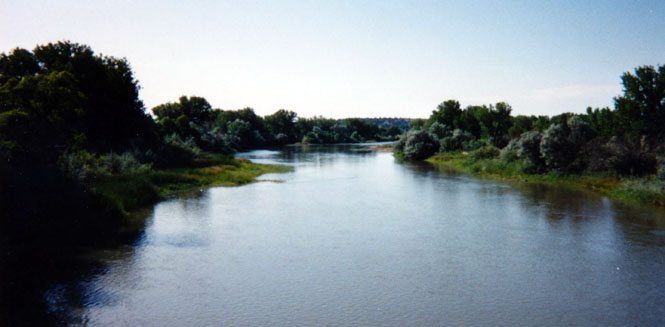
Not too many miles across the state line into Wyoming I stopped at Fort Laramie National Historic Site. This bridge over the Platte River (built in 1880) is no longer used by anything except foot traffic.
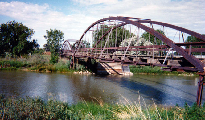
Taken while standing on the bridge (I always have such a sense of history on the Platte River).
Fort Laramie.
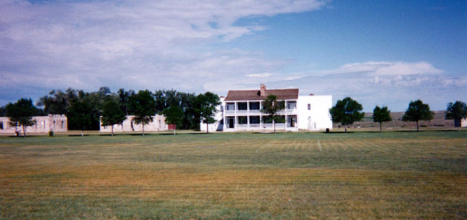
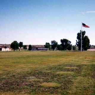
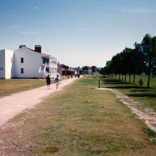
They've done a really nice job of restoring the Fort, and have left some buildings in an attractive state of suspended decay. Not far from the Fort I stopped at a rest area that had a rather clever method of pointing out the sites.
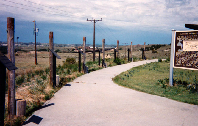
The photograph shows the posts in the ground through which one-inch diameter pipes have been driven all the way through through. By looking through the pipes you can see exactly what the plaque just below the pipe is describing. Simple and effective.
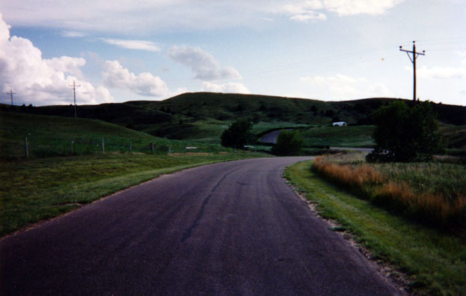
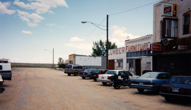
I rode west until I hooked up with interstate 25 and took it north as far as Casper before heading due west again. It was along this road that I went through some of the heaviest rain of the entire trip (excepting perhaps the ten minutes or so along the Oregon coast) and had to temporarily seek shelter under an old shack. In any event, by the time I reached the small town of Shoshoni the clouds had cleared away. The photograph shows the bustling streets of Shoshoni. That's my motorcycle parked with the cars. There's something endearing about a new town that builds its wide Main Street out to the edge of the prairie. Whatever magnificent growth they were expecting over 100 years ago, it didn't happen.
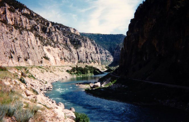
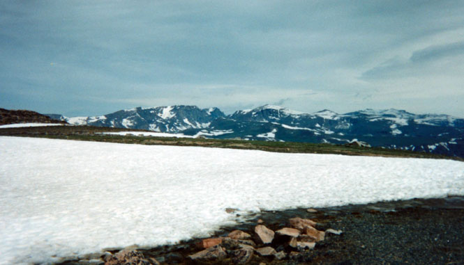
From Shoshoni I turned north and was finally riding along a road I hadn't yet been on before (but have always wanted to). Just south of Thermopolis, Wyoming is the Wind River Canyon. This shot is looking up-stream along the road I just came down. A really beautiful place and quite unexpected. I'll need to ride this route again.
At a rest stop not far from Grass Creek.
When I reached Cody I had to decide whether to turn west into Yellowstone or continue north into Montana. As I had already been on that particular road into Yellowstone several times already, I just kept on going north--something new.
 Montana
My goal was the town of Red Lodge, where I planned to spend the night before heading south into Yellowstone.
The secondary road into Red Lodge (from the east) passes over a high ridge that is well above the tree line. About the time I arrived, the sun was just a half-disk on the horizon. This was largely irrelevant, however, as the sky had now become completely overcast with very dark clouds. And, about the time I reached the top of the hill it started raining quite hard accompanied by huge amounts of lightning.
I realized that I was riding at the same level as the storm (or rather, in the storm), and as there were no trees anywhere, I was the highest thing around. Probably not a smart place to be riding.
Anyway, as there was really no place to stop and get out of the storm, I kept on riding until the road dropped down the other side into the town of Red Lodge. That ride along the top of the ridge--with constant lightning above and below--was one of the more dramatic rides I have ever had. Surreal, even.
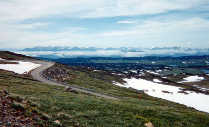
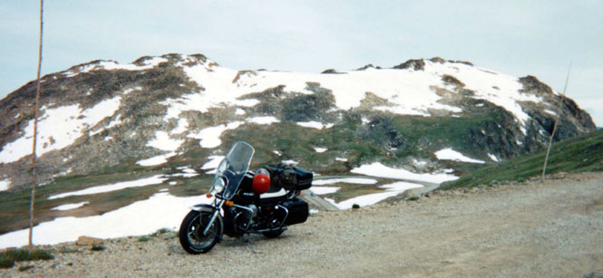
 Beartooth Pass is a near-11,000 foot pass along the
Montana-Wyoming border just north of Yellowstone and is one of the more
spectacular roads in America.
Beartooth Pass is a near-11,000 foot pass along the
Montana-Wyoming border just north of Yellowstone and is one of the more
spectacular roads in America.
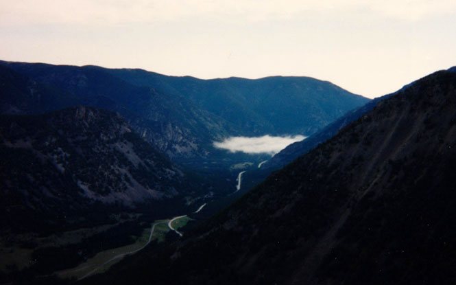
If you look at the photograph, below, you'll see a cloud bank in the valley (we're looking towards Red Lodge). Of course, when you're riding in a cloud it's called fog. That fog extended all the way to Red Lodge that morning and it created a very strange condition. As you can see the sky was otherwise quite bright, so I rode in a condition of near white-out for about ten miles. The fog was so thick and the sun was so bright that virtually all I could see was a bright white haze. I could only see two to three stripes on the road ahead of me, so needless to say, I rode rather slowly for some time. There were no other cars on the road.
The view looking up the valley towards the Beartooth Plateau. I will shortly be riding over it.
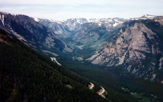
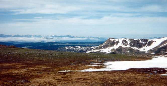
Looking towards the Absaroka Range (Yellowstone).
Looking back towards the Plateau:
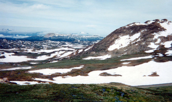
It was pretty cold up here.
Wyoming
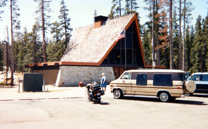
This photograph is the only one I took of Yellowstone. Probably not too many tourists go to Yellowstone and return with only a single shot of a service station.
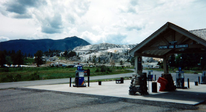
Incidentally, for at least the last day and a half, my rear shocks were getting worse by the mile. When I reached Mammoth, they were barely working at all and were little more than un-dampened springs. Consequently I was wallowing terribly in the turns, and even the most mild of dips in the road caused me to bottom out the suspension. This was going to be a trying trip if I didn't solve this! I borrowed a large pair of slip-pliers and adjusted the shocks up to the maximum preload (rise) to keep them from bottoming out too often. This helped some, but nothing would really solve the problem except a new pair of shocks.
Montana
I left Yellowstone by heading straight north out of Mammoth Hot Springs to Livingston, Montana and then--after eating some pizza--stayed on the interstate through Butte.
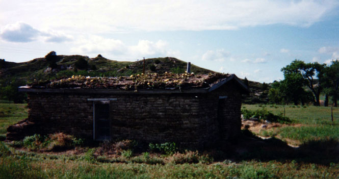
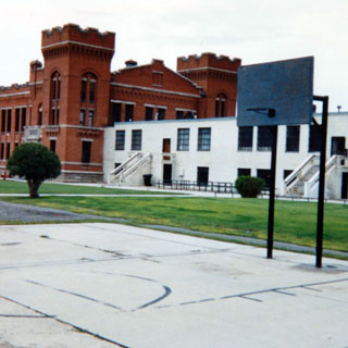
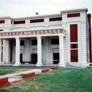
I stopped at Deer Lodge, Montana to tour the Towe Ford Museum. Half of this museum (dedicated to almost exclusively to Ford cars) is in Sacramento while the other half is in this, its original home in Deer Lodge. Although I did tour the museum, a far more interesting museum was the one right next door: the old Montana State Penitentiary. This prison had closed in 1976 and was open to the public to wander through (following the signs for a self-guided tour). A really fascinating place. Not that I needed any reminding, but a prison is a very bad place to be.
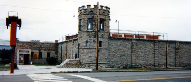
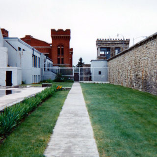
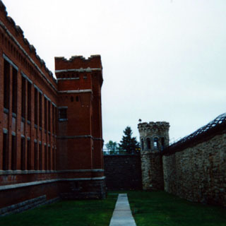
The building in the photograph (below-right) was a theater for the prisoners, donated earlier this century by a mining tycoon. One of the prisoners later set it on fire some time in the sixties, so the interior was gutted. Its interesting to think that until recently, only prisoners would be able to see this building.
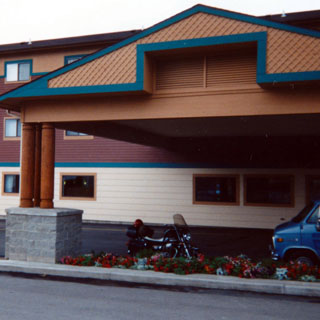
From Deer Lodge I resumed my interstate riding (not the best way to tour) to Missoula, where I stopped for the night. My room was on the third floor and over-looked the over-sized awning. Nice flowers.
 Idaho
Idaho
From Missoula I rode across Idaho to Wallace where I had lunch at a small cafe inhabited by two groups of people who had opposing views on whether or not smoking should be allowed in restaurants--I heard plenty of arguments to support each side.
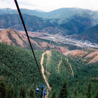
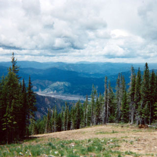
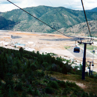
Just west of Wallace is the (claimed) world’s longest gondola run. The photograph shows the base station where I boarded my car. The ($12.00) ride to the top of the mountain took about twenty minutes.
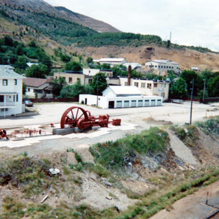
This area is home to the largest silver mine in the United States. The reddish stuff in the valley is what you get after removing the silver from the mountain.
 Washington
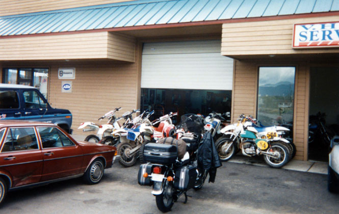
From Wallace it was a fairly short ride down the hill to Spokane where I stopped at a motorcycle shop to change my oil. I rate a motorcycle shop as a good one if they supply you with a pan and let you change your own oil. This was a good shop (no shocks, though).
From Spokane I headed west (finally, on a new road!) to the small town of Wilbur. The photograph was while taken sitting on the motorcycle, stopped at a Chevron Station.
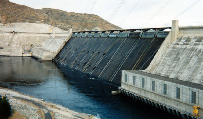
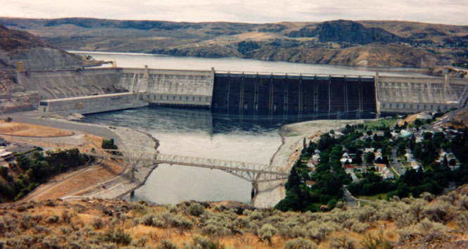
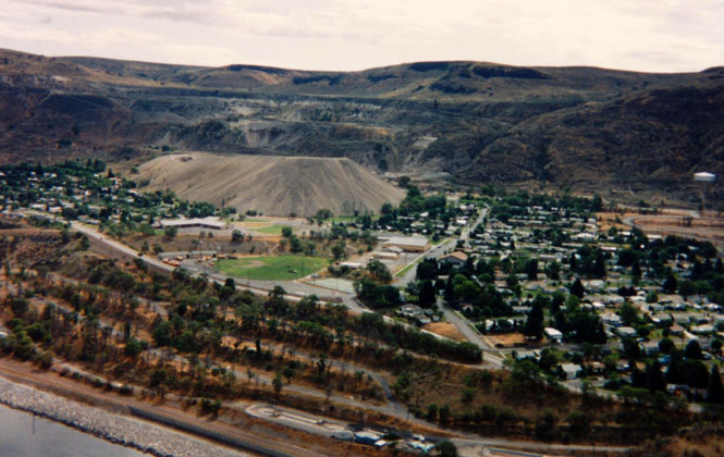
After fueling I headed north to the town of Grand Coulee and then across the Columbia River to the town of Coulee Dam.
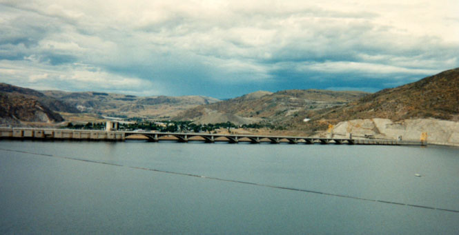
As you can see the water no longer flows across the face of the dam, being diverted instead through the new power house on the right bank.
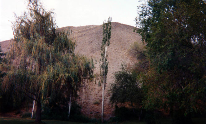
The immense sand pile (below, not far from where Grandma Shafer used to live) looked just as big now as it did thirty years ago. You'll have to trust me when I say that I did climb to the top. When I got there I discovered that my camera had no more shots left in it....
I spent that night in Coulee Dam after visiting for about an hour with Bob Babler, a close friend of my dads from high school. Among other stories of growing up in Coulee Dam, Bob told me how he became the fastest person to ride a motorcycle across the bridge that crosses the river just below the dam (photograph, above). There's a T-intersection at the town end of the bridge (the direction he was riding) so his ride across didn't end too gracefully. Still, I couldn't help but think that whatever speed he was doing; that record still stands. I couldn't help but think, too, that Grandma might not have thought Bob Babler the best influence on her son.... A very nice man. Glad to have talked with him.
By the way, at night they do release the water over the spillway and (after a fashion) shine lights on the dam just as they used to do.
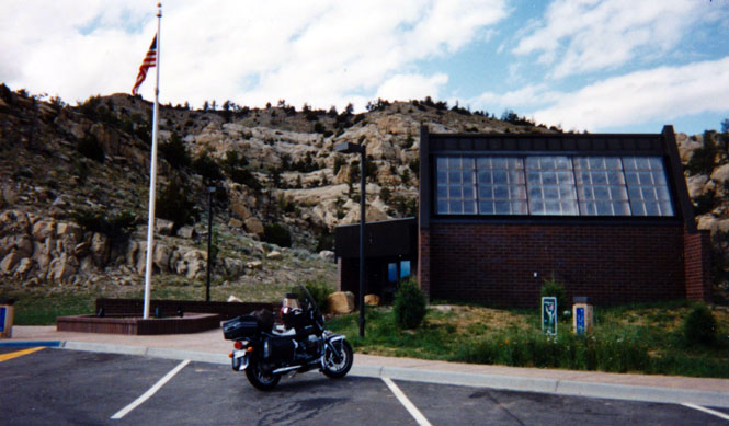
Not too far from Coulee dam is its overshadowed brother, Chief Joseph Dam. This dam hold some sort of world record for the longest series of generators. I'll say one thing for it, not one drop of water escapes without giving up whatever potential energy it started with.
 After taking the
self-guided tour of the dam, I talked with a uniformed Corps of Engineer worker
for what must have been 1 1/2 hours, about everything from how to build a dam to
the ignorance of most people on where their electricity or water or gas comes
from or where their sewage goes, to the nature of the human race. I never did
figure out just what his job at the dam was.
I'm not normally in the habit of hanging around and talking with people for too
long, but as you can tell by the photographs the weather wasn't looking very
promising.
After taking the
self-guided tour of the dam, I talked with a uniformed Corps of Engineer worker
for what must have been 1 1/2 hours, about everything from how to build a dam to
the ignorance of most people on where their electricity or water or gas comes
from or where their sewage goes, to the nature of the human race. I never did
figure out just what his job at the dam was.
I'm not normally in the habit of hanging around and talking with people for too
long, but as you can tell by the photographs the weather wasn't looking very
promising.
My intention was to ride north to North Cascades National Park, unless the weather said otherwise. And, even though the weather actually was worse by the time I left Chief Joseph, I decided to gamble and go north anyway.
I stopped at the small town of Pateros for gas and (I expected) food. I bought a newspaper and sat down at a booth thinking that the waitress would come right on over. Well, after about twenty minutes had passed I suspected that I was never going to be served.
I stayed there for perhaps forty minutes until I had read the entire paper quite thoroughly. I then left the paper at the table and left the restaurant; I never was waited on. I considered leaving a tip, but decided against it. Anyway, I really just needed a break from riding.
 I did finally get lunch at Twisp;
I'm sure the food was better
than it would have been at Pateros.
I did finally get lunch at Twisp;
I'm sure the food was better
than it would have been at Pateros.
From Twisp I stayed on the road as it curved north and then west over the pass and into the Park. This National Park is not as developed as some. There really isn't any way to tell that you've entered the park (and there is no visitor's center). There was no entrance Ranger Station and consequently there was no fee to enter. As is often the case on these trips, during the very best scenery and riding conditions I don't usually bother to stop and take a picture. Doing that tends to disrupt the whole experience. So you'll have to be satisfied with the second rate scenery (by comparison) of the photographs.
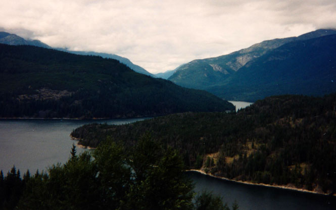
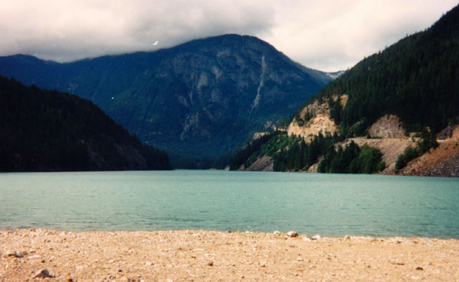
I took the photograph (above) hoping that the strange green color of the lake would be captured. It more or less is.
 From the National Park I headed west across the mountains to the city of Mount Vernon.
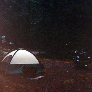
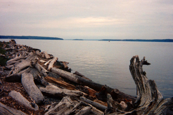
I rode south on Interstate 5 for about as far as I could stand the (relatively)
crowded freeway before veering off to Camano Island. At the far western edge of
the island is Camano Island State Park, which is where I camped for the the
night.
From the National Park I headed west across the mountains to the city of Mount Vernon.
I rode south on Interstate 5 for about as far as I could stand the (relatively)
crowded freeway before veering off to Camano Island. At the far western edge of
the island is Camano Island State Park, which is where I camped for the the
night.
This is a really beautiful area and I spent probably two hours hiking through the forest and along the beach. A nice place.
The ride, the next morning, down I-5 was rather mind-numbing, particularly the ride through Seattle. It seems that there was an accident during the morning rush-hour so that it was quite literally stop-and-go for about an hour. Nothing like being stopped on a major freeway system full of impatient people trying to get to work when all you want to do is to get out of their city! I have always hated riding through Seattle.
At Tacoma I followed the signs that directed me towards the Fort Lewis Military Museum. When I pulled up to the guard gate the uniformed guard told me that I couldn't enter the Fort without a pass.
He could not issue me a pass. I had to turn around and go to another guard gate to get one. My pleas that I only wanted to go to the museum "just right over there" were dismissed.
When I reached the other guard gate and asked for a pass, that guard told me that I couldn't proceed past his gate without a "protective vest". It seems that the Army (at least at this Fort) requires motorcyclists to wear a highway construction worker's vest with reflective tape.
Now, I wouldn't argue that perhaps a vest might make a person more visible, and perhaps it might even prevent an accident. But (as my reasoned argument went) I only wanted to ride a 100 yards to the museum! The guard told me only that "There ain't no one gonna let you in here without no vest" (I couldn't park where I was). Wonderful.
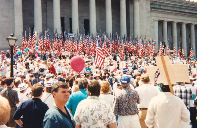
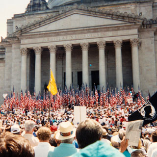
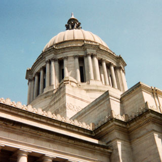
I stopped at Olympia with the intention of seeing the state capitol building. Instead I stayed about three hours waiting for Ross Perot to show up and give a half hour speech (accepting the petitions that would put him on the ballot in Washington).
 Oregon
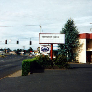
From Olympia it was a straight shot down to Portland and then on to Carlton and McMinnville where I checked into the "Restaurant Closed" Hotel.
While registering the lady behind the counter very seriously asked me if I intended to drive my motorcycle into the room. I replied that I doubted that she'd want me to do such a thing, and so had no plans to do so.
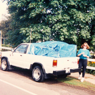
After taking a bit of time to get fuel to Becky's truck (she ran out of gas just short of Carlton--we paid the service station attendant who delivered the fuel with a box of fireworks, it being that season) we both arrived at Mike and Lorraine's to pack up a bunch of stuff to take back to Eureka.
The careful taping and wrapping that we did around the load in Becky's pickup looks nice and neat in the photograph, but I'm afraid it didn't last too long. No matter. Everything did arrive in Eureka in fine shape.
Becky and I rode together, after a fashion, to the coast and Lincoln City. It was raining hard and I was forced to ride with my visor up as it was fogging something awful. Of course that only meant that I took all the rain right in my face, but at least I could see! At Newport we stopped at the Oregon Coast Aquarium for perhaps two hours. We both felt that the Sea Otters and the Jelly Fish were the two best displays there and were worth stopping to see.
We really made no attempt at all to stay together as we left Newport and drove (or rode) south to Port Orford to Ruth and Bill's lovely house on the hill (Fiddleback) where we had a truly delicious dinner of salmon and rice. Becky left shortly the next morning while I stayed a few hours longer before heading out, myself.
 California
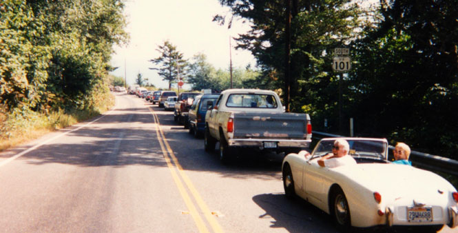
Not very far below the California border I followed an Austin-Healey Sprite sports car that was doing remarkably well on that tight and twisty road. Even though my rear suspension was quite ruined by that time I still had no problem moving at a rate much faster than most cars were traveling. But that Sprite stayed ahead of me. I took their picture while we were waiting at a construction site. After talking with the driver I found out that he regularly races the car and has owned it since new (1962). They were having a ball.
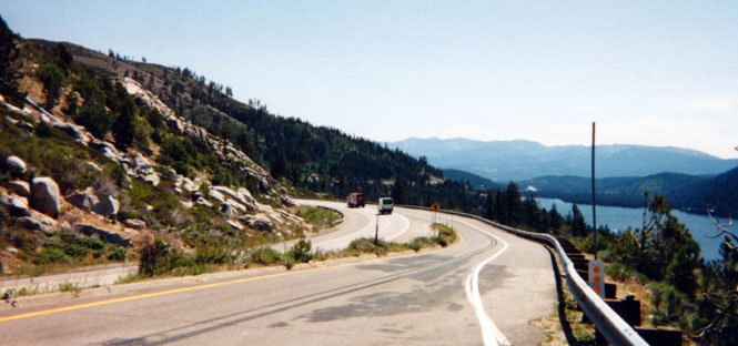
I stayed at Becky and Gil's that night and left the next morning around 11:00 after stopping at a K-Mart to pick up some new tie-downs (it seems that somebody had driven off to work with my old ones!). The trip from Eureka to Sacramento is a well-known one (to me, anyway) so I didn't bother to take any photographs. As at Eureka, I stayed in Sacramento only that night and left the next morning along Interstate 80, over the Sierra Nevada Mountains.
Rest stop in the Sierra Nevada.
Donner Lake and I-80.
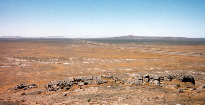
 Nevada
At another rest stop; this time in Nevada.
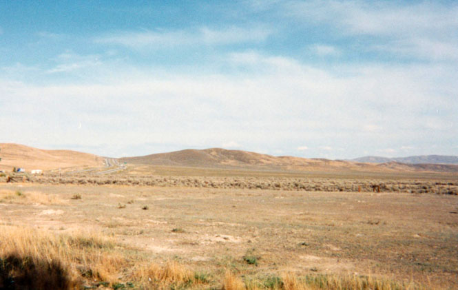
According to the information at the rest stop there is quite a bit of geothermal activity in the area. Somewhere off against the hills is a geyser of some sort. Certainly, I didn't see anything.
I stopped for the night at Elko, Nevada. I probably could have ridden farther, but I just didn't feel like it (ride quality). As it turns out, I'm very glad that I didn't. After each day's ride I always do a quick inspection of the motorcycle just to make sure that nothing untoward is about to happen (beyond the fact that my shock absorbers were no longer absorbing shocks). Normally I don't see anything, but this time I found that one (of two) pins that holds the swing-arm (rear wheel assembly) to the motorcycle had come unscrewed about 1/4 inch. It isn't a pleasant thought to imagine what would have happened had it come all the way out! Even so, nothing did happen and I was careful to check on it frequently the rest of the trip, as I don't carry a wrench big enough to tighten it down securely.
 Utah
Utah
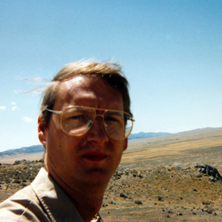
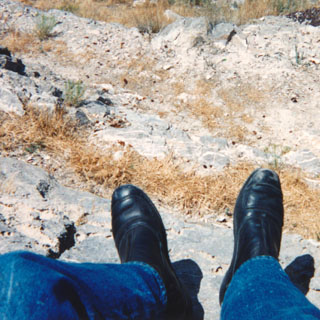
And, yet another rest stop, this one in Utah on the Bonneville Salt Flats.
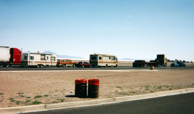
The flats themselves are flat (really) and white, so I took a picture of the cars and trucks and trash cans instead.
About fifty miles into the flats I stopped at yet another rest stop. The middle photo is what a person looks like after riding all morning in 100 degree weather; not a pretty picture. The last picture is one that I took after wondering just how it would turn out. Well, that's how it did. Nice shoes...
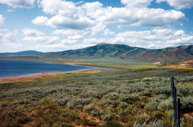
I left Sacramento with every intention of returning to Kansas via northern New Mexico. But, somehow I ended up riding through Park City, Utah instead. Just beyond Salt Lake City I turned off on US-40 through some really spectacular high plains scenery.
Strawberry Reservoir, just south of Heber City.
 Colorado
I stayed on highway 40 through Vernal, crossing into Colorado before turning south at the town of Dinosaur and down into the small town of Rangely, where I spent the night.
South of Rangely is a seventy-mile stretch of road that I've never been on, but has always intrigued me. There are no towns along the road (or even away from the road) and it looks like it passes through some terrific country. Unfortunately there was road construction the first fifteen miles of this road, and in view of my dismal shock absorbers I didn't take that route.
Instead, I rode on into Rifle, Colorado (and a McDonalds for breakfast), which is on Interstate 70.
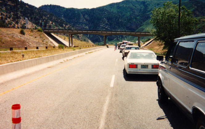
This is my traditional picture of the road construction that is perpetually taking place through Glenwood Canyon. Someday (I suppose) this construction will really be done. I have my doubts.
A truly monumental task in road building. The canyon (about thirty miles long) is fairly narrow, and since it already carries the Colorado River and a railroad, there isn't any room left for a freeway. At least not your normal sort of freeway.
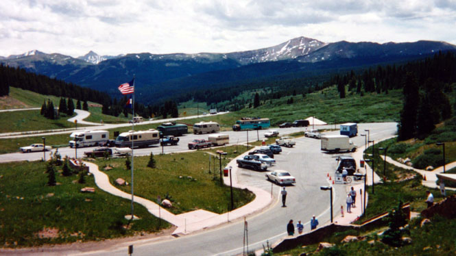
They are building a complex system of double-decker roads along with a really impressive curving tunnel in order to fit it all in. The last picture taken of the trip was taken near the summit of Vail Pass. There was a ranger-type person selling books and things behind the van on the right hand side of the parking lot. I bought Becky a book on Birds of the Central Rockies (future Christmas present).
Kansas
The ride from Denver to Lyman was a killer. That stretch of freeway has always been very bumpy, and nothing I could do would keep the bike from bouncing up and down. I hated to even look down at my rear wheel as it was bouncing up and down at a blurry, frantic pace. It worked best to ride well up on the fuel tank.
I rebuilt the shocks soon after returning to Wichita. Good trip. Sometimes tiring. Good trip, still.
About 5,000 miles.