May, 1997

Sunday |
Monday |
Tuesday |
Wednesday |
Thursday |
Friday |
Saturday |
11 May |
12 |
13 |
14 |
15 |
16 |
17
|
18
|
19
|
20
|
21
|
22
|
23
|
24
|
25
|
26 |
27 |
28 |
29 |
30 |
31 |
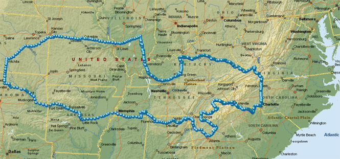
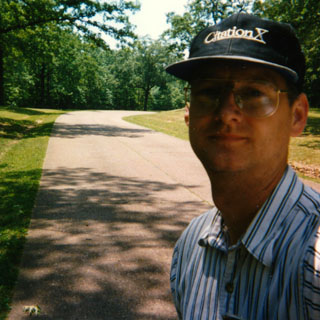
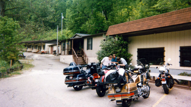
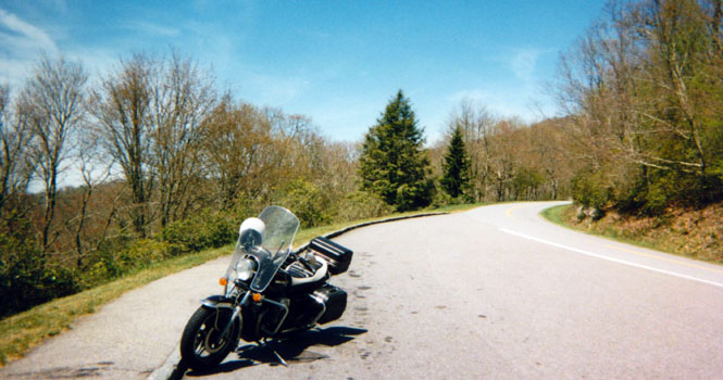
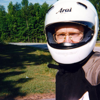
This was a shorter one-week (plus two day) trip taken in late May. I often take longer trips in July and head towards the northwest. But, this year I wanted to hit some of the southeastern states, so it made sense to leave earlier in the spring when the weather wouldn’t be quite so oppressive.
 Kansas
 Oklahoma
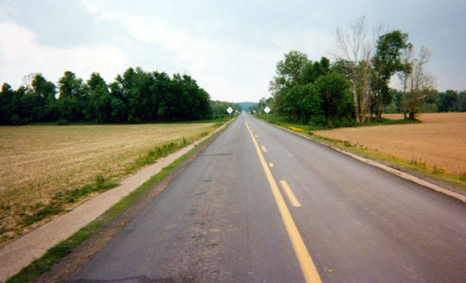
The route from Wichita to Memphis was fairly routine, except for the fact that I kept missing the turnpike south of Muskogee and ended up taking several back roads instead—not a real problem. Oklahoma is the absolute worst state that I’ve been to about marking their highways.
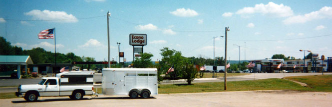
It isn’t at all unusual to see an exit on the freeway marked simply "Exit." No city, no highway route, just "Exit." You get used to looking behind, at the road signs in the opposing lane for possible insight. I stopped somewhere along the way in Oklahoma for lunch; there’s nothing special about that motel (or the horse trailer).
 Arkansas
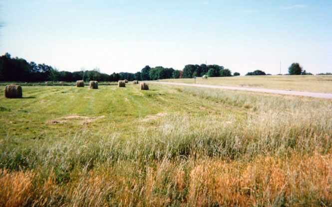
Arkansas rest stop.
 Tennessee
I spent that night just outside of Memphis.
 Mississippi
From Memphis I shot down to Mississippi for a bit before turning north to Shiloh National Battlefield Park.
Tennessee
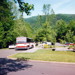
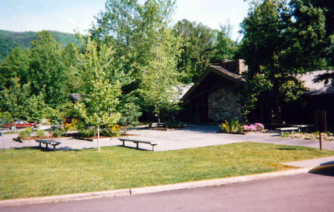
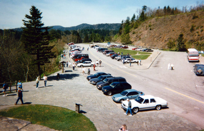
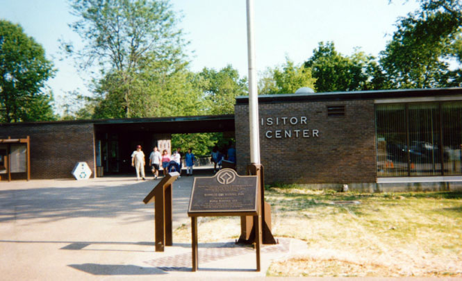
At the Shiloh visitor center the first thing I did was to buy a book of Civil War battlefields (which served me well, later on the trip), and to watch the film and study up on the battle of Shiloh.
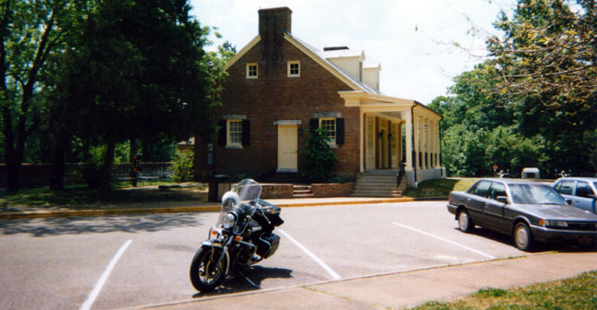
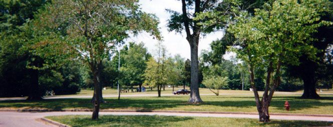
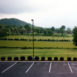
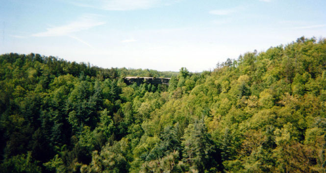
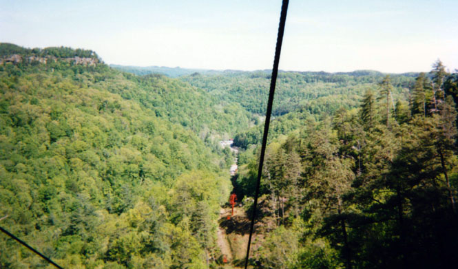
Taken from the visitor center parking lot--looks like a tour off in the distance.
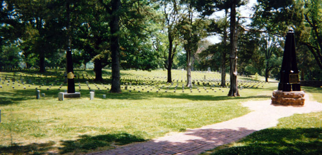
Part of the Union Cemetery. For the most part, the southern dead were either removed or buried in a mass grave. There were so many deaths here, and the weather was so warm, well…
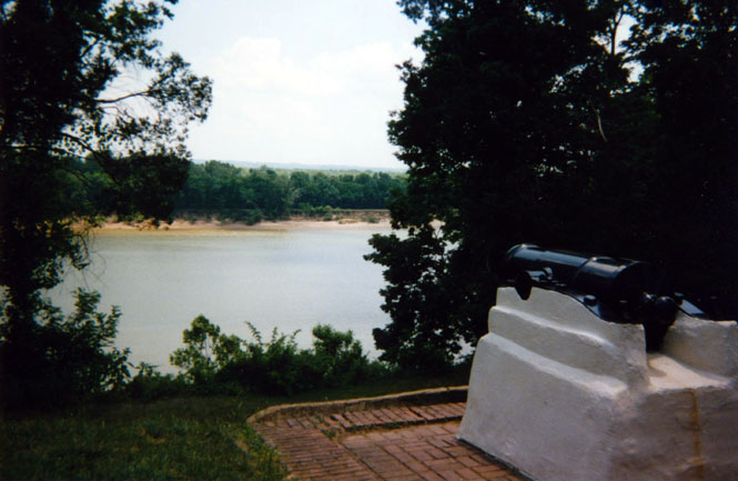
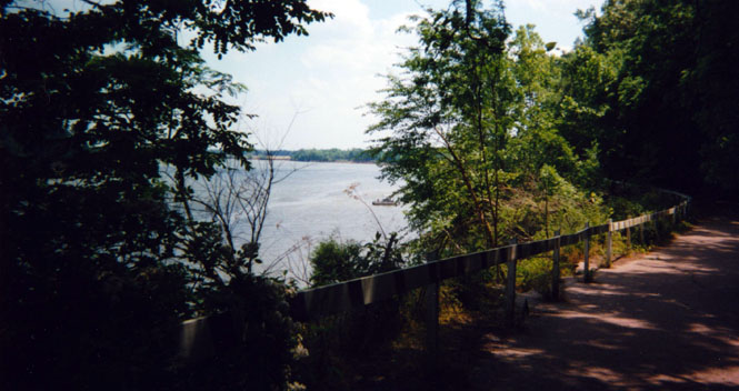
The view of the Tennessee River--from near where the Union army arrived.
I left the bike in the visitor parking lot, and walked the park. That’s really the only way to see any battlefield park, and Shiloh in particular.
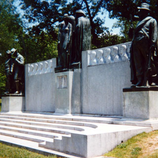
A monument to the Confederate dead and one of several large monuments on the grounds from the citizens of a state (Iowa in this case).

The "sunken road" was the site of some of the fiercest fighting of the entire war. During the day, the south under Braxton Bragg made an incredible eleven separate charges against the Union forces of Prentiss and Sherman.
Bragg never committed his entire strength which would have been more than enough. Instead he attacked piecemeal until the Union finally ran out of men. Even though the Union lost this particular part of the battle, their delay gave Grant enough time to repositions his lines to mount a complete reversal the next day and to defeat the Confederates (end of history lesson).
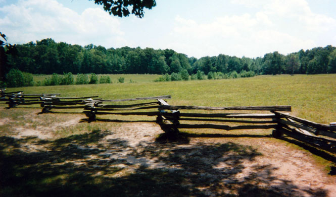
The "sunken road" and the Hornet’s Nest.
The "Hornet’s Nest" battle was fought throughout here. It apparently looked much the way it does now. Most everybody else chose to tour the park by car (not much better than just staying in the visitor's center,) so I had the entire road--and the park--to myself.
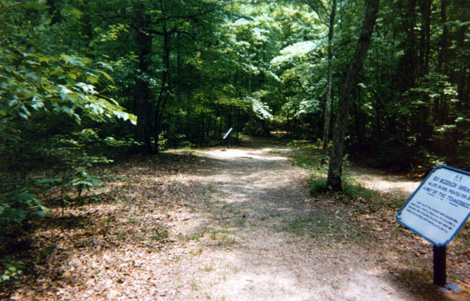
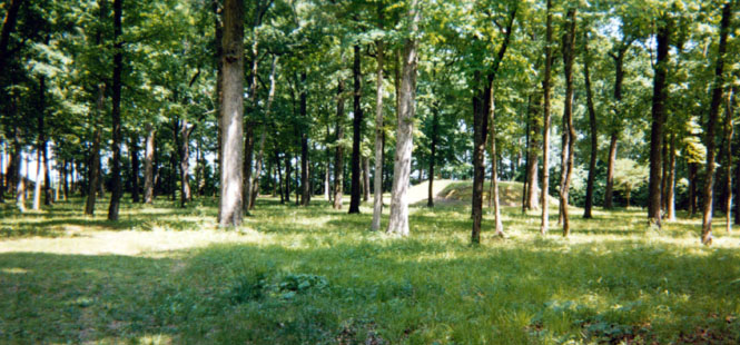
Quite apart from the Civil War part of the grounds, are the Indian mounds. There were several in the area, and some amazing sculptures have been found buried in and around them.
Tennessee River.
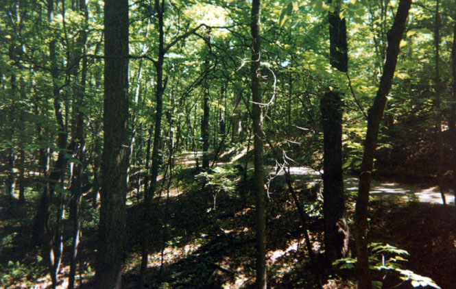
After departing Shiloh, I wanted to travel at least a bit of the Natchez Trace Parkway.
That route runs from southwest Mississippi to Nashville, and is really a beautiful road. As with the Blue Ridge Parkway, the speed limit is a rather slow 45-mph, so it would take some time to do.
 Alabama
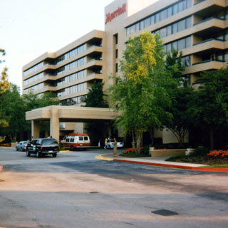
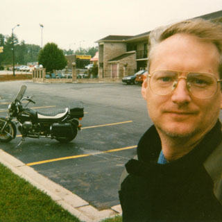
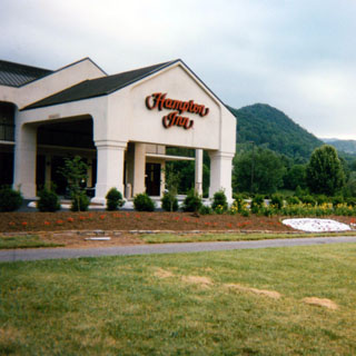
I stopped early in Huntsville since I wanted to go through the NASA museum the next day. This Marriott Hotel was by far the best place I stayed at during the trip—certainly the most expensive.
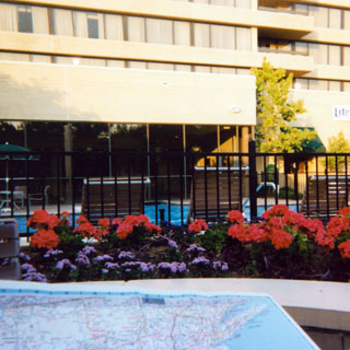
I dropped down to the good-sized pool and studied the map. I had to figure out just where I wanted to go the next day.
Huntsville has long been an Army munitions proving ground, and so was a natural location to become the headquarters of the Army’s missile program. There’s a mix of both Army hardware and NASA hardware.
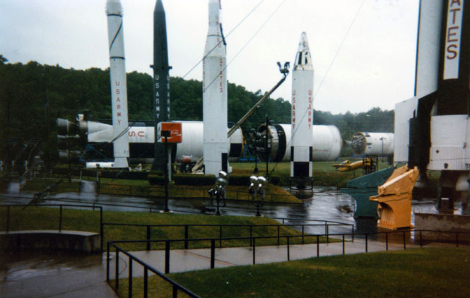
I would have thought that they could have displayed the X-15 better.
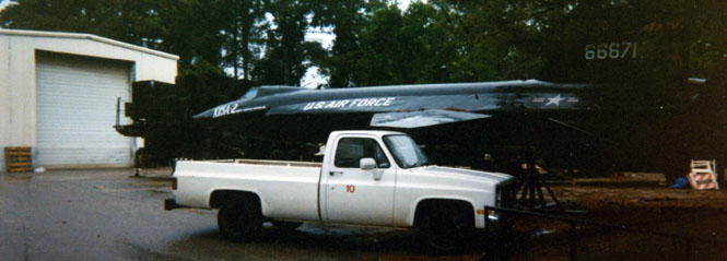
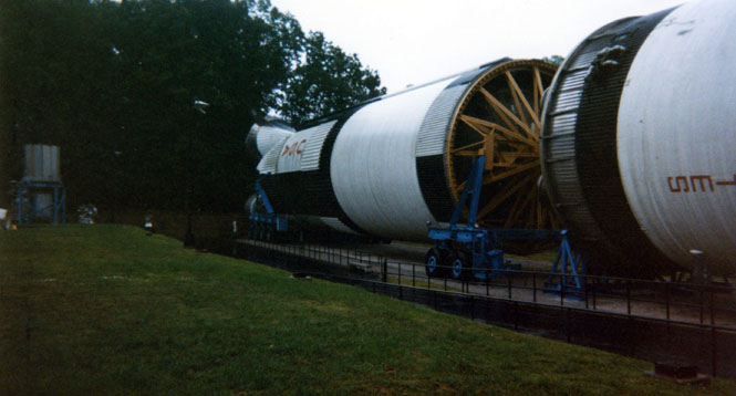
All told, I think that the Hutchinson Kansas museum does a better job of explaining things, even though the Huntsville museum has far more objects on display. Not surprisingly, this museum makes Werner Von Braun out to be something of an All-American, incomparable engineer (which in some ways he was), but ignores the nagging bits about his days as a Nazi official knowingly using slave labor to produce war machines (as the Hutchinson museum makes clear). They also ignore the fact that a top official of the Apollo program, and very close friend of Von Braun’s from Germany, was eventually deported for his war crimes (I've drifted from the subject).
 Georgia
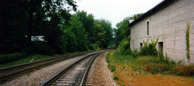
From Huntsville I followed the river north, and then turned southeast, hopping over a range of mountains into Georgia. I hit some pretty strong rain before I stopped at Kennesaw to see the railroad engine "The General".
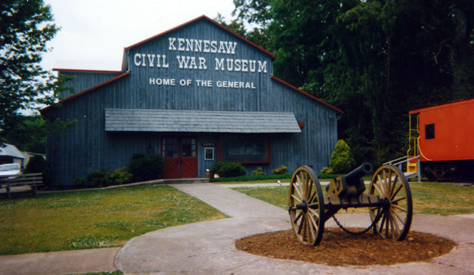
If you’ve ever seen the Buster Keaton movie, then you know the rough plot (if not, then rent that movie now!). Naturally, this being Georgia, the southern train men who chased down the engine (first on foot, then with a hand cart, then with a commandeered engine) were the heroes (just as in the movie), while the Yankees who stole it were the villains. The engine was stolen from this very town, and on these very tracks (well, they may have been replaced sometime in the last 130 years).
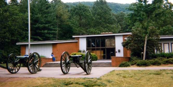
I stopped at the Kennesaw Mountain National Battlefield Park after getting soaked once again. The running of this battle was fairly simple. The Confederacy under Johnston held the mountain between Sherman and Atlanta. Sherman first mounted a head-on attack, stalled (learned a valuable lesson), and then flanked around the mountain and drove on into Atlanta.
The visitor center.
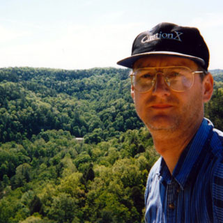
I hiked to the top of the mountain. That’s Atlanta off in the distance. It was a drizzly day.

The last part of the path up the mountain was paved.
From Kennesaw, I foolishly got caught up in rush hour in Atlanta, before escaping to Gainesville where I spent the night.
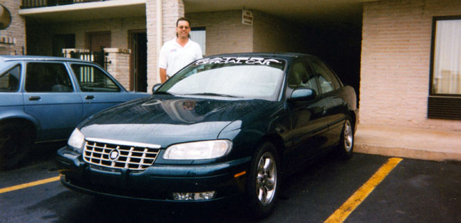
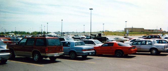
I saw a Cadillac Catera (first one I’d seen) in the parking lot, and talked with its owner. Has it happens, Cadillac had donated the car to be used as a pace car on the sports car circuit, and this was one of the SCCA officials.
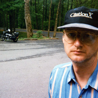
Part of the reason for this trip, was to ride some of the famous motorcycle roads of northern Georgia. I could have happily spent several days in this area. Really nice.

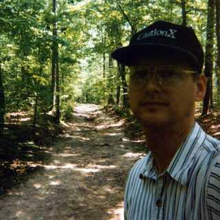
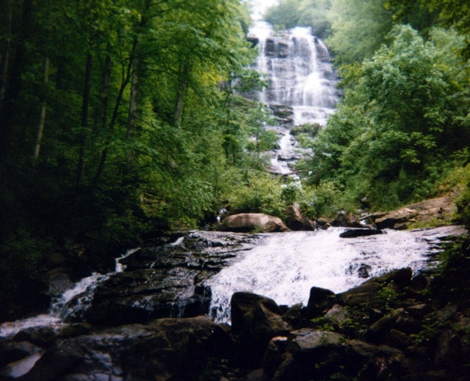
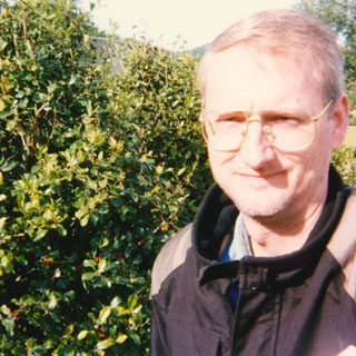
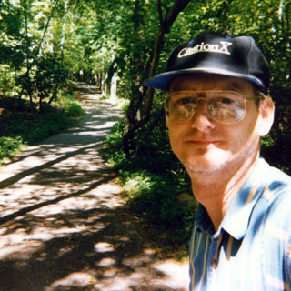
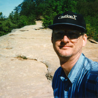
I stopped at Amicalola Falls, which is in the Chattahoochee National Forest. I don’t look real cheerful in that picture do I?
Creek coming from bottom of falls.
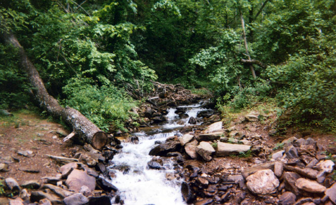
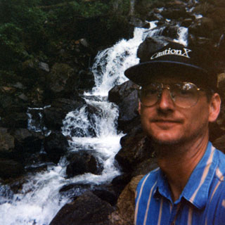
Amicalola Falls.
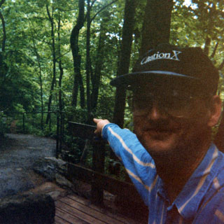
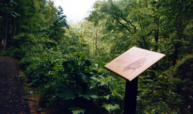
The sign says something about "Who will cook for you?" Apparently, that’s what the local owls are supposed to say (and here I always thought that they just said "who").
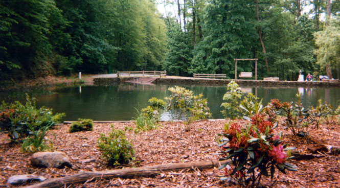
Small fishing pond near the falls--way over-landscaped.
Some ways past the falls I stopped for gas in a no-account town.
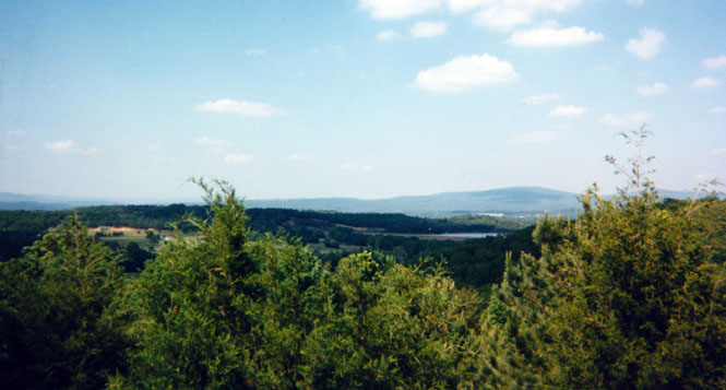
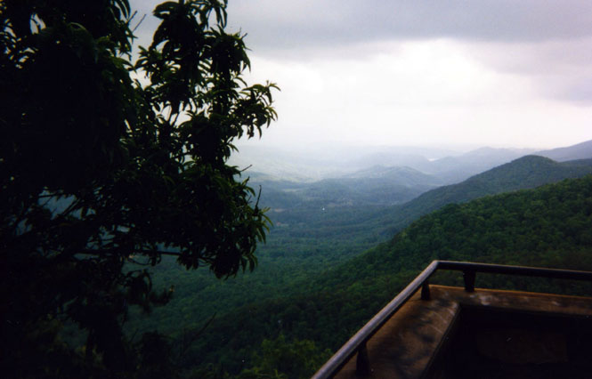
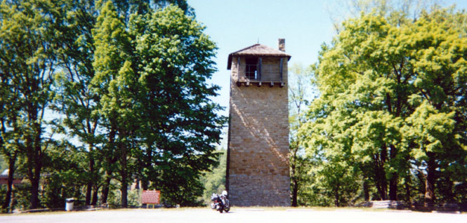
I stopped at a state park (Fort something-or-rather) and talked to the resident ranger (Ed) about a particular motorcycle road and town that (I thought) was in northern Georgia—Deal’s Gap. He knew most of the area, but hadn’t heard of it. He gave me directions to a Ford dealership in Chatsworth where a friend of his worked who might know. Later as I was taking pictures at one of the "scenic overlooks" in the park, another ranger drove up, and told me to check back with Ed. It seems that Ed had called down to Chatsworth and indeed his friend did know where Deal’s gap was—it’s in North Carolina.
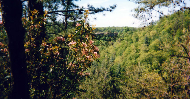
Allegedly this is a spectacular view of the mountains. About all I could see was the interior of a cloud.
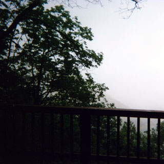
It was raining off and on throughout the day.
I did make it to Chatsworth, and was able to look up the Ford dealership. Soon there were half a dozen motorcyclists telling me where all the good roads were, and the places that I just had to see.
 North Carolina
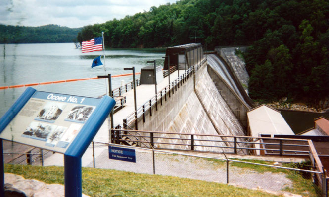
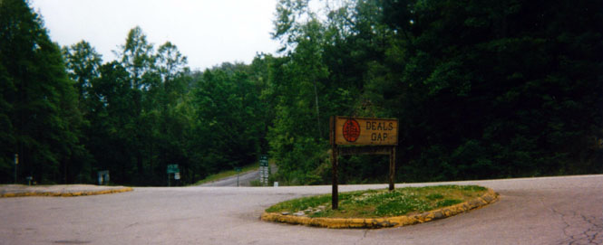
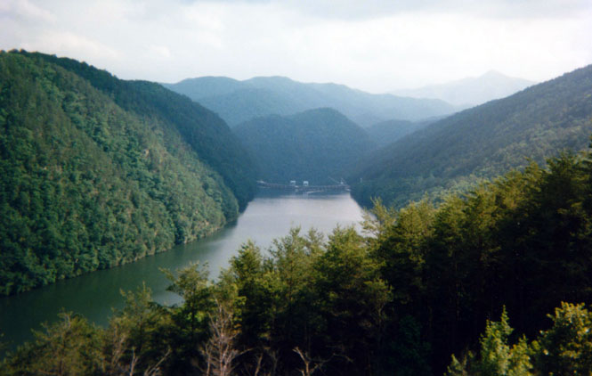
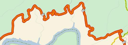
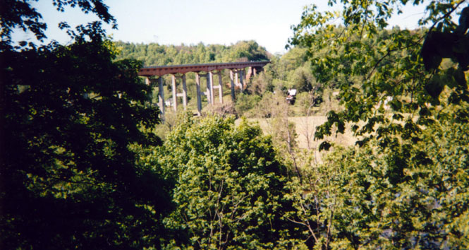
I headed north across the state line to North Carolina, then east on ‘64’ along the Ocoee River. There were a number of similar TVA dams on the river One of these (but not the one in the picture, I think) was used in the movie "The Fugitive." Not far from here I also rode past the site of the Olympic kayak competition. Near Topton I turned on ‘129’ towards Deal’s Gap.
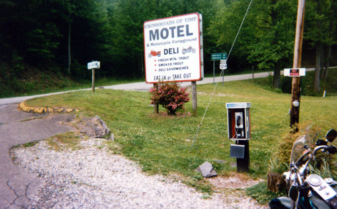
The town of Deal’s Gap is actually little more than motel, store, and gas station. It caters mainly to motorcyclists.
The view looking south down ‘129’. ‘28’ is off to the left.
Just a few motorcyclists were there. Apparently during the summer months, the parking lot is usually full. These folks had ridden down from Toronto, just to ride "The Road."
Another TVA dam.
I didn’t take any pictures along the eleven miles for which the road is famous. There are supposedly some 311 curves, and I believe it. The road surface was very good, and most all the turns were very generously banked.
The posted speed limit is 55 mph, and the local bike groups maintain some sort of honorary listing of those people who are brave (or foolish) enough to run the eleven miles at the average speed. I didn’t even come close. Shrug...
Tennessee
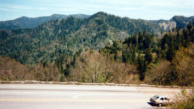
After crossing back into Tennessee, I turned north on the Foothill Parkway towards the Great Smoky Mountains National Park.
Rest stop along the parkway.
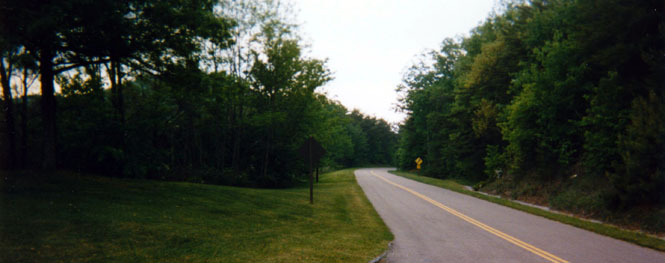
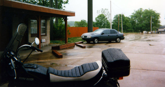
I stopped for the evening in Townsend (where I also had dinner).
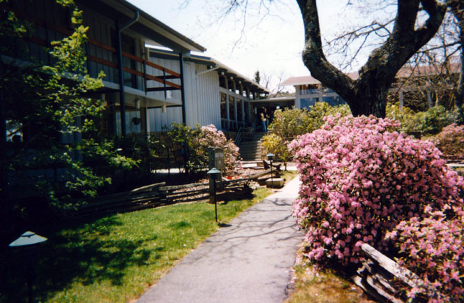
Since this was the off season, the motel rates at even some of the better places were really quite reasonable. I think I paid only $32.00 to stay here.
The view from my motel room. Nice.
And, the view from the parking lot (perhaps the reason for taking this picture will come to me).
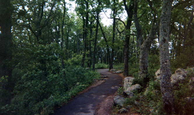
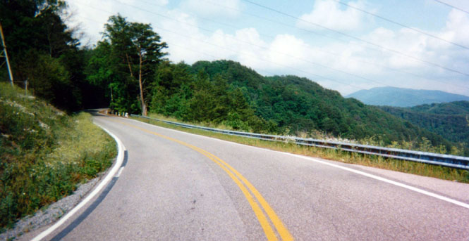
Unlike other National Parks, Great Smoky Mountain doesn’t have an entrance fee, or any sort of entrance gate. The stretch of road from Townsend to Gatlinburg was the best of the entire trip. Just perfect weather, early in the morning, and no other traffic. Beautiful.
At a roadside rest area.
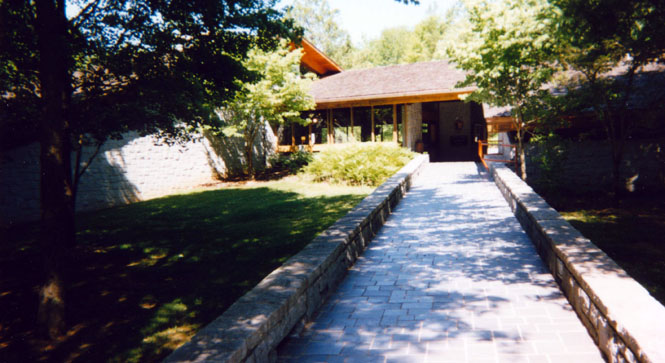
I arrived at the visitor center through the back entrance. They had several nice displays of the area, but it wasn’t all that impressive compared to the visitor centers in our other National Parks.
From the visitors center I rode a couple of miles to the edge of Gatlinburg for fuel. The shot here is from the gas station looking back into the park.
This shot is from the same place, except I’m looking into the city. The change was quite dramatic. The boundary of the National Park was literally a wall of trees—on one side, seemingly untouched forest; on the other side, a mess.
Riding back into the park, I stayed on the main park road to Newfound Gap. The picture was taken from a monument dating from the dedication of the park. We can thank John D. Rockefeller for essentially buying the park, and giving it to the country (much as he did for Yellowstone, and the Grand Teton—thanks, John).
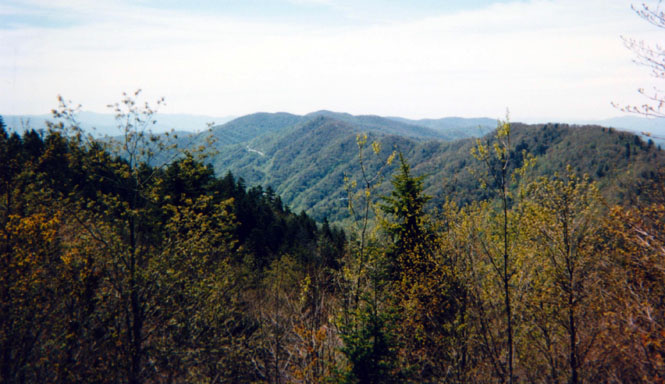
From the summit. It was spring, but the trees didn’t look at all healthy.
View looking east across the Appalachians
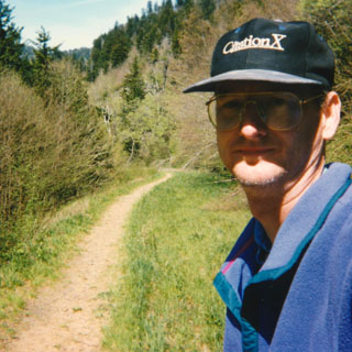
I walked a short distance along the old highway.
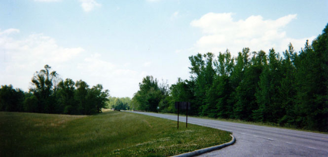
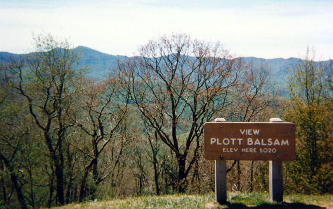
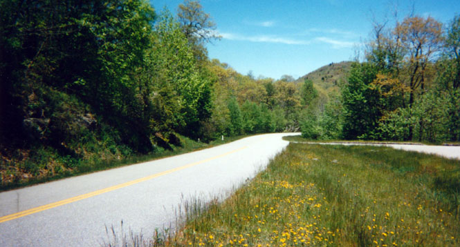
Just before the town of Cherokee, I turned north on the Blue Ridge Parkway. The speed limit on the parkway is just 45 mph, so you wouldn’t want to use it if you wanted to get anyplace fast. But, it’s still a great road for seeing the Appalachian Mountains, provided you don’t want to see any of the towns.
Stopped along the parkway.
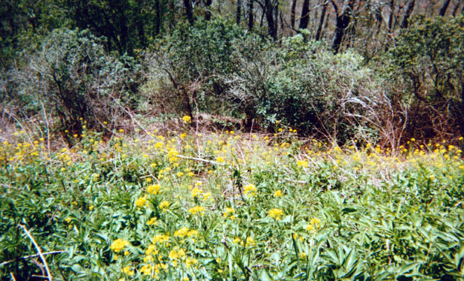
Looks like a bunch of weeds in the picture, but at the time this was a field of wild flowers. Really, the area was just covered in flowers.
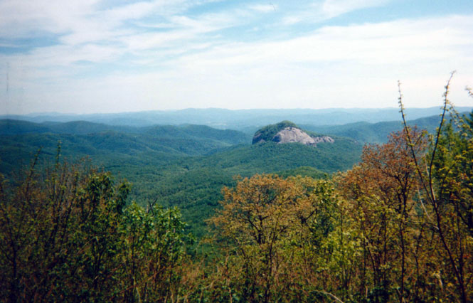
View of Glass Mountain (or was that Diamond Mountain?). Apparently, during certain times of the day, the mountain sparkles in the sun, and had long been a landmark for the Indians and early settlers.
More "weeds" along the Blue Ridge parkway.
I stopped for lunch at Mount Pisgah. This was a resort built not long after the parkway was complete. It’s worth noting that the parkway and Appalachian Mountains look much better today than they did in the photographs taken when the road was built. Huge areas had been over-logged, and it looked quite desolate.
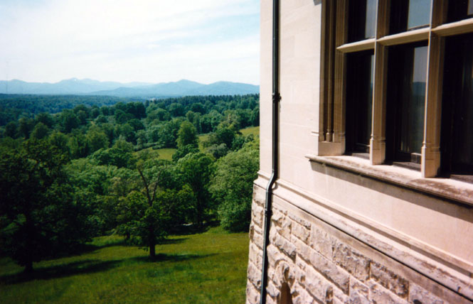
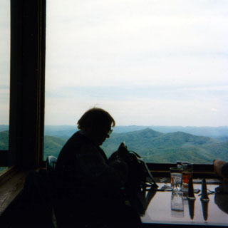 The view from my lunch table (I have no idea who that woman is). At one time, the mountains you see in the distance were
all part of the Biltmore estate.
The view from my lunch table (I have no idea who that woman is). At one time, the mountains you see in the distance were
all part of the Biltmore estate.
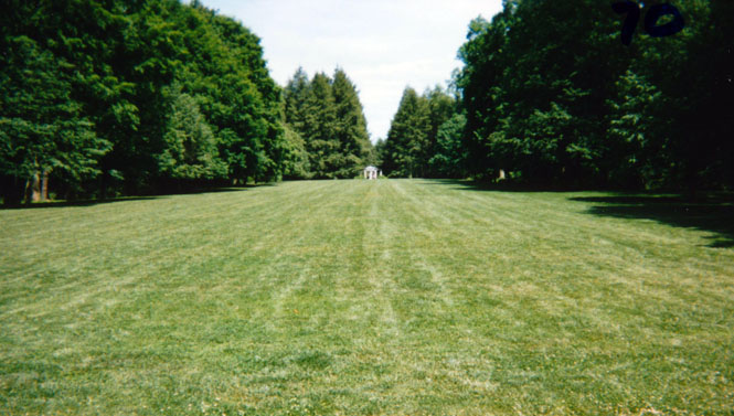
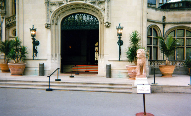
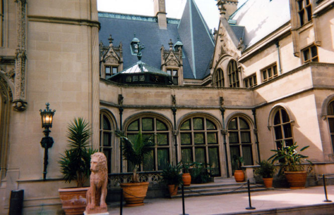
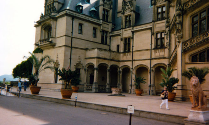
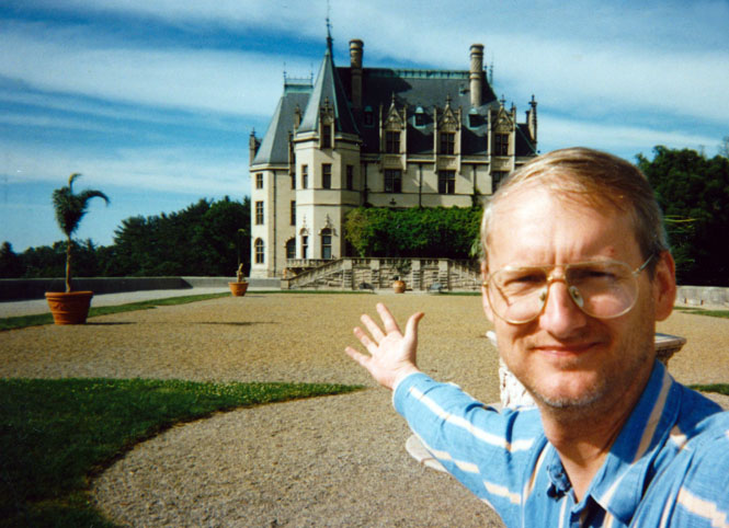
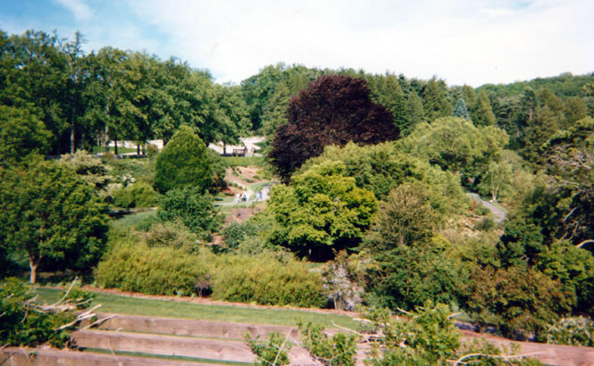
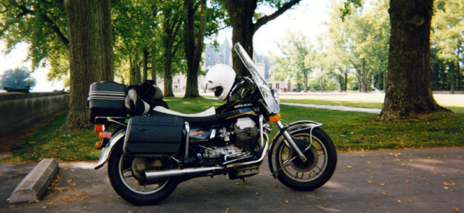
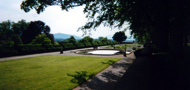
I exited the Blue Ridge Parkway at Asheville, home of the Vanderbilt mansion, The Biltmore. I remain a little perplexed by the whole thing. George Biltmore, son of Commodore Biltmore, built the house in 1895. It was (and I suppose still is) the largest private residence in the United States. The house and estate are still owned by the descendants, and it is not a state or national park. What perplexes me is how the place can possibly make any money. This is not some old mansion that requires you to use your imagination to see how it once was. It is still in very good shape. The gardens are well kept, and everything about the house is still in good running order. Some of the tapestries were undergoing renovation at the time—for several millions of dollars. Everywhere you looked were estate workers keeping the place running smoothly. I was impressed when, on arriving on a motorcycle, they offered to give me a cut piece of wood, made just for that purpose, to set under my side-stand to keep it from sinking into the asphalt.
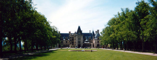
The tour of the house was self-guided. They did a very good job of putting up discrete signs and barriers to keep you moving in the right direction, and out of places you weren’t supposed to be. Most of the rooms in the house were opened though. All in all, I thought it was quite tasteful. Except for Vanderbilt’s bedroom, however. Most people don’t require a throne next to their bed.
The same man who did New York’s Central Park laid out the grounds (this time, measured in miles, not acres). Nature never looked so completely natural. Every tree, rock, and creek was positioned to look perfect. Photos of the grounds during construction show a rather bare and treeless landscape.
Part of the mall that leads to the front, separated by the parking area you see in the previous shot.
Taken from a balcony. They prohibit any photography from within the house.
Front entrance. The doors were kept wide open—no screens.
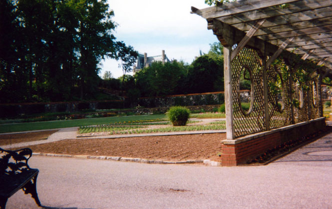
Through those windows was a sunken courtyard of sorts. I’m not really sure what you’d call the area. If this were a Grand Hotel, the room would be the lobby.
The library was on the ground floor of this side of the house. The second and third floors have more living areas, and still more entertaining rooms.
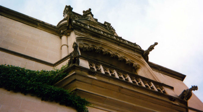
Some of the many gargoyles.
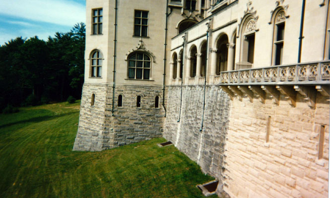
View of the back of the house. The ground drops away towards the rear. The rough stone level is below ground in the front of the house. This level had a swimming pool, gymnasium, and a bowling alley.
It wasn’t clear (to me) what I was standing on. It’s a raised area with high (25 foot) stone walls on all three sides leading up to the side of the house. I don’t think that there was any structure below me, but there could have been. It had meticulous designs made from grass and gravel, but to what purpose, I’m not certain. There were no weeds of course.
One of many gardens.
That red-roof building in the distance is the potting shed. By itself, it would dwarf most any mansion in the best of neighborhoods. But here, it looked quaint.
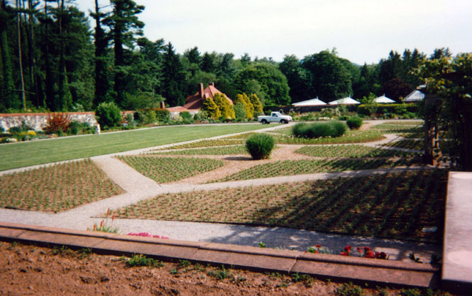
Gardens, gardens, everywhere. All perfect, no weeds. Never a plant out of place.
Motorcycles were allowed to park fairly close to the house (what a great place!) Cars had to park some distance away. There was handicapped parking right up next to the front entrance. I was glad that the bike still looked clean. It wouldn’t do to have a filthy bike here.
More gardens
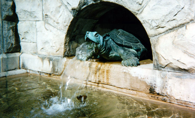
Just a small detail. Minor fountains of this sort were everywhere. And, they all worked. Again, who pays for all of this?
 South Carolina
From Ashville, I shot down the freeway (26) towards South Carolina. The speed limit was
a ridiculous 55 mph (I’d been seeing either 70 mph or 75 mph in other states), but
the traffic was doing a good 85-90 mph—the fastest of the whole trip. This is a case
of the state setting the limits so low, that it makes everyone a law-breaker. And if
you’ve already
 broken the law, you might as well do a good job of it…
I had every intention of stopping at Cowpens National Battlefield Park (Revolutionary War). But when I finally got there, the gate was closed. The yellow sign on the post warns of all sorts of dire criminal consequences if you dare to leave your car or belongings at the entrance. I heeded the warnings, and left.
From Gaffney I had intended to make my way over some back roads to Kings Mountain National Military Park. Some two hours later, I did finally reach the park, but not after wandering the South Carolina countryside without any real clue as to where I was (but, I was never lost…)
Just where am I?
I hate to admit that I’m lost, but…
Someplace in South Carolina
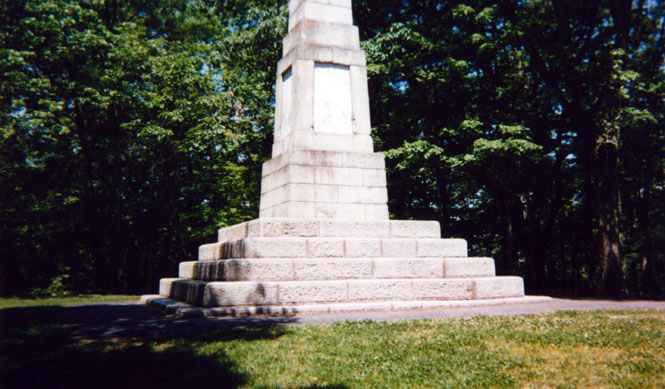
Kings Mountain Visitor Center. This was the site of one of the early victories over the British—a real turning point in the war.
There was a good trail around the mountain with numerous monuments to the soldiers.
Along the trail.
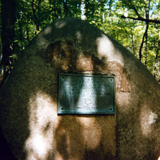 The plaque is for a speech that President Hoover gave at the 150th
anniversary of the battle. It states that 75,000 people were in attendance. Wow! I
couldn’t believe that number, but the ranger I talked to said it was probably a valid
number. Again, pictures from that time show that there were very few trees, and not much
vegetation on the hills. So, it would have been possible for 75,000 people to gather. They
would have had to come by train from a wide area though.
The plaque is for a speech that President Hoover gave at the 150th
anniversary of the battle. It states that 75,000 people were in attendance. Wow! I
couldn’t believe that number, but the ranger I talked to said it was probably a valid
number. Again, pictures from that time show that there were very few trees, and not much
vegetation on the hills. So, it would have been possible for 75,000 people to gather. They
would have had to come by train from a wide area though.
Monuments to the "brave and patriotic solders"…
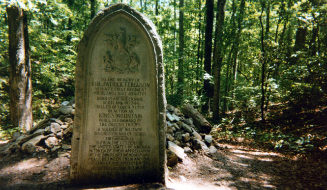
I thought that this was a nice touch. The commander of the British forces was killed in battle, and was buried here under the pile of rocks per his Scottish custom. The monument was placed by the United States. The actual details of the battle aren’t pretty. The British were completely surrounded on the mountain (hill) by the American forces (The British solders, with the exception of their leader, were actually all American—not solders brought from England). When they tried to surrender, the Americans continued to fire—they were taking no prisoners. Eventually, a cease-fire was called, but even then, many of the British prisoners were killed while in captivity.
North Carolina
From Charlotte, I turned north to blast across North Carolina on the freeway (77) towards Virginia.
Mount Airy, home of Andy Griffith, and the setting for the Andy Griffith show. Mayberry is Mount Airy
 Virginia
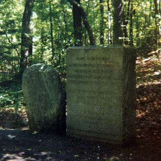
Stopped at Shot Tower Historic Park in Virginia (the making of buck-shot)
Molten led is dropped from the top of the tower to be quenched in a bucket far below. The tower sits on the edge of a river bluff, and extends for some distance below the ground level of the parking lot. This site is nearly 200 years old. Shot is still made this way, and during this trip I passed the Remington ammunition plant which had a tower for the same purpose.
Freeway crossing of the river. I spotted the old highway bridge not far from here, and stayed on that road as much as I could. The freeway blasts right though the mountains, while the old highway follows the rivers and goes around the mountains.
Even though I’m not a big freeway fan, this one was impressive. Generally, the mountain ridges here run east-west, while the road runs north-south. Consequently, there were some really deep earth-fills as the highway crossed the valleys, and some equally long tunnels—many of them curved—when crossing the mountain ridges. For all that, the road wasn’t all that busy, and I wonder how somebody justified putting this freeway through.
 West Virginia
Welcome station to West Virginia. Really, you’d think, judging only by the freeway system and the rest stops, that West Virginia was one of the wealthiest states in the country.

Virginia
 Kentucky
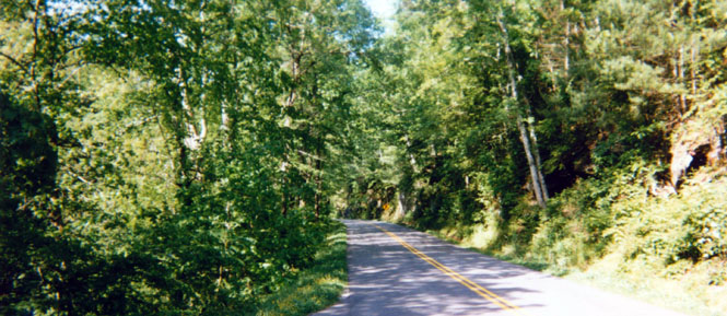
I stayed on ‘460’ (sort of) looping back down through Virginia, and then on up to Kentucky to Pikeville, where I spent the night. This whole area is serious coal country. It was pretty clear that the independent coal trucks aren’t held to the same vehicle safety and speed laws that the rest of us are. Those things just flat haul. The back roads are quite fun. Typically, there’s a river down the middle of the narrow valley with rail tracks on one side, and the highway on the other. When the tracks cross the river, so does the road. And because the road follows the river, there’s a good certainty that the road won’t have any hair-pin turns in it, which means you can roll into some fairly blind turns at a good clip knowing that the road won’t do anything stupid.
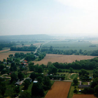
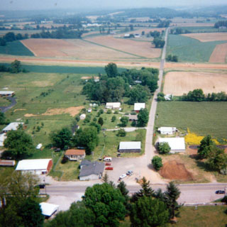
From Pikeville I followed the Mountain Parkway towards Lexington. The Parkway shows as an interstate on the map, but it’s really not quite up to that level. South of Stanton (yes, I know you can’t really read these names on the map segments) I stopped at the Natural Bridge State Park.
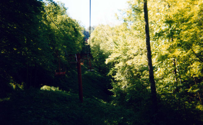
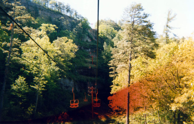
I took the tram up the mountain to see the natural bridge. This shot was near the bottom—looking up the mountain.
It’s difficult to tell here, but the ridge in front is just about vertical.
An odd thing, this. I’m standing on the natural bridge. It all looks quite ordinary, and not at all scary. It was only when you walked to the edge and looked over that you realized that it’s really a long way down.
I walked around the valley to take this shot of the bridge. In the previous shot, I was standing in the middle. Even in this shot, it’s hard to tell just how high above the ground that the bridge really is. (I wonder how many drunken Kentuckians have fallen off?)
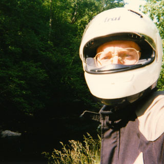
I think I'd been on the road too long that day.
Another shot of the natural bridge—this time with an artistic frame of flowers and trees.
The trip back down the tram. My motorcycle is parked in the clearing in the center of the picture. It was really quite a smooth ride, even when crossing the cable guides.
From the park I rode through Lexington and then south along the Blue Grass Parkway towards Fort Knox. Lexington is surrounded by miles and miles of immaculate horse farms. Many of the white board fences were doubled, so that a person could ride (or drive) between horse pastures without having to enter one. The mansions were generally just a bit beyond good taste, but they certainly were big.
The stretch of road between Elizabethtown (never heard of it either) and Fort Knox is a miserable stretch of strip malls, strip joints, used car lots, pawn shops, and all the other junk that inevitably surrounds military bases. The fact that it was very hot didn’t help my mood any.
That comment aside, I thought this was funny. There are several Amish communities in this part of Kentucky. This shot was taken in a Wal-Mart parking lot (where I bought the film/camera that took this shot) of an Amish buggy tied to one of the light standards. Somehow, I wouldn’t have thought that the Amish would have shopped at Wal-Mart—don’t know why not though.
I didn’t bother taking a picture of the gold depository. It looked just like the pictures I’ve seen of it.
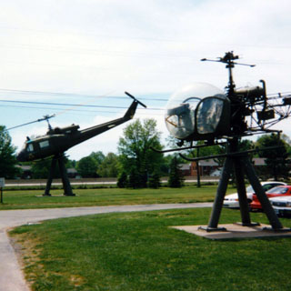
I spent a good two hours, though, at the George Patton Armored Infantry Museum though (or a similar title). Quite interesting. These helicopters reminded me of an insect collection
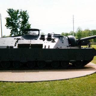
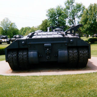
This and the next shot are of a large, sleek tank. It didn’t have any other label except the T-28 designation, So perhaps it is a Soviet T-28. The museum had a large collection of U.S. and foreign tanks stretching all the way back to the First World War. Some the British tanks from that war are as intimidating as anything built today (in one of the Indian Jones movies, a fictional German tank is working its way up a desert valley in search of the Holy Grail. The tank in that movie looked almost identical to the British WWI tank).
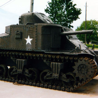
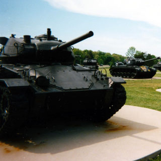
The only photographs I took are of the static displays on the grounds. There were many more items inside the main museum building. I was especially interested in their collection of German Tanks from WW2. The tanks that they were building towards the end of the war far outmatched anything we had, and continue to look quite modern even today. Luckily, their engine technology didn’t keep pace with the rate of increasing armor weight.
I’d been to Mammoth Cave National Park several years ago, but thought I’d drop in for a look anyway. Unfortunately, I just missed the last tour of the day, so I wasn’t able to actually go down into the cave.
The Visitor Center.
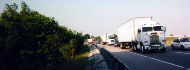
My intention was to swing down to Bowling Green to see the Corvette Museum and then to head back north to Indiana. Unfortunately, a major traffic snarl ended that.
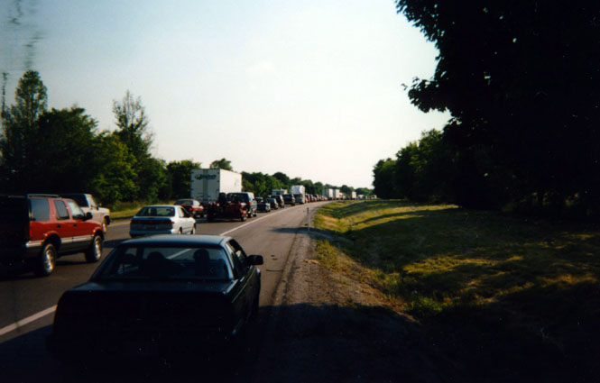
At times, the traffic came to a complete halt for several minutes. So in lieu of baking my motorcycle (it is air-cooled after all) and myself, I parked it on the side of the road.
Moving very slowly.
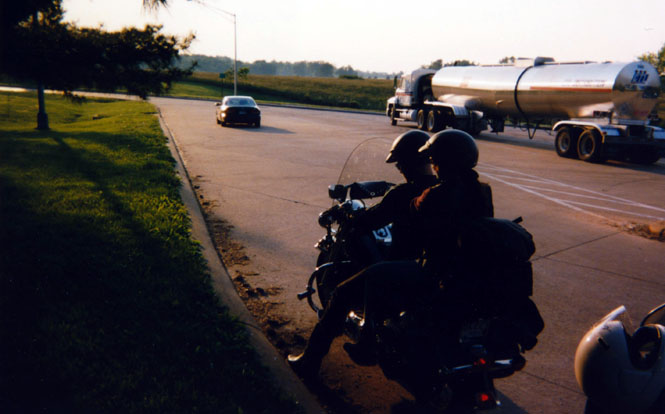
Eventually I reach a rest stop where I tried to wait it out. Those folks had recently bought their new Harley-Davidson and all the leather and fringe and other accessories that Harley happily sells. Not only had they never seen a Moto Guzzi, they’d never even heard of it. Amazing.
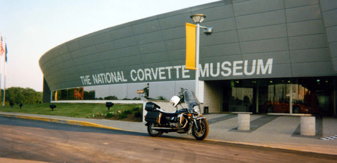
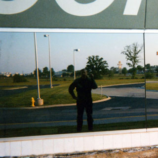
By the time I made it to the Corvette Museum, it was closed. Drat. I took a picture of my reflection in the museum window.
I spent the night in a Best Western just across the street from the museum. The next morning, I hung around until the place opened up. This odd shaped addition to the museum allows the cars parked inside to be seen in natural light.
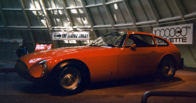
The museum was a rather fawning history of the make, and had a sample of every year and model ever built (I think). It’s odd then, that the only picture I took was of a Corvette built by a style center in Italy on commission by GM. I like it. It was never built.
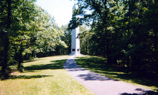
From Corvettes to Confederates. In the southwest corner of Kentucky is the birthplace of Jefferson Davis (President of the CSA). The monument resembles the Washington monument in style if not substance. I thought it was all quite shabby, in a sad sort of way.
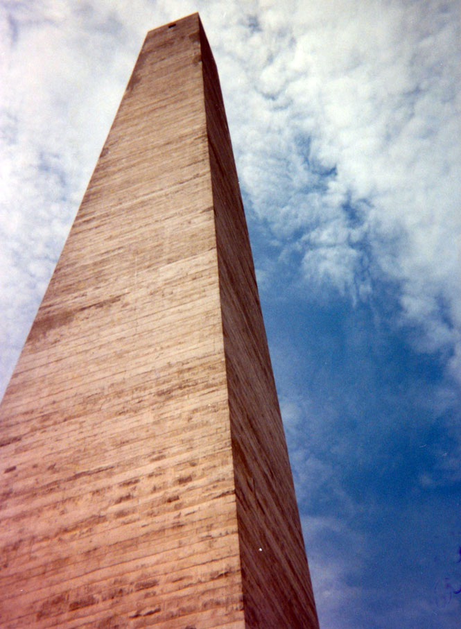
Taken from the top of the monument. Built around 1910ish I believe. Certainly many Civil War veterans were still around.
If the town of Elkton expected that the Jeff Davis monument would become a tourist Mecca, I’m afraid they were disappointed.
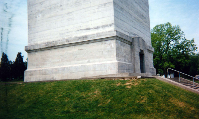
Unlike the Washington monument, this one is built of concrete. There’s an elevator inside that takes you to the top (for a small fee). I told the high school student who operated the elevator that he didn’t have to give me the whole spiel about Jefferson Davis—to his relief.
I wish I could tell you just how tall, but I lost the literature. The park store and museum would be happy to sell you all the Civil War items you need—provided that you are only interested in "The Cause." In fact, they would just as well prefer that you didn’t call it the Civil War at all. The War of Northern Aggression sounds so much better don’t you think?...
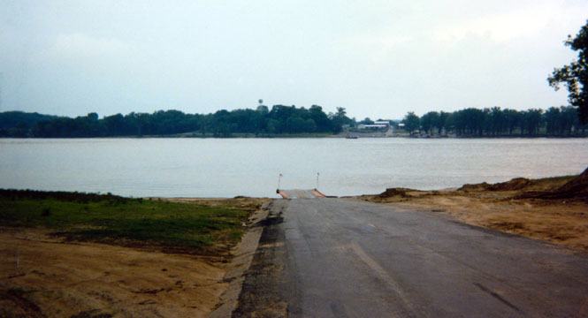
After changing the oil in Marion, Kentucky (now aren’t you glad that I haven’t bored you with all my maintenance stories?) I crossed the river into Illinois. This shot was taken with my back to the Ohio River. Those rain clouds you see would soon be upon me. Heavily.
The Ohio River. We’re waiting for the ferry to arrive.
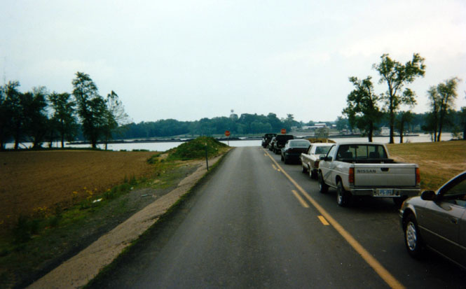
I walked to the head of the line for this shot. Soon after taking this picture, the sky let loose. It just poured on me as we loaded onto the ferry, and didn’t let up one bit during the crossing (15 minutes?). I just had to stand there and take it, while the car people were dry in their cocoons talking about me (well, I supposed that they were).
 Illinois
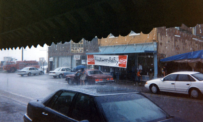
The town of Cave-In-Rock was having a fish fry to support the local cemetery (this being the Memorial Day weekend). I waited out the storm in the café over a dish of rhubarb pie and ice-cream. (I did make a donation to the cemetery fund)
Eventually, the rain let up enough that I could continue on, but it never really stopped. I spent the night in Effingham, Illinois with the expectation that I would ride to Springfield the next day for the races.
As it happens, the races were rained out. This shot was taken in the morning. I don’t mind riding in the rain, but I hate having to leave in the morning while it’s raining.
 Missouri
Kansas
By the time I reach St. Louis, the rained had stopped, and it was clear sailing all the way to Wichita.
All in all, it was a very good trip.
About 3,000 miles.