January, 2015

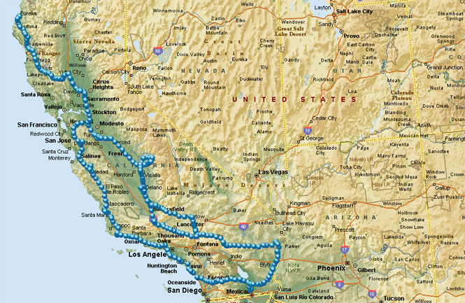
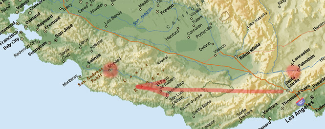
A driving trip by Awanna and Daniel from Eureka to southern California.
Possible goals included the Henry Coe State park southeast of San Jose, the Getty museum in Los Angeles, and perhaps Sequoia National Park. That last one seemed a bit doubtful considering the time of year, but the visitor center was in the lower slopes of the Sierra, so it might not be too out of reach (only true if I'd gone to the correct visitor center).
 California
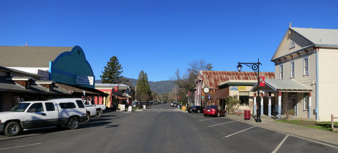
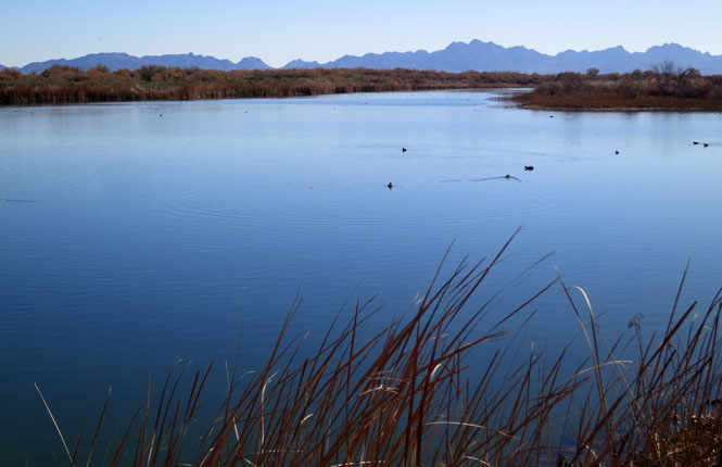
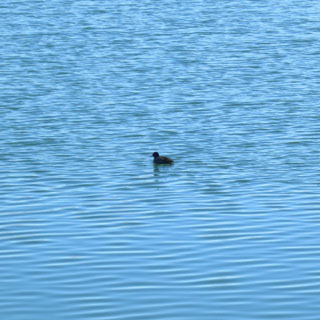
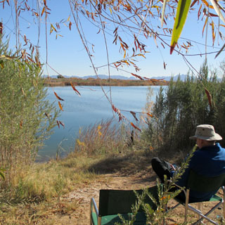
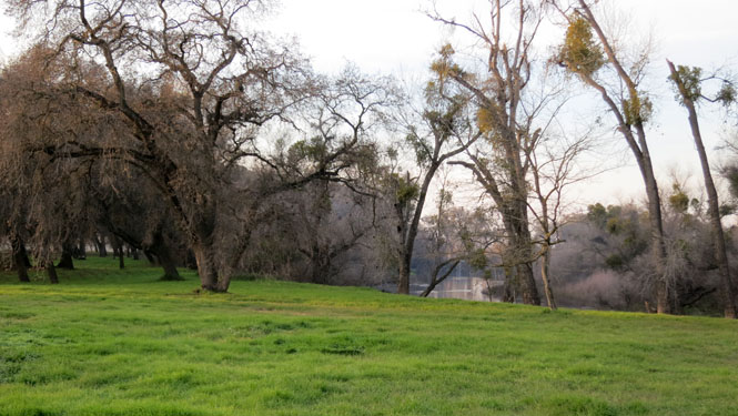
Upper Lake, California. They've done a better job of
maintaining the historic feel of their small town than most other lakeside
towns along Clear Lake.
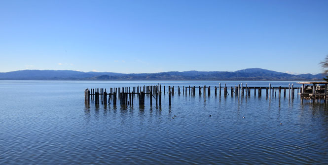
Clear Lake.
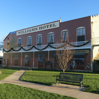
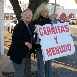
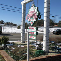
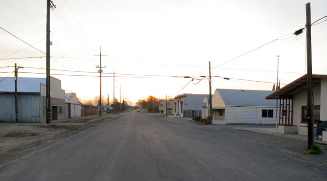
Williams, California.
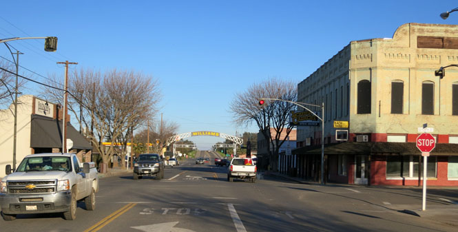
The large mural shows what the old Williams Hotel looked like--it burned years ago. Lifelike manikins do generally catch your attention.
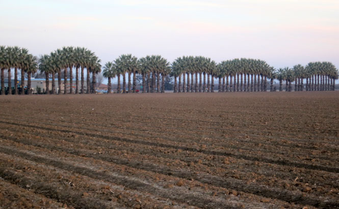
Zamora, California. "Zamora" is a type of soil:
The Zamora series is a member of the fine-silty,
mixed, thermic family of Mollic Haploxeralfs. Typically, Zamora soils have
grayish brown, slightly acid loam A horizons; brown silty clay loam, neutral
Bt horizons; and yellowish brown C horizons.
--USDA Soil Survey types
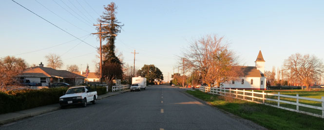
When I-5 was built, it went around some of the existing towns, and ran directly through others. Zamora was one of the later; it didn't survive the blow.
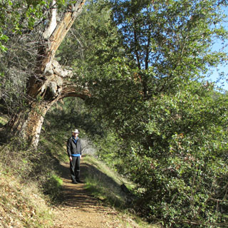
 Henry W. Coe State Park
is the second largest state park in California (behind Anza-Borrego Desert).
It started as the Pine Ridge Ranch (13,000 acres) and was given to the state
of California by Sada Coe in 1958. Later the park expanded to include
three more ranches expanding its size considerably to 89,000 acres.
Henry W. Coe State Park
is the second largest state park in California (behind Anza-Borrego Desert).
It started as the Pine Ridge Ranch (13,000 acres) and was given to the state
of California by Sada Coe in 1958. Later the park expanded to include
three more ranches expanding its size considerably to 89,000 acres.
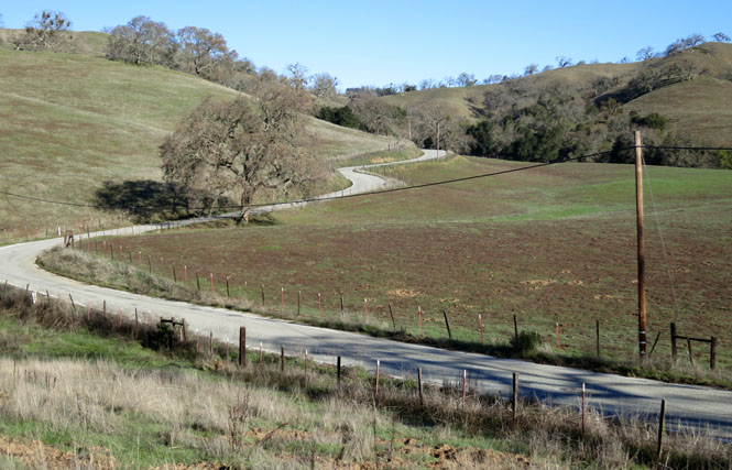
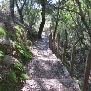
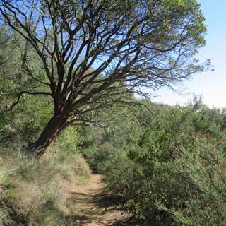
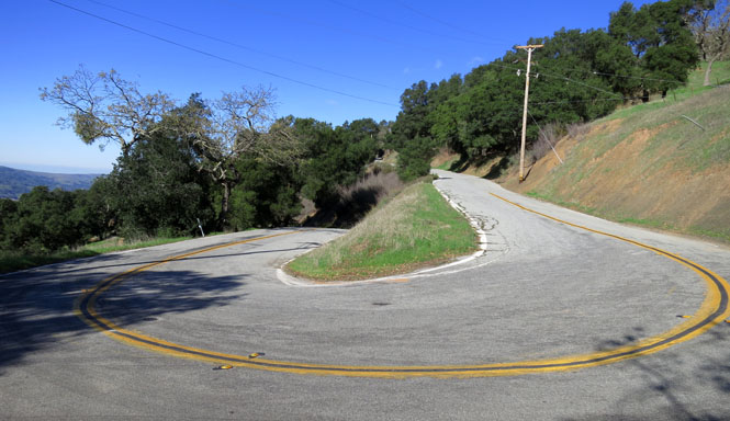
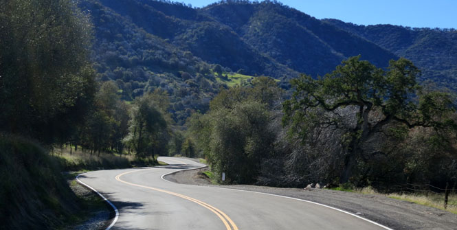
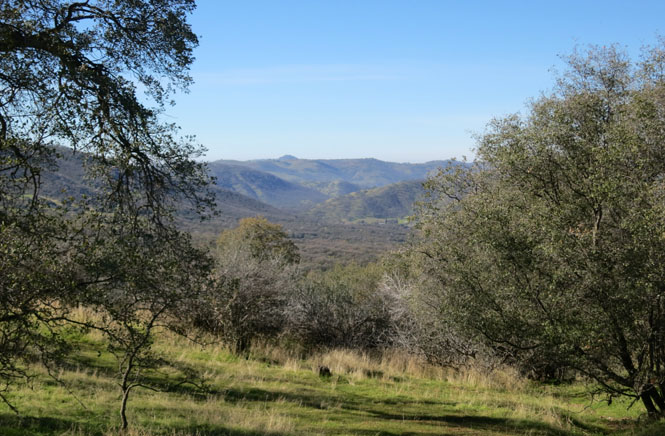
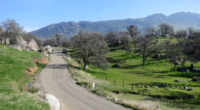
For all its size and location, I don't think it is visited much. While it's not far from the congestion of the south bay, it's still quite remote and the route to it is not developed beyond this narrow and winding country road.
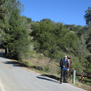
The pavement ends at the old ranch house. This vast park must be walked to be seen. We walked just a bit down the corral trail.
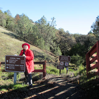
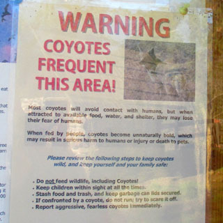
We looked; but, didn't see a single coyote.
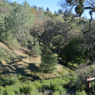
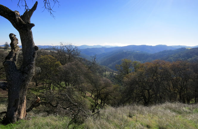
The park extends to those peaks. It's quite a remarkable thing for so much undeveloped land to be just down the road from Silicon Valley.
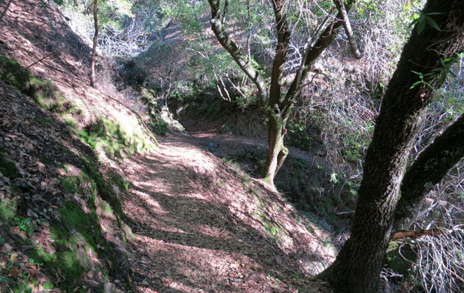
The road to the park entrance isn't one that you'll be driving fast.
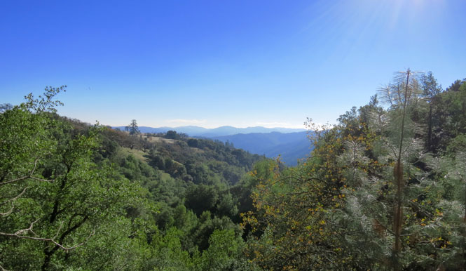
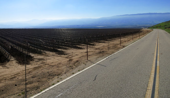
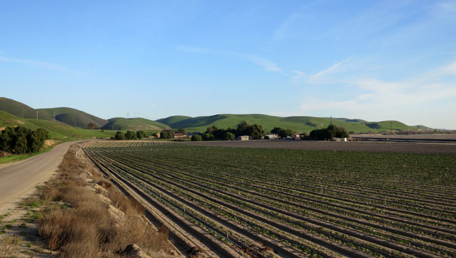
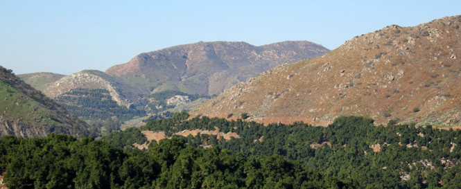
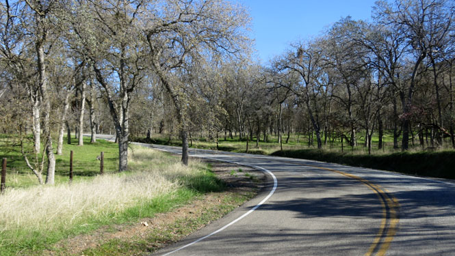
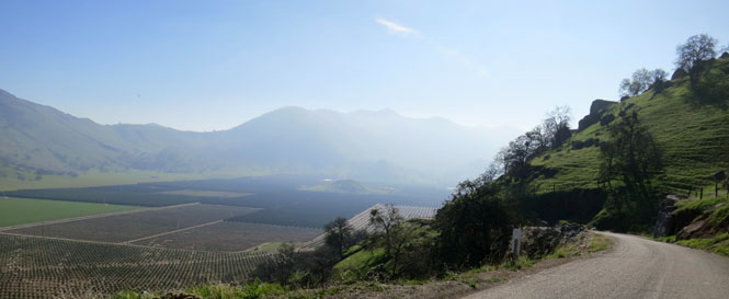
Driving down Salinas Valley, following the old highway that hugs the hills along the east side.
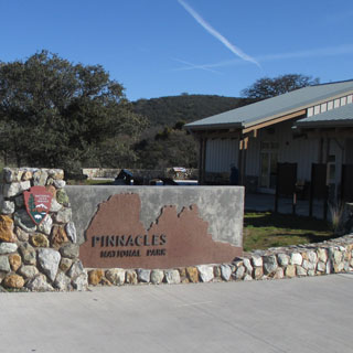
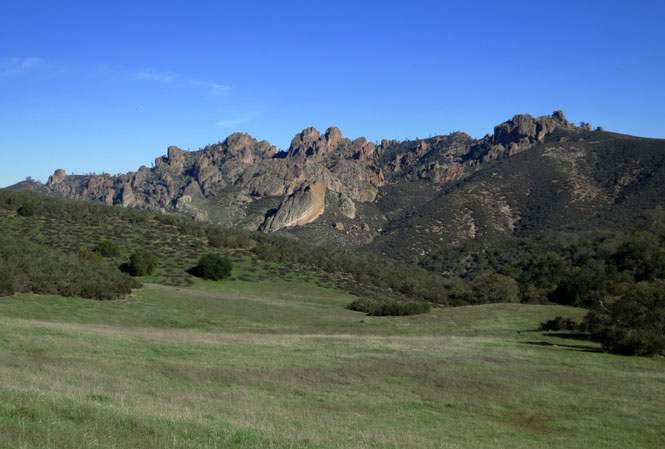
CA-146.
 Pinnacles National Park surrounds
the eroded core of old Neenach Volcano--from some 23 million years ago.
Pinnacles National Park surrounds
the eroded core of old Neenach Volcano--from some 23 million years ago.
Pinnacles National Park, located near the San
Andreas Fault along the boundary of the Pacific Plate and the North American
Plate, is an excellent example of tectonic plate movement. The Pinnacles
Rocks are believed to be part of the Neenach Volcano that occurred 23
million years ago near present-day Lancaster, California, some 195 miles
(314 km) southeast. The giant San Andreas Fault split the volcano and the
Pacific Plate crept north, carrying the Pinnacles. The work of water and
wind on these erodible volcanic rocks has formed the unusual rock structures
seen today.
--NPS web site
We'll be visiting the southern remains of the peaks in just a few days.
The park has two entrances; east and west. We're on the west side. You cannot drive directly from one to the other. If you want to see the other side, you'll need to walk there (or drive a very long way around).
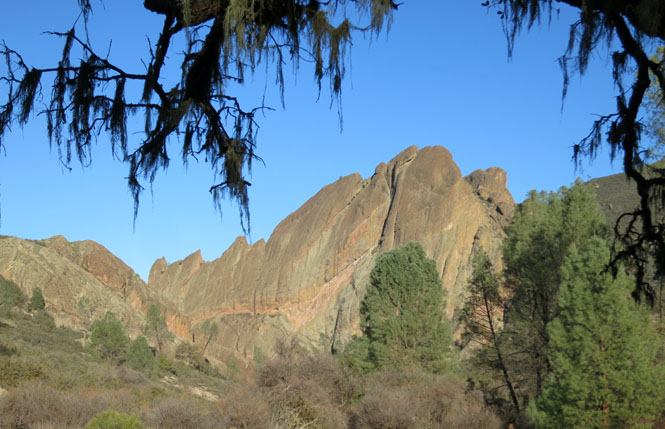
California condors have been released back into these peaks, and we were lucky enough to see two of them soaring (along with their far less spectacular cousins, the vultures)
Following Metz Road along the edge of the valley.
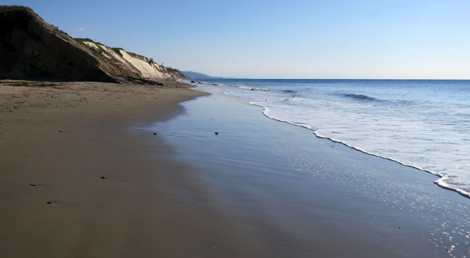
Gaviota State Park
and Beach. The rail bridge is still used by Amtrak trains (and lighter
freight).
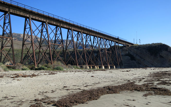
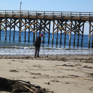
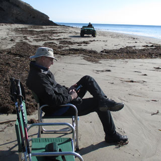
The pier was closed as having recently been damaged by a storm. That four-wheeler is being driven by a park volunteer who was especially vigilant about keeping his beach clean of any trash.
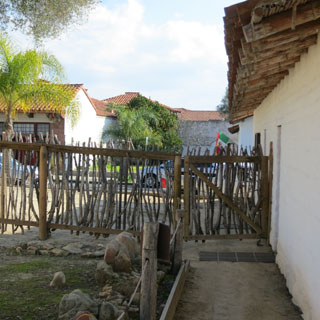
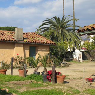
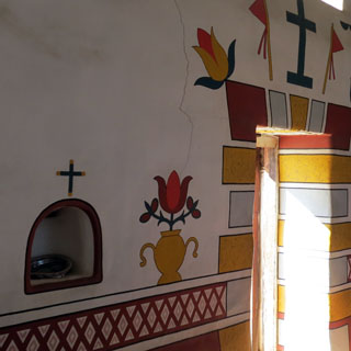
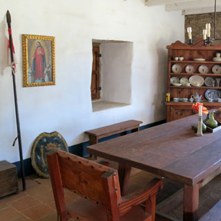
El Presidio de Santa Barbara State Historic Park.
The nearby mission seems to get more attention, but the old presidio is
equally important to the history of California. Rather unfortunately,
when the city was expanding, the value of the fort wasn't respected, so many
of the original buildings were destroyed as the inflexible grid street
system spread. Some buildings did survive, and a nice job is being
done to preserve those and to replicate what had been lost.
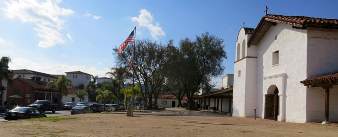
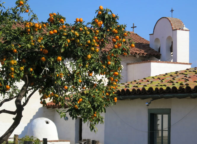
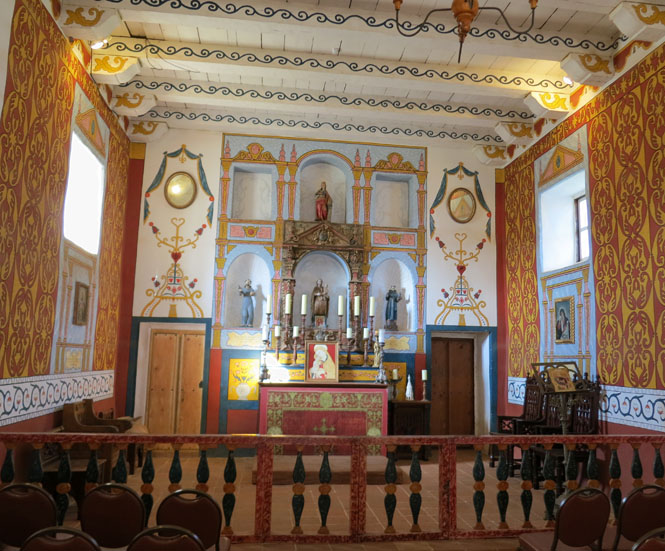
Again; this is the church of the presidio, and not the famous mission, which is not far away.
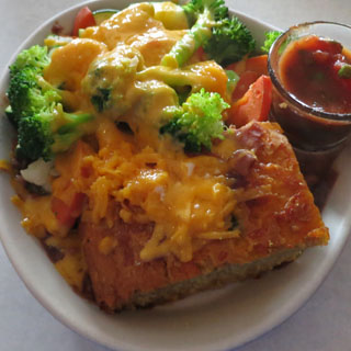
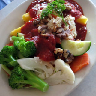
Downtown Santa Barbara is full of interesting restaurants. We ate lunch just across the street from the presidio at the Sojourner Cafe. That's a polenta dish on the left and a cornbread dish with fresh vegetables on the right. Very good.
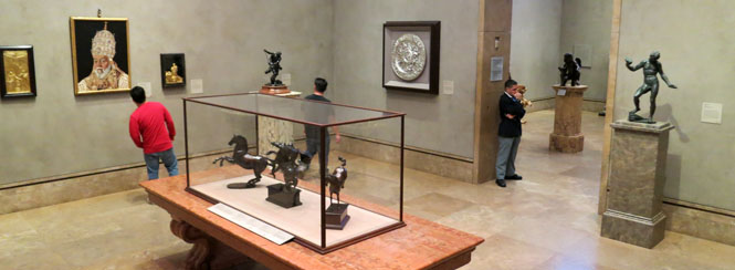
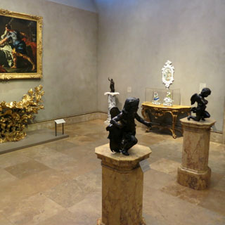
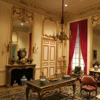
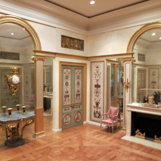
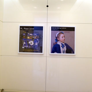
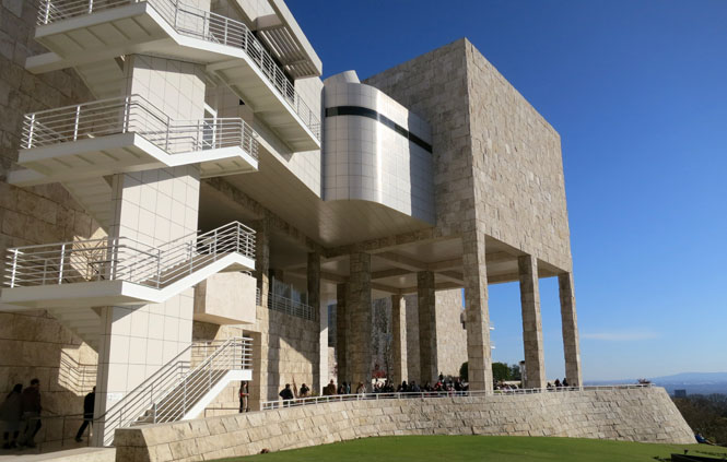
Founded by J. Paul Getty ("the meek shall inherit the earth, but not the mineral rights"), the Getty Museum is of two parts: The original was built in 1954 and then expanded to the Getty Villa in 1974. The Getty Center opened in 1997 as an additional campus in Brentwood. We would be visiting the Getty Center.
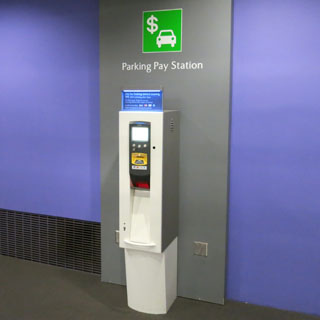
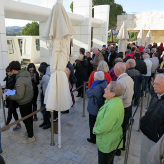
We were the morning's first in the multiple level parking garage.
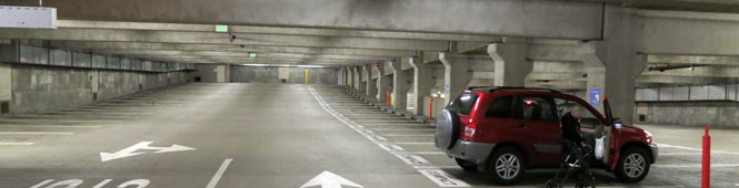
Entrance into the garage is direct, with no stopping for a ticket (a good idea). However, you are expected to buy a ticket from one of many self-service stations in the garage and in the art center. You'll need that ticket to get out.
You might also want to memorize your parking level (or color) in addition to the nearest support column.
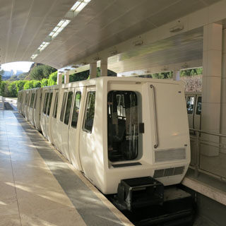
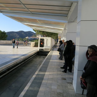
All parking is below the hill. You'll take one of these trains for the short (but steep) ride to the top. There are two trains shuttling back and forth so fairly large crowds can be moved quickly.
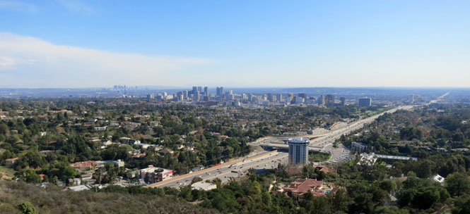
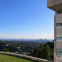
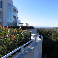
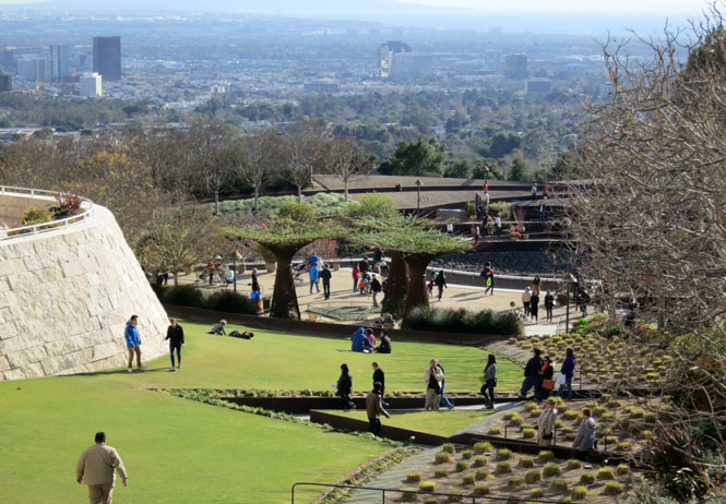
It's a spectacular view from the top. I can only guess how many expensive houses had to be purchased and cleared away when the top of the mountain was leveled.
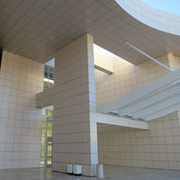
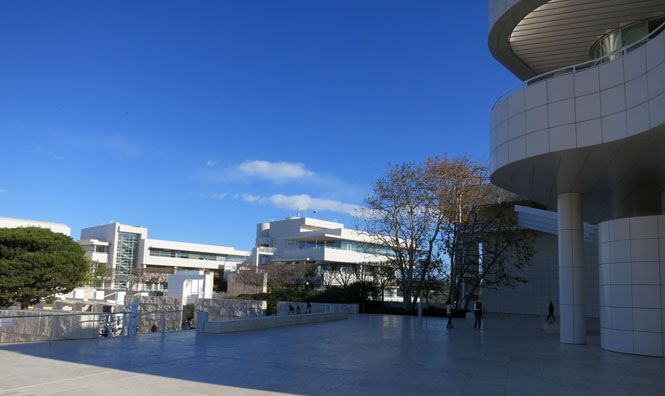
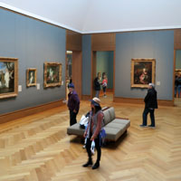
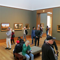
The complex includes several separate buildings, but, if you know your way, you can move from one building to the next without ever going outside.
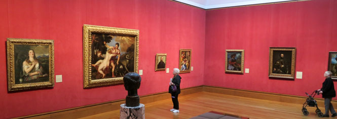
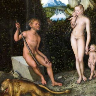
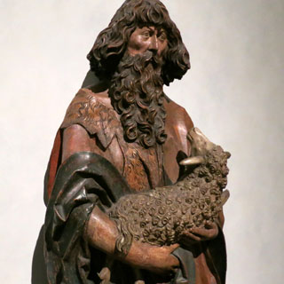
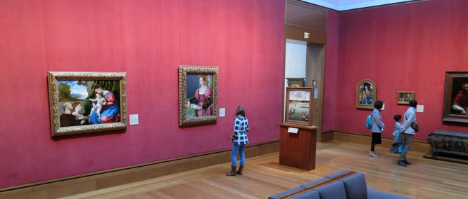
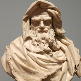
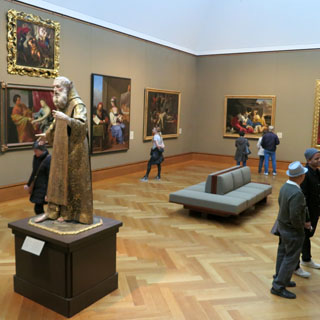
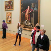
The framed art is virtually all European, and virtually all pre-20th century.
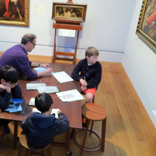
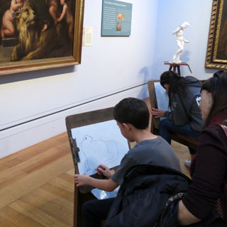
Tables and art supplies were available for you to draw from several originals. We were impressed by the boy's drawing of the lion. He only has the outline, but he did capture something of the lion's look. Neither of us tried our hand at it.
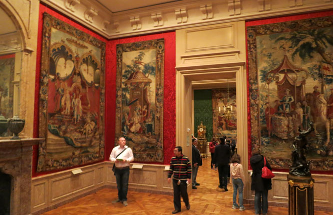
Goodness; J. Paul must have spent his summers in Europe collecting at a vast scale. Entire rooms from European castles have been brought to Los Angeles.
The guard on the left (she, who is giving me the eye) was soon to chastise me for standing too close to the wall (I was not), entirely ignoring that boy across the room.
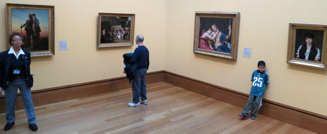
The broad hallways had plenty of chairs to rest where you could talk without bothering people looking at the paintings. The elevators had excellent posters letting you know what you would see at each level. Really; this whole center was very well planned.
Overheard at breakfast this morning:
Woman A - I've never been there; have you?
Woman B - I was there,
once. It's OK, I guess. They have a bunch of art if you like
that sort of thing. It's just a lot of paintings and stuff.
Woman A
- Is it all original?
Woman B - I don't know.
Woman A - 'cause that
would be really expensive!
I expected it to be impressive, but the Getty is even more than I thought it would be.
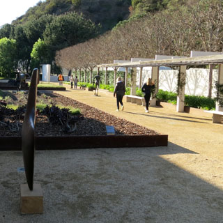
These gardens are intended to be an art installation of themselves. Those steel trees (with living tops) are impressive.
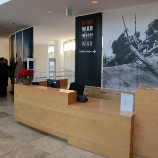
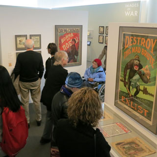
One of the revolving exhibits was of World War 1 images. It is worth noting that it was not intended to be any sort of history of the war--just the art imagery that came from it.
Unfortunately, judging only by overheard conversations, many people walking through the exhibit had no idea what World War 1 was about, nor which countries were fighting which countries, nor which side the United States was on.
Waiting for the train to take us down the hill. The line looked long, but it moved quickly enough as the trains shuttled back and forth. It was a cold morning (now, afternoon).
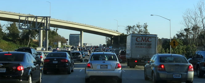
It's New Year's Eve, so perhaps travel on I-405 isn't as congested as it otherwise would be. It's congested enough, though.
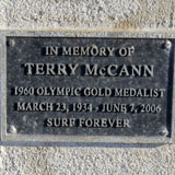
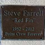
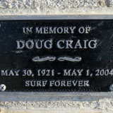
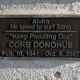
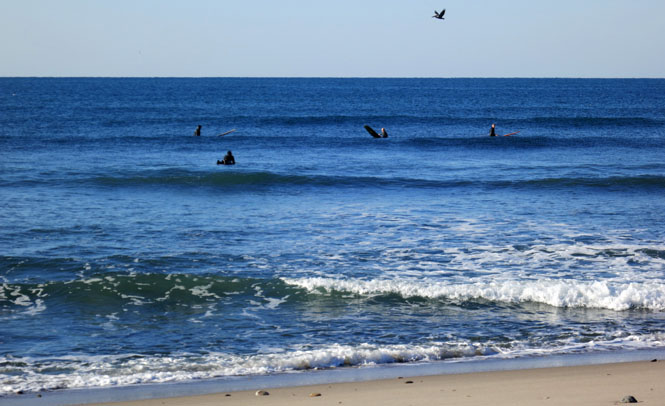
San Onofre State Beach on New Year's Day. Yes; the surfers are out there.
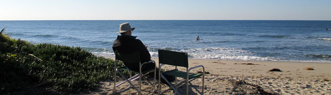
I don't believe these memorials are for people who died at this beach; I think they were just regular surfers in this area.
CA-78. We turned east before reaching San Diego.
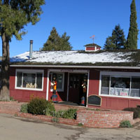
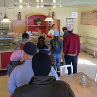
Mom's Pies has two locations. This one is along CA-78 west of Julian, and their main store is in the town of Julian. We each had a single slice of apple pie with a cut of sharp cheddar cheese.
The pie was good. However, the extraordinary inefficiency of the place was beyond belief, even comical--but, probably not so much to the throngs of people who arrived after us.
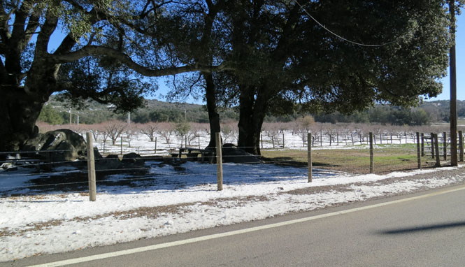
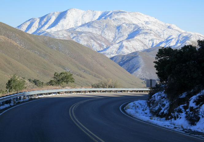
You don't expect so much snow around here. Luckily, we were not here just a few days earlier, when all traffic came to a halt.
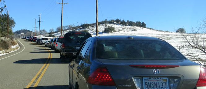
Banner Road. What are all these cars doing here? Apparently, all of southern California decided that morning to drive to a nearby historic town on New Year's Day. Stop-and-go for miles and miles.
But, we kept going and the traffic vanished.
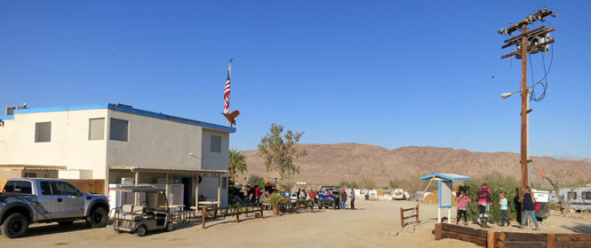
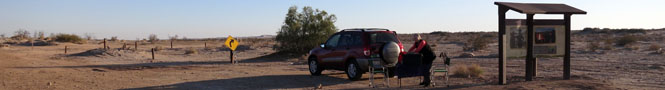
Ocotillo Wells, California has a hotel and a general store and lots of parking for off-road desert vehicles.
Kane Spring is not a town. It's the site of a spring that once supported travel through this desert.
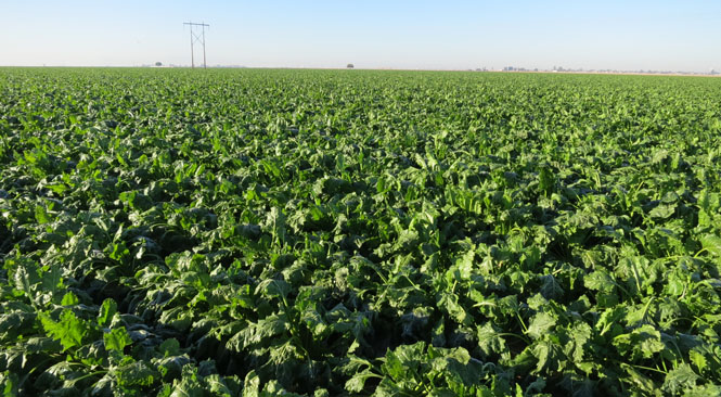
We're down to El Centro, along the Mexican border. Many different things are grown here, but I think this is beets. Sugar beets.
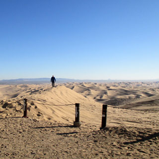
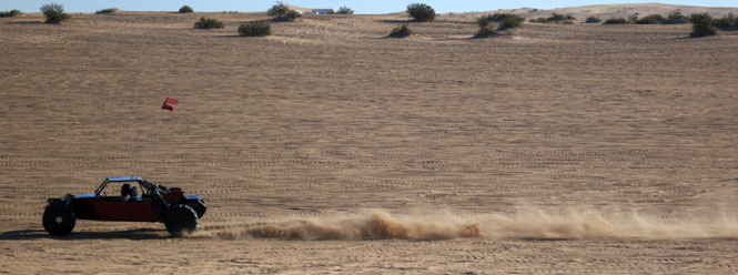
Glamis Dunes. It's just amazing that a highway was ever built across these dunes. How did they stabilize the bed? How hard is it to keep blowing sand off the road?
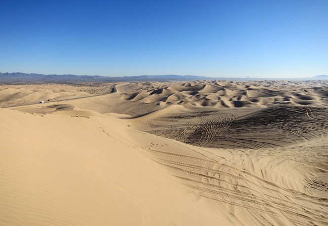
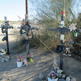
Those surfers (above) with the memorial plaques didn't die at the beach, but I'm pretty sure that these people died in the dunes. Frankly, it looks pretty dangerous the way people drive at tremendous speed up and over the dunes without any certainty that there will be nothing on the other side to get in the way.
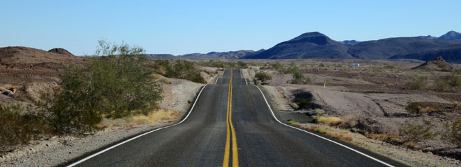
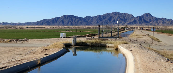
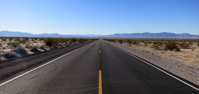
Direct driving towards the Colorado River. January is the perfect time to be here.
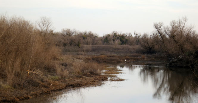
The Colorado River has changed its path over the years due to natural and periodic floods, but I think what happened here does not look so natural. We stopped for a break along the old banks of the river--now a calm bend of the river.
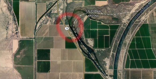
It is likely that this is exactly what the Colorado River once looked like all the way to the Gulf of Mexico.
Alfalfa is the major crop around here.
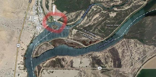
Horse Island for lunch. When you mark your state boundary with a river, you have to expect that in a hundred years, it won't make as much sense.
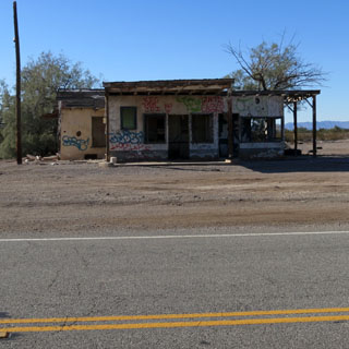
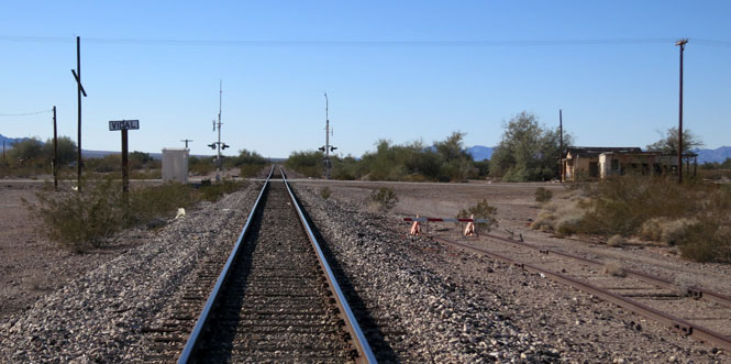
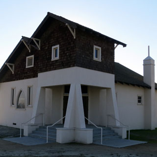
Vidal, California is known (if at all) for two things, the Boy in the Box and the cult of the Solar Lodge, and one of the homes of Wyatt Earp and his wife Josie.
The Boy in the Box
Charges were filed against 13 members of the Solar Lodge secret society
after their ranch near Vidal, California was raided by deputies of the
Riverside County Sheriff's Department on July 26, 1969.
When the
deputy sheriffs arrived at Solar Ranch, they found 6-year-old Saul Gibbons
sitting inside a six-foot by six-foot box with a chain padlocked to his left
leg and attached to a heavy metal plate.
It was alleged that between
May 1969 to July 26, 1969, the boy was kept chained up in the box and left
exposed to the heat of the Sonoran Desert. He was not allowed to leave the
box during those 56 days.
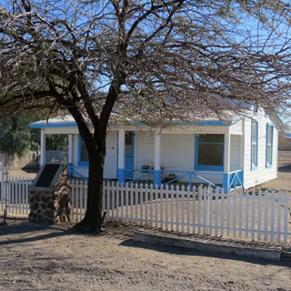
Wyatt Earp in Vidal
In 1906 he discovered several veins that contained gold and copper near
Vidal, California on the Colorado River and filed numerous claims at the base of
the Whipple Mountains.
Wyatt spent the winters of his final years working
these claims in the Mojave Desert and living with Josie in their Vidal cottage.
He and Josie summered in Los Angeles, where they befriended early Hollywood
actors and lived off real estate and mining investments.
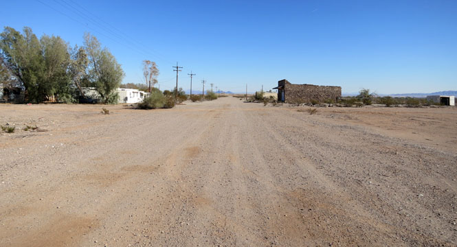
That's Wyatt's house on the left.
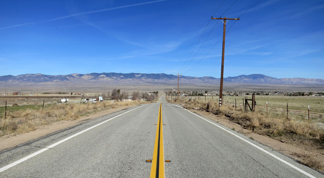
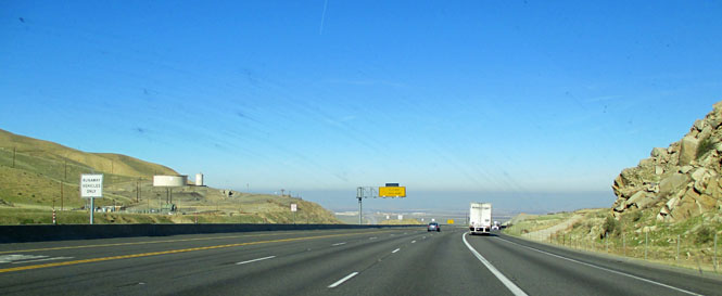
CA-62 doesn't get much traffic.
Joshua Trees are common.

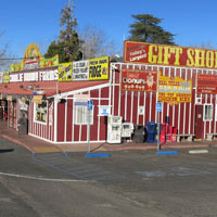
Charlie Brown Farm, Littlerock, California. You may not need anything here, but you'll find it.

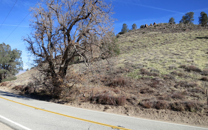
As promised, we visited the original site of the volcano that would eventually become Pinnacles National Monument. There is no sign to indicate that there's something special about this hill. I had the latitude/longitude coordinates from a geology web site.
Clearly, the years of erosion did not produce the dramatic peaks of the left-hand side of the volcano that traveled a couple hundred miles to the north. Perhaps the peaks are yet to be uncovered after a few million more years of erosion.
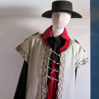
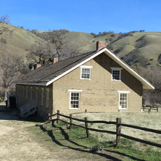
Fort Tejon State Historic Park.
The fort was established in 1854, and was abandoned ten years later.
It was there to control conflicts between settlers, the Sebastian Indian
Reservation and Indians not on the reservation to the east. It's not
clear that it was especially successful at any of this.
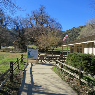
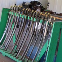
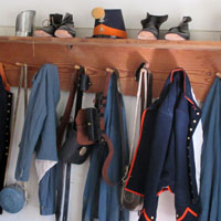
What the well-dressed Dragoon is wearing...

Grapevine grade.
The "Grapevine" is the 6 1/2 mile segment of the
Ridge Route that extends from Fort Tejon to the bottom of Grapevine Grade.
Many people erroneously believe that the "Grapevine" got its name because
the original 1915 highway had a series of "switchbacks" which allowed early
vehicles to gain elevation as they climbed the grade heading from
Bakersfield toward Los Angeles. The serpentine path resembled a giant
grapevine.
Although this observation was true, the name actually came
from the fact that early Wagoner's had to hack their way through thick
patches of Cimarron grapevines that inhabited "La Canada de Las Uvas,"
Canyon of the Grapes. Traveling the grade today, look for patches of what
appears to be ivy on both sides of the canyon near the truck run-a-way
escape ramps. What you see are descendant vines which date back to the
1800s.
--http://www.ridgeroute.com
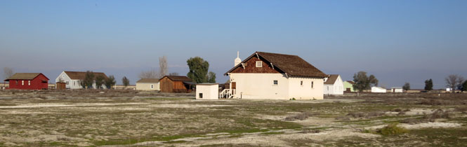
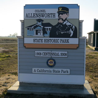
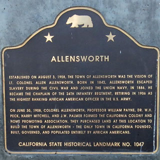
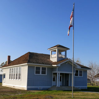
Colonel Allensworth State
Historic Park
In August 1908 Colonel Allen Allensworth and four
other settlers established a town founded, financed and governed by African
Americans. Their dream of developing an abundant and thriving community
stemmed directly from a strong belief in programs that allowed blacks to
help themselves create better lives. By 1910 Allensworth’s success was the
focus of many national newspaper articles praising the town and its
inhabitants.
An unavoidable set of circumstances made it impossible
for the residents of this tiny town located 30 miles north of Bakersfield to
achieve their founders’ dreams over the long term. But the town did remain
home to a handful of families and individuals throughout the 20th century,
and true to the courage and resolve of its founders, the town has survived
and persevered, earning the well-deserved title “The town that refused to
die.”
--park web site
They were unlucky in their location. The ground is now hard, white and mostly barren.
Driving through the San Joaquin Valley, it's clear that water is on the minds of everybody. They need it; there isn't enough of it; other people want it.
Signs seen along the way:
No water = no jobs
Farm water feeds the
nation
Food grows where water flows
Pray for rain
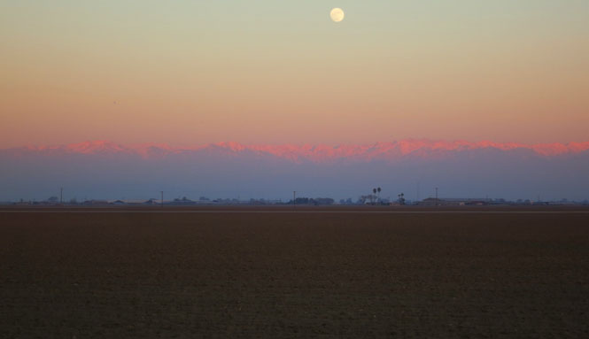
The Sierra Nevada at sunset.
Kramer Junction has four corners and even more gasoline stations.
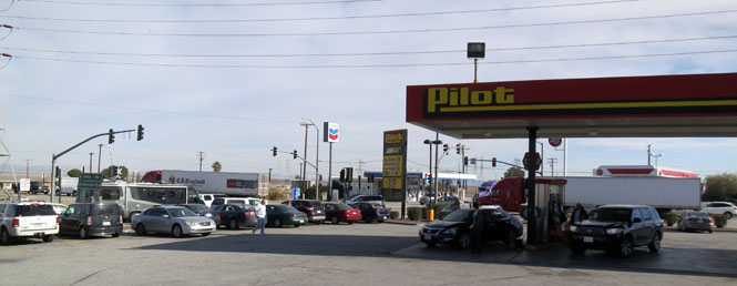
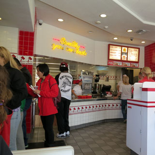
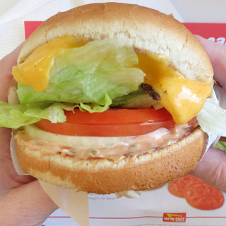
If you are at In-N-Out and you know the (not so) secret menu, you can order a grilled cheese sandwich.
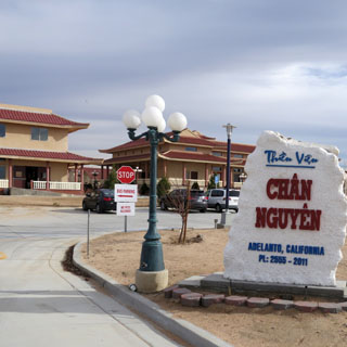
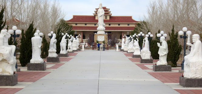
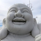
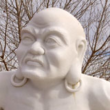
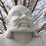
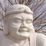
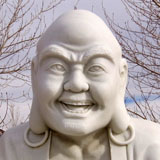
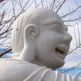
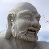
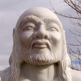
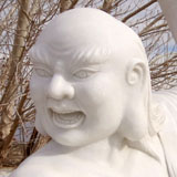
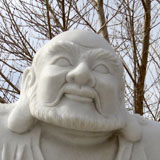
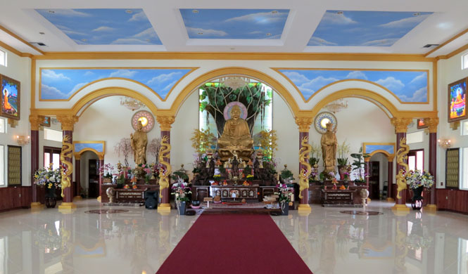
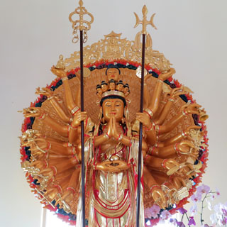
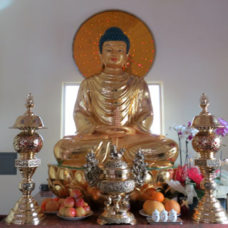
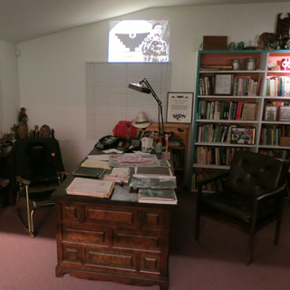
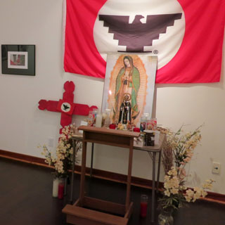
Something unexpected always comes along. North of Adelanto is the Thiền Viện Chân Nguyên Buddhist Temple.

A volunteer gardener offered to help explain the place (and to invite us to stay for food at no cost). He struggled a bit to cover the major tenants of Buddhism, but here's what he intended:
Four noble Truths:
truth of suffering
truth of the cause of
suffering
truth of the end of suffering
truth of the path that leads
to the end of suffering
which leads to the Eightfold Path of:
Right Understanding,
Right Thought,
Right
Speech,
Right Action,
Right Livelihood,
Right Effort,
Right
Mindfulness and
Right Concentration


As requested, we removed our shoes to enter the temple. You won't find a room that's cleaner.
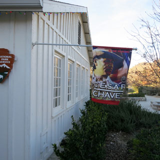
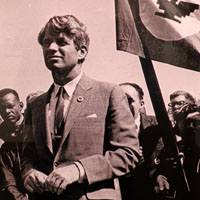
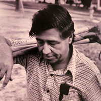
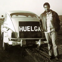
It happened just
a few years ago; the original site of the United Farm Workers in
Keene is now the César E. Chávez National
Monument.
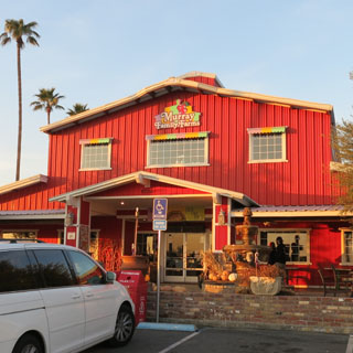
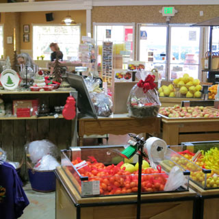
Stopping at an impressive fruit stand. We had something called an Oklahoma Fried Pie (this part of California being populated by thousands of Oklahomans during the dust-bowl days). But, having had plenty of genuine Oklahoma Fried Pies, I must say that they haven't got it quite right.
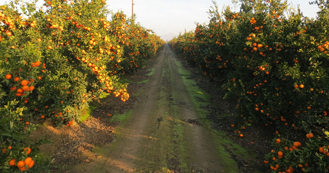
Orange trees go on forever.
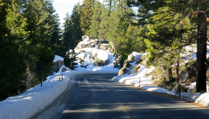
CA-180 climbs rapidly. It isn't far before you remember that this is still January.
A bit of confusion. There's 1) Giant Sequoia National Monument, then there's 2) Sequoia National Park and then there's also 3) Kings Canyon National Park. This is all surrounded by Sequoia National Forest. I intended that morning to go to one place, but ended up at another. Oh well.
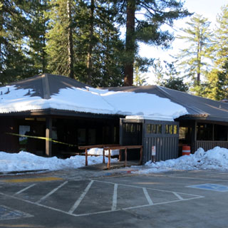
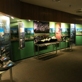
The visitor center for
Kings Canyon National Park.
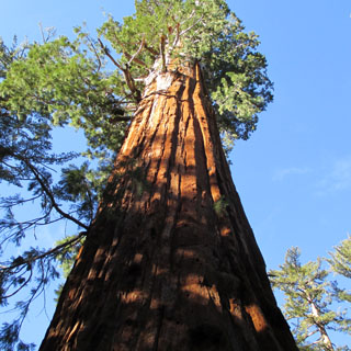
How do you take a photograph of a really, really big tree? Perhaps part-by-part is the way to go.
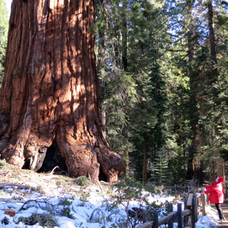
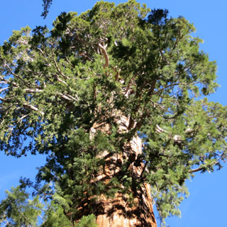
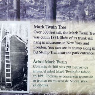
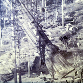
The world is full of famous trees.
Just as with their taller cousins along the northern California coast, it's hard to come to grips with the size of these trees. The trunks of the Sequoia Trees in this park are considerably bigger than those Coastal Redwoods.

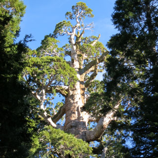
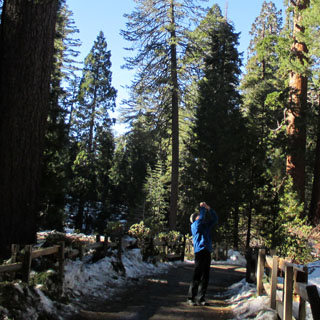
People walking the paths with their necks bent back.
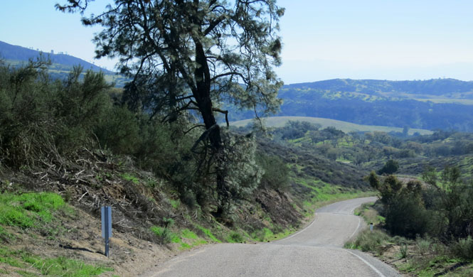
CA-245 is not a shortcut to the valley floor. But, it is a very nice road.
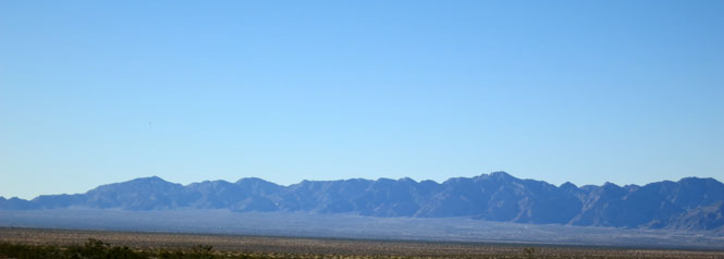
I am always impressed by how very sudden the Sierra Nevada Mountains are. You've got dead-flat land for miles, and then you don't.
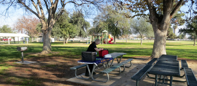
Dinuba City Park is a nice place for lunch.
Great Valley Grassland State Park (on
the San Joaquin River) is actually no longer a state park. Budget
choices have been made...
George Hatfield State Park (on
the Merced River) is also no longer a state park. Choices...
Crows Landing, California.
Think about the long-term strategy to produce this row of trees. Would the planter have even seen the result?
Quite a trip! It always happens that general plans lead to other things that were not even thought about.