March 12, 2017


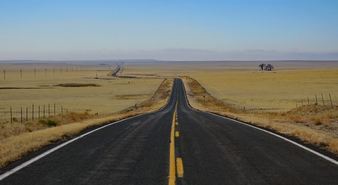
The Kiowa National Grassland is in the mostly unpopulated eastern half of New Mexico. Not long after the homestead act of 1862 you would have found this area to be more active than it is now. But, most of the towns are gone, and the few that remain are not always noticed when you drive by. The railroad tracks, too, are gone.
I've been nearby several times, but have never stopped at this point. This is the survey marker for the point where Oklahoma, Texas and New Mexico come together. The boundaries are perhaps not what you would expect. The eastern border of New Mexico is not straight, but wraps around the panhandle of Texas by about a mile before continuing north. Therefore, if you were to stand on the monument and face north, you'd have Oklahoma in front of your right shoulder, New Mexico in front of your left shoulder, and Texas behind you (just as you see below).


 New Mexico
To get to the Kiowa National Grasslands, you need to aim for the town of Mills, New Mexico. Once there, you'll be surrounded by the grasslands.

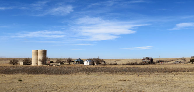
Mills, New Mexico. The post office first opened in 1889, but the town really no longer exists. The town was part of the empire of Melvin Mills. In the foreground, you can see the embankment where the railroad once was.
At Mills, turn west on the unpaved road. The quality of the surface is really pretty good at this point.

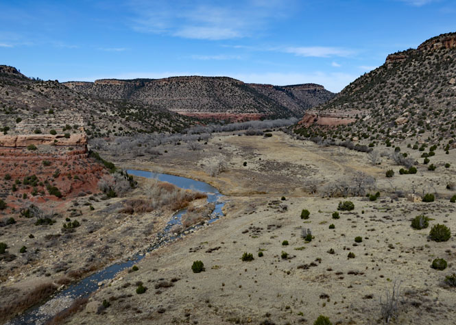
You can now see the canyon, just ahead. It drops down quite suddenly. On the horizon are the snowcap peaks of the Rocky Mountains.


Above the canyon, the ground is nothing but rock.

At this point, I'm walking the rest of the way. Any pickup or other high-clearance vehicle should be fine if you take it very easy. If you're not careful, though, you could scrape clean the underside of your car (and your phone won't help you).


There's not much room for passing, but then, there's probably never much traffic. As always, the car heading downhill must do the backing. Walking is easy enough.


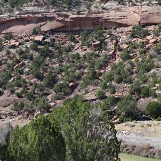
Melvin Mills planted an orchard that covered hundreds of acres along the Canadian River. There were thousands of fruit trees here: peaches, pears, apples, plums, apricots, cherries, walnuts, chestnuts and almonds. If you look closely at the photo (center, right), you can see the remains of the stone building that was used to store and keep the produce cool.
A view looking north.
A huge flood in 1904 destroyed everything. An attempt to make another go of it was made, but the last harvest was in 1912.
This is a view looking south.

The Canadian River doesn't look so fierce, today.

Walking south through the canyon.

It's amazing to see how very high the water has been. It wouldn't be easy to climb these walls, so you hope there is enough warning.


A view looking back to the north. It's time to walk back. I'm heading to the bluff you see directly and then turning right and climbing up the same road I came down.

Mills Canyon and the Kiowa Grasslands. Quite unexpected.