 November
17, 2005
November
17, 2005

Sunday |
Monday |
Tuesday |
Wednesday |
Thursday |
Friday |
Saturday |
13 November |
14 |
15 |
16 |
17
|
18
|
19
|
20
|
21
|
22
|
23
|
24
|
25
|
26
|
27
|
28
|
29
|
30
|
1 December
|
2
|
3 |
A report of a second trip to New Zealand (in 2011) can be found here.
I took two longer trips this year (along with many more weekend trips) that
couldn't have been more different. The
first one was for
 just one week and was virtually all
spent in the Great Plains region between Kansas and Saskatchewan. That one
had rolling hills with long views of fenceless prairies. It's probably
not an area that many motorcyclists dream of riding. That's not the case
for where I rode on this trip--it is generally accepted that New Zealand has the
best motorcycle roads in the world.
just one week and was virtually all
spent in the Great Plains region between Kansas and Saskatchewan. That one
had rolling hills with long views of fenceless prairies. It's probably
not an area that many motorcyclists dream of riding. That's not the case
for where I rode on this trip--it is generally accepted that New Zealand has the
best motorcycle roads in the world.
This trip started with a notice in the Moto Guzzi National Owners Club magazine
advertising rental Moto Guzzis in New Zealand--Guzzi Gander, LTD.
 After just a couple of emails with Dave I was ready to go. Taking
advantage of two additional
days off (without spending vacation time) during Thanksgiving, I set aside two
weeks for the trip. Of course, the seasons in New Zealand are opposite
Kansas, so I'd be riding in late spring.
After just a couple of emails with Dave I was ready to go. Taking
advantage of two additional
days off (without spending vacation time) during Thanksgiving, I set aside two
weeks for the trip. Of course, the seasons in New Zealand are opposite
Kansas, so I'd be riding in late spring.
 I didn't really do much
more planning for this trip than I've done for the others. Mainly, I spent
time going over road maps until I felt fairly comfortable where everything was.
I did buy several guidebooks, but I didn't take any of them with me. This
wasn't going to be a tourist trip of the top-ten sites of New Zealand.
This was to be two weeks of riding.
I didn't really do much
more planning for this trip than I've done for the others. Mainly, I spent
time going over road maps until I felt fairly comfortable where everything was.
I did buy several guidebooks, but I didn't take any of them with me. This
wasn't going to be a tourist trip of the top-ten sites of New Zealand.
This was to be two weeks of riding.
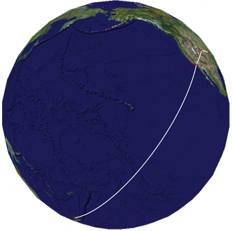
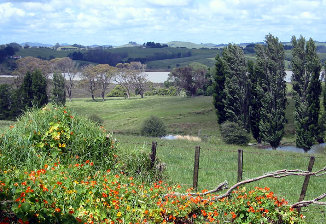
In order to better judge how far I could expect to ride each day, I made this overlay of New Zealand. The latitude isn't too far off, either. In total land area, New Zealand is about the same area as Colorado or the U.K. But, it's spread out far enough that you could do quite a bit of riding. After all, a trip from Roswell, New Mexico to Fort Yates, North Dakota is a pretty good ride.
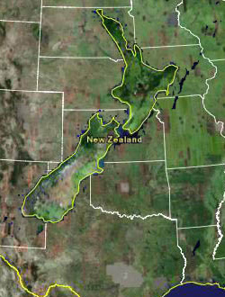
The motorcycles were in Auckland, so that determined where I'd be spending the
first couple of nights and the last night before leaving. I made reservations for those nights. I
planned to ride the most northern part of the North Island before riding back
through Auckland and points south. Beyond that, I didn't have any definite
plans, and the town where I spent each night was determined only by where I was
around 6:30 that evening. In short, other than the exotic (for me)
location, I'd run this trip exactly like any trip heading out from Kansas.
last night before leaving. I made reservations for those nights. I
planned to ride the most northern part of the North Island before riding back
through Auckland and points south. Beyond that, I didn't have any definite
plans, and the town where I spent each night was determined only by where I was
around 6:30 that evening. In short, other than the exotic (for me)
location, I'd run this trip exactly like any trip heading out from Kansas.
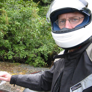
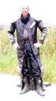
Everything I packed would have to be transferred to the saddlebags and rear trunk of the Guzzi. My riding suit and boots packed nicely in a larger duffle bag, and I carried my helmet and gloves with me in a smaller bag.
 Kansas
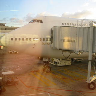
Thursday was just another day at work, but by the time I turned out the light in the hotel room it was late Saturday. Anyway, I ducked out early to catch my flight from Wichita to Denver, then on to Los Angeles before switching from United to Qantas and taking the late night flight to Auckland.
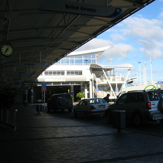
Auckland
I arrived in Auckland very early, Saturday morning. Friday just
 never happened. After
waiting in customs and immigration lines that never seemed to move, I converted
whatever cash I had in my wallet to something more appropriate (and colourful)
and went searching for an ATM. I also picked up a mobile phone from the
Vodaphone booth in the
main airport lobby. I had arranged for the phone several weeks
earlier--so, I knew what my phone number would be. Any calls I
made were taken off my credit card, and the whole thing worked very well.
never happened. After
waiting in customs and immigration lines that never seemed to move, I converted
whatever cash I had in my wallet to something more appropriate (and colourful)
and went searching for an ATM. I also picked up a mobile phone from the
Vodaphone booth in the
main airport lobby. I had arranged for the phone several weeks
earlier--so, I knew what my phone number would be. Any calls I
made were taken off my credit card, and the whole thing worked very well.
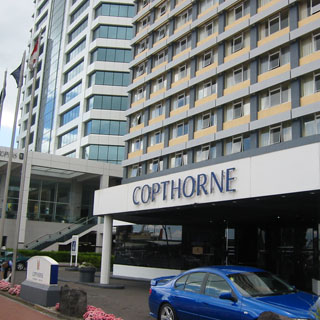
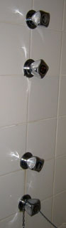
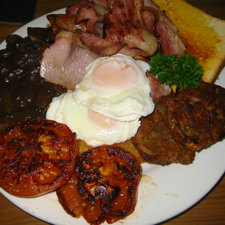
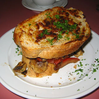
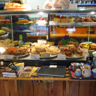
The Copthorne Hotel turned out to be a very handy place to stay in Auckland. It's right on the wharf, and I could walk most anyplace I'd want to go. Not surprisingly, this was the most expensive place I stayed during the trip, but that's to be expected. Perhaps it's the least interesting of things to take a picture of, but I'd never seen this sort of faucet arrangement in a bath/shower...
 road assistance
services and maps. I never needed road assistance, but at least I had
the card.
road assistance
services and maps. I never needed road assistance, but at least I had
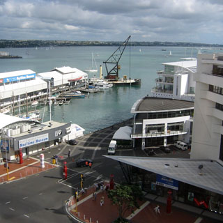
the card.This was the view from my 10th floor room.
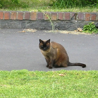
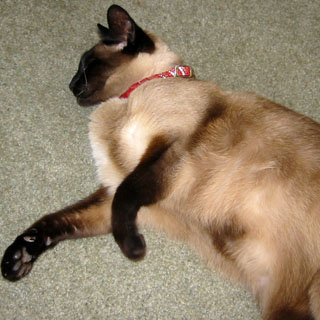
The wildlife seen on the trip was limited to birds of many types (that's the only detail I can give), a sea lion, and many dead possums (if you can count that). So, I'll include at least a few cat pictures. I had several chances to add to my dog-in-truck collection, but never quite had the camera ready.
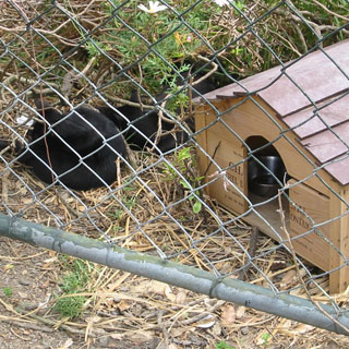
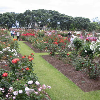
These cats weren't even close to any houses, but somebody at least delivers water and (probably) food. The Rose Gardens in Dove Meyer Park.
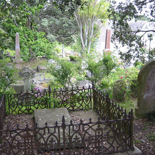
Stephen Chapel and cemetery, one of the older churches (Anglican, of course) in Auckland. You can just barely see the chapel in the upper RH corner of the photograph.
More "wildlife" (you take what you can get).
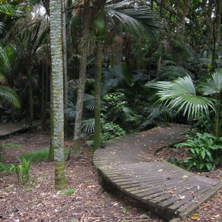
This was just a small park in a residential area of Parnell, but you'll get an idea of the sorts of plants that grow here.
Parnell, a township area that is within Auckland, but is a distinctive area in its own right (with countless restaurants). I didn't have a map with me, and was just walking down any street that looked interesting. I did come across some unusual areas (I ignored the "No through traffic" signs--there's always a way).
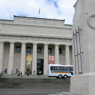
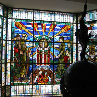
Eventually, I found my way to the New Zealand War Memorial Museum. This building is at the top of a hill in a much larger park. The memorial is dedicated mainly to World War I, but certainly covers much more than just that.
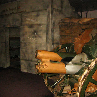
There's an exhibit very much like this one at the Imperial War Museum in London. They have replicated the trenches down to the sounds and smells.
On a per-capita basis, New Zealand lost more men than any other country in that war. This wall, and others just like it, has the names of all the dead from that war and from all the later wars and conflicts.
I cannot imagine the effect WW1 had on this country. In many ways it reminded me of traveling through Illinois (or other states). Most every small town in that state has a memorial to the Civil War dead. Likewise for the New Zealand towns. And as with the American Civil War, New Zealand formed their battalions from individual regions. So just as whole towns in Illinois lost many of their young men in a single battle in the Civil War, so did New Zealand during the first World War. The exception being that they never had that many to begin with.
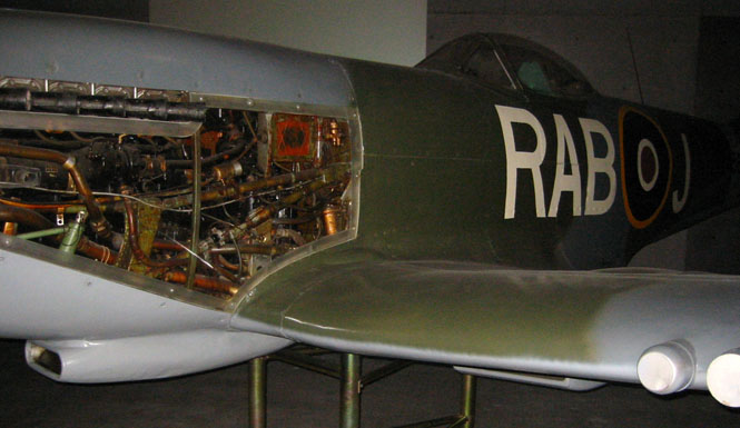
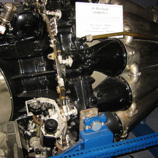
A nice later edition Spitfire (Mark XVI) on display.
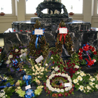
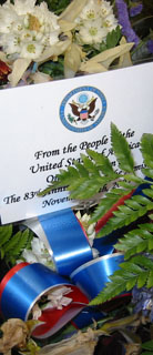
This war memorial still had the flowers that were placed there from the Armistice Day ceremonies just a couple of weeks earlier. As would be expected, most of the cards were from New Zealand organizations, but it was nice to see a card and arrangement from the "People of the United States."
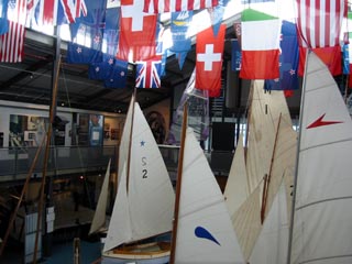
I toured only the War Memorial and Natural History portion of the museum, but there were a couple of other special exhibits. One was a Maori exhibit, and the other was a traveling exhibit on da Vinci. You can see just a bit of both in this view from an upper balcony.
This wingless Moa bird couldn't coexist with people, so when that happened (not really all that long ago) the giant bird became extinct. The largest bird that ever lived. He must have been impressive.
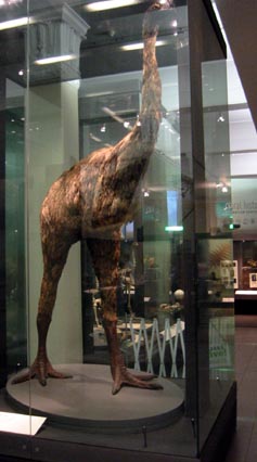
No moa
No moa
In old Ao-tea-roa
Can’t get ‘em
They’ve eat ‘em
They’re gone and there ain’t no moa.
--dreadful poem by W. Chamberlain
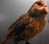
And I always thought that all parrots were colourful...
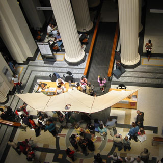
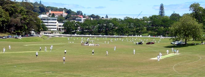
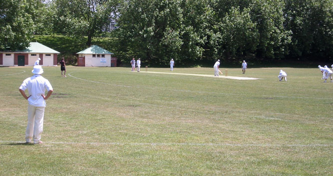
I bought an ice-cream cone from a vendor and stopped to watch the cricket games (matches?). Apart from the very basics (it's good for the batter to hit a ball, and it's good for the pitcher to knock over the pins behind the batter), I'm afraid that I just couldn't figure this game out. Not much would seem to be happening, when several folks would shout out "Nicely played!" And, there was rarely any action in the field. I didn't once see a runner "take out" a player from the other team, so I guess that's not done, either.
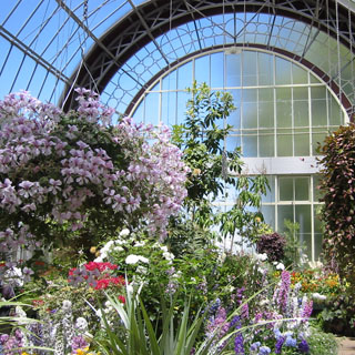
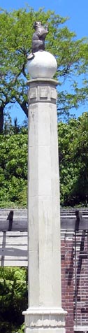 These gardens are within the
War Memorial Park grounds. Just outside this hot house (although it had
another name) was this larger monument with a ball on top, and a cat on top of
that. I didn't see any explanation, but I'm sure there's a good story
behind it.
These gardens are within the
War Memorial Park grounds. Just outside this hot house (although it had
another name) was this larger monument with a ball on top, and a cat on top of
that. I didn't see any explanation, but I'm sure there's a good story
behind it.
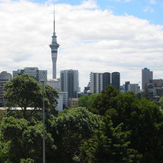
As long as that tower is visible, you really can't get too lost walking around Auckland.
 Not lost, perhaps, but it was not always
straightforward to get across some of the streets. There are some
areas where pedestrians were not expected to be.
Not lost, perhaps, but it was not always
straightforward to get across some of the streets. There are some
areas where pedestrians were not expected to be.
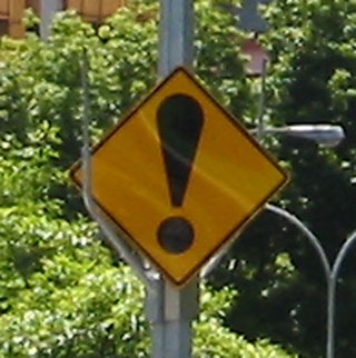
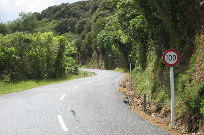
That exclamation! sign was something that I'd see occasionally during the next two weeks. It doesn't carry much information, but I found it effective, anyway. You can be sure that there's something up ahead that you might want to pay attention to.
For reasons that are never clear, some art museums shrug off taking photographs, while others confiscate all cameras. There may be real copyright issues with some paintings, and there might (but, I doubt it) be an issue with certain materials from the bright light of a flash. Mostly, though, it's just a rule that exists for its own reason. At the Auckland Art Gallery, you cannot take pictures.
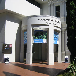 But, nobody cared if I took a picture of the entrance. Like many art
museums, everywhere, they started with a classic Victorian era building (that
the original founders of the museum built), and then grafted on a stark, angular
addition that was intentionally at odds with the base building. I'll give
you odds that in fifty years it will be the new addition that needs structural
repairs while the original will still be going strong.
But, nobody cared if I took a picture of the entrance. Like many art
museums, everywhere, they started with a classic Victorian era building (that
the original founders of the museum built), and then grafted on a stark, angular
addition that was intentionally at odds with the base building. I'll give
you odds that in fifty years it will be the new addition that needs structural
repairs while the original will still be going strong.
There was a live exhibit in an annex building, next door, on Maori Tattoos. When I say "live" I mean that there was a well-tattooed man having even more tattoos applied. Both he and the artist were on a rug on the bare floor (there was a rope around this "exhibit") and the ink was being applied using a stick with a nail in it. Or at least, that's what it looked like to me. The stick with the nail was moved into position while another stick was used to tap the nail into the skin. Tap, tap, tap. Tap, tap, tap. It didn't occur to me to check if photographs were allowed; it just didn't seem polite, somehow.
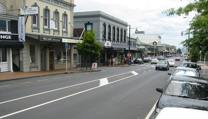
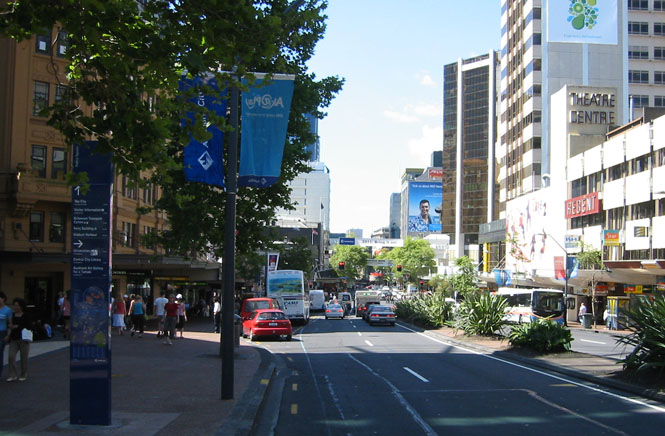
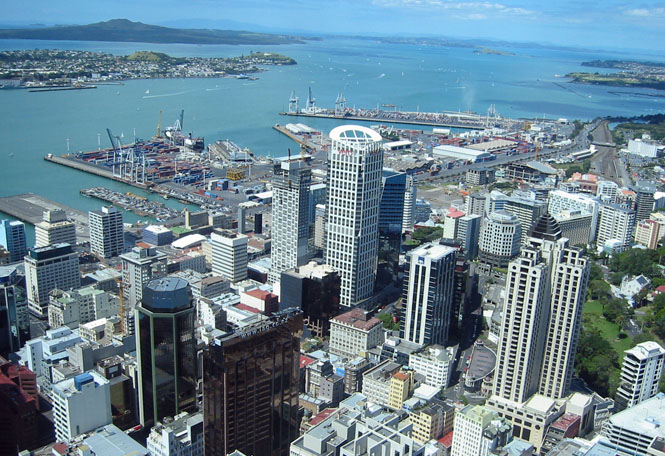
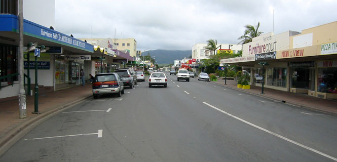
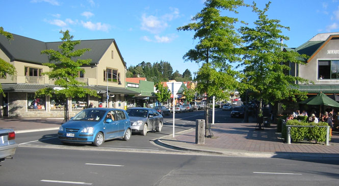
I enjoyed downtown Auckland. The sidewalks were busy, and the place has a friendly feel to it.
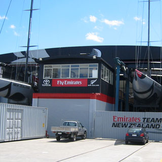
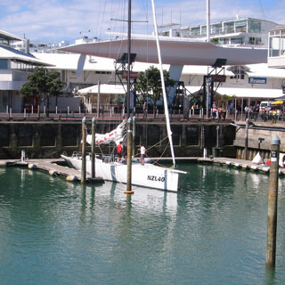 That large sailboat (the one out of the water)
is the Big Boat that was used by a New Zealand entry in the
Americas Cup
race of 1988. This was hardly gentlemanly, as the Big Boat
was
vastly bigger than the
12-meter boats that had been used. The response from Dennis Connor was
an equally outlandish boat--this time a large catamaran--that easily won the
"race." Anyway, here it sits. Not surprisingly (as
these things go), after that episode a large team of international lawyers
re-wrote the rules to preclude anything of that sort from happening in the
future. No more handshakes. The much smaller boat in the water
is one of the more conventional Americas Cup racers. There are a pair
of them in this slip and you can buy a ticket to join the crew.
Americas Cup racing in the U.S. is not really looked at as a national team
event (or with much national fervor),
That large sailboat (the one out of the water)
is the Big Boat that was used by a New Zealand entry in the
Americas Cup
race of 1988. This was hardly gentlemanly, as the Big Boat
was
vastly bigger than the
12-meter boats that had been used. The response from Dennis Connor was
an equally outlandish boat--this time a large catamaran--that easily won the
"race." Anyway, here it sits. Not surprisingly (as
these things go), after that episode a large team of international lawyers
re-wrote the rules to preclude anything of that sort from happening in the
future. No more handshakes. The much smaller boat in the water
is one of the more conventional Americas Cup racers. There are a pair
of them in this slip and you can buy a ticket to join the crew.
Americas Cup racing in the U.S. is not really looked at as a national team
event (or with much national fervor),
 but when New Zealand won the cup in
1995 and 2000, I gather that the country went crazy for their team.
Considering the nature of the place, sailing is clearly a very important
sport. I'd see old posters and signs all through my trip celebrating
the Americas Cup wins.
but when New Zealand won the cup in
1995 and 2000, I gather that the country went crazy for their team.
Considering the nature of the place, sailing is clearly a very important
sport. I'd see old posters and signs all through my trip celebrating
the Americas Cup wins.
I have no idea just how far I walked that day.
Probably 15 miles, but it could have been more. I finished the day by
attending an impressive downtown theater to watch "The
World's Fastest Indian." This is the story of New Zealander Burt
Monro, an old codger who was fanatical about making his old Indian Scout go
as fast as possible. Eventually, he surpassed 200 mph on the
Bonneville Salt. Anthony Hopkins plays Burt, and
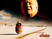 the movie is very good (even
if you don't know motorcycles). I knew that the movie was playing in
New Zealand, so when I saw it on the marquee, I made sure to see it. I
needn't have been in such a hurry. I later found that every town that
had any sort of theater was also showing this movie. The couple I sat
next to in the theater (from Invercargill--Monro's home town) were able to
identify several people they knew, including the mayor of Invercargill (this
as we walked through downtown after the movie--of course, we weren't talking
during the movie). When the credits rolled, the audience broke into
applause.
the movie is very good (even
if you don't know motorcycles). I knew that the movie was playing in
New Zealand, so when I saw it on the marquee, I made sure to see it. I
needn't have been in such a hurry. I later found that every town that
had any sort of theater was also showing this movie. The couple I sat
next to in the theater (from Invercargill--Monro's home town) were able to
identify several people they knew, including the mayor of Invercargill (this
as we walked through downtown after the movie--of course, we weren't talking
during the movie). When the credits rolled, the audience broke into
applause.
And so ended my first day. It started Thursday in Wichita with my normal drive into work, and it ended late Saturday night walking through downtown Auckland, New Zealand.
The second day had always been planned as a time-zone recovery day, and I think that worked well. I probably could have started riding, but it helped to have the extra day to relax and get the feel of the place. I spent most of the day doing more walking, but not nearly as much as I had the day before.
The National Maritime Museum was just across the street from my hotel. They had an interesting display of what the passenger quarters of the sailing ships were like for the working class immigrants to New Zealand. The entire room actually rolled and creaked authentically.
This was my chance to be a grinder on an Americas Cup boat. Well, perhaps not. In any case, the faster you cranked, the more lights you displayed. Tough work. This was really quite an interesting museum. There were dozens of boats on display.
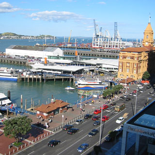
The view from the museum, looking back towards the Copthorne Hotel. The boats you see in the foreground are part of the museum.
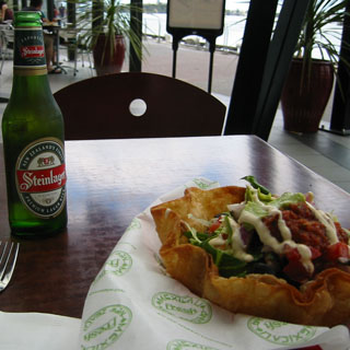
Steinlager is one of the more common New Zealand beers. The food next to it was advertised as Mexican, but I'm not so sure. No matter. It was quite good, anyway.
There is still quite a bit of Americas Cup work going on. I didn't try knocking on the front door to see if they'd allow visitors, but I gathered by all the signs, that they were not there for the benefit of casual sightseers.
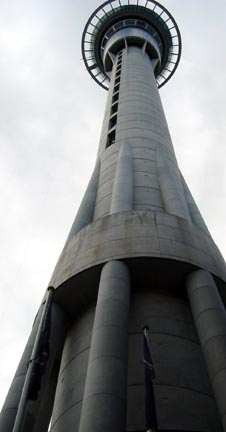 I had used the
Skycity Sky Tower as a landmark the day before, but I didn't go up to
the top. I'd do that, today. For what it's worth, the tower is
the tallest in the Southern Hemisphere and is 328 metres high (which works
out to 1,076 feet). The observation deck is at 700 feet, which is
still pretty tall.
I had used the
Skycity Sky Tower as a landmark the day before, but I didn't go up to
the top. I'd do that, today. For what it's worth, the tower is
the tallest in the Southern Hemisphere and is 328 metres high (which works
out to 1,076 feet). The observation deck is at 700 feet, which is
still pretty tall.
You enter the tower by first going through Skycity (a large hotel and casino) and descending to the lower footing of the tower. Pay your money, and the elevator takes you to the observation deck. Pay a bit more money, and the elevator will take you to the top deck. Pay still more money, and you can climb the stairs to a much higher exposed platform on the mast. I didn't do this last bit. Both the elevator and the floor of the main observation deck had a glass panel that you could stand on. Oddly, the clear elevator floor didn't faze me, but the observation deck was strangely unnerving at first.
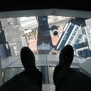
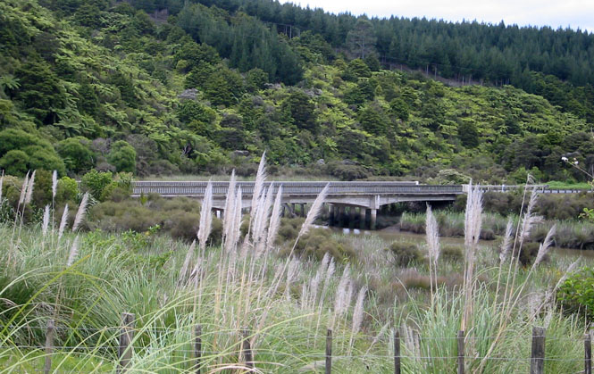
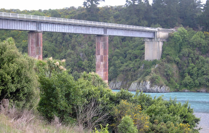
As you might expect, the view from the deck was spectacular. This is a view of the bridge that crosses over the harbour to the north. I'd be crossing that very bridge on the motorcycle in a couple of days.
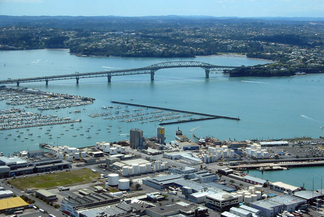
I've turned the camera to the right, and we're looking out towards the Hauraki Gulf.
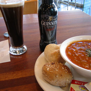
The tower also offers a cable drop system in which you drop off the observation tower and are lowered to the ground. It sounded interesting, but I didn't do it. I decided to have some bean soup and a Guinness, instead.
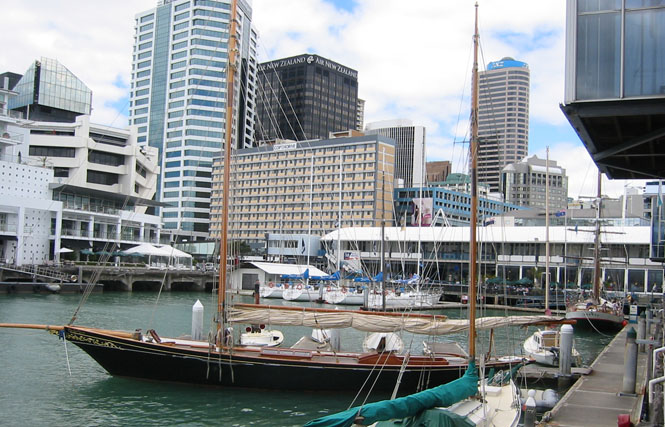
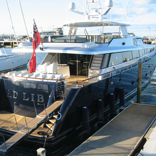
There were countless really nice boats tied up along the piers. This one is typical. Life is good.
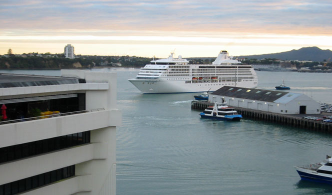
A couple of cruise ships arrived when I was there. This one was just coming in. The picture was taken by sticking my camera out my hotel room window.
Tomorrow, I ride!
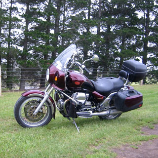
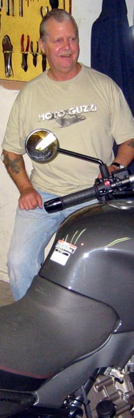 I met
Dave Gale for the first time when he picked me up Monday morning and we drove the few miles (start thinking
Kilometres) to his house where I'd
first see the fresh Moto Guzzi EV-Touring.
I met
Dave Gale for the first time when he picked me up Monday morning and we drove the few miles (start thinking
Kilometres) to his house where I'd
first see the fresh Moto Guzzi EV-Touring.
 Blood-red and black with gold
pin striping. Very nice. Frankly, I would not have been in New
Zealand were it not for Dave and his Guzzis. Touring on--let's
say--a Honda VFR would be nice (I suppose), but to tour New Zealand on a Guzzi
would be something very special. And, in any case, I have never met a
Guzzi owner I wouldn't trust completely. You have to love the bike to want
one, otherwise you'd
never have even heard of it in the first place. There are very few casual
Guzzi owners (which is not to say that there aren't any Guzzi owner's casual
cats). That's Dave standing next to his Guzzi Breva 1100.
Blood-red and black with gold
pin striping. Very nice. Frankly, I would not have been in New
Zealand were it not for Dave and his Guzzis. Touring on--let's
say--a Honda VFR would be nice (I suppose), but to tour New Zealand on a Guzzi
would be something very special. And, in any case, I have never met a
Guzzi owner I wouldn't trust completely. You have to love the bike to want
one, otherwise you'd
never have even heard of it in the first place. There are very few casual
Guzzi owners (which is not to say that there aren't any Guzzi owner's casual
cats). That's Dave standing next to his Guzzi Breva 1100.
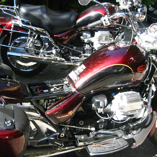
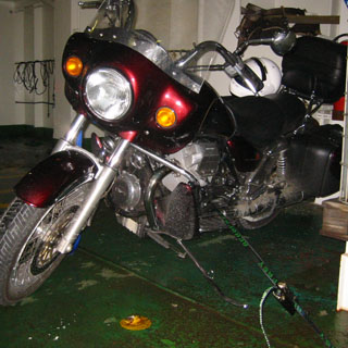
 This California EV-touring is really just the end result of 20 years of
improvements over my own bike. There are many differences (fuel injection,
hydraulic valves, larger displacement) but the underlying character is
unchanged. It wouldn't take me long to become completely at home on this
motorcycle.
This California EV-touring is really just the end result of 20 years of
improvements over my own bike. There are many differences (fuel injection,
hydraulic valves, larger displacement) but the underlying character is
unchanged. It wouldn't take me long to become completely at home on this
motorcycle.
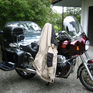
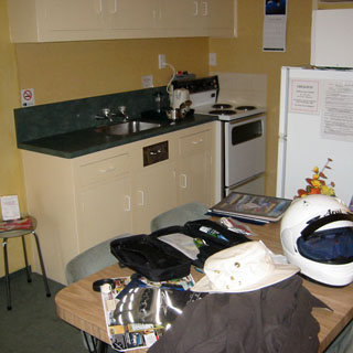
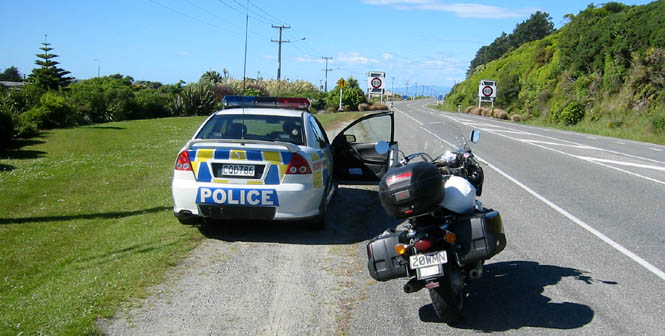
I transferred everything in my duffle bag to the saddlebags and rear trunk. Whites in the left side, and colors in the right. Plenty of room. The trunk had the toiletries bag and first-aid kit as well as walking shoes and the jacket liner for my riding suit. The light (but waterproof) jacket you see hanging on the mirror was rolled up and put in a saddlebag. Along with my riding suit, I'd have enough combinations to be warm and dry, on or off the bike. Dave handed me a plastic bag with a couple of tie-down straps for the ferry and he also lent me a useful book of recommended motorcycle routes.
Time to go.
Keep Left Keep Left Keep Left

Dave even thought to put a label on the inside of the windshield, just for me...
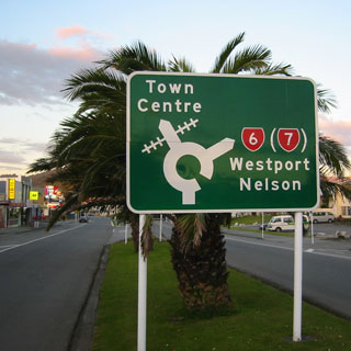
Northland
This first day was the only one that I had generally planned ahead of time. And, that plan was to run north to the tip of the island, and then return back down through Auckland. This would be a good shake-down, and if I needed to check back in with Dave, it could be easily done.
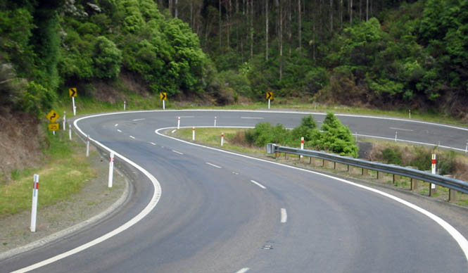
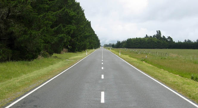
On the map, the single-digit highways appear to be the major routes that connect all the larger cities together--sort of the equivalent of the Interstate Highway. Well, not exactly. Not even close, really. Away from the larger cities, these primary highways are just two-lane black tops like all the other roads. Perfect.
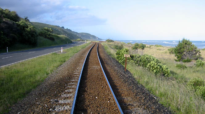
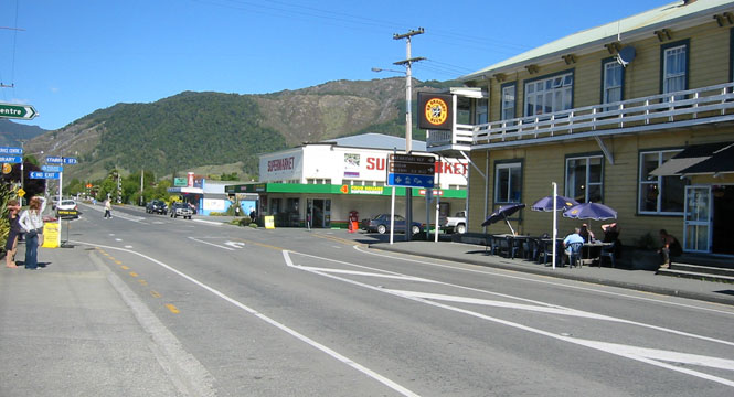
I stayed on Highway 1 through Whangarei and then to Kawakawa before breaking away to Highway 10, which followed the coastline.
First stop for fuel at Moerowa. A few (very) unimportant points about the
service stations:
● Everywhere I went, the pump switch was identical (a sheet metal flap
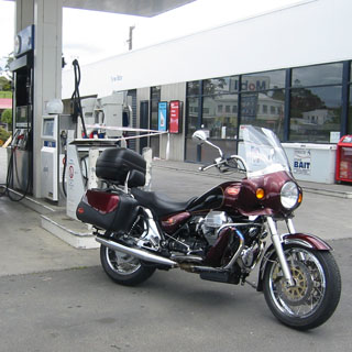 that was held
closed by replacing the nozzle).
that was held
closed by replacing the nozzle).
● All the pumps, everywhere, were fairly new.
● I didn't come across a single non-digital pump, and certainly nothing that
might date from 40 years ago (as would be common in the more remote areas of the
U.S.).
● None of the pumps took standard credit cards.
This last point meant that I'd be running through more cash than I expected.
That wasn't a problem as ATM machines were common.
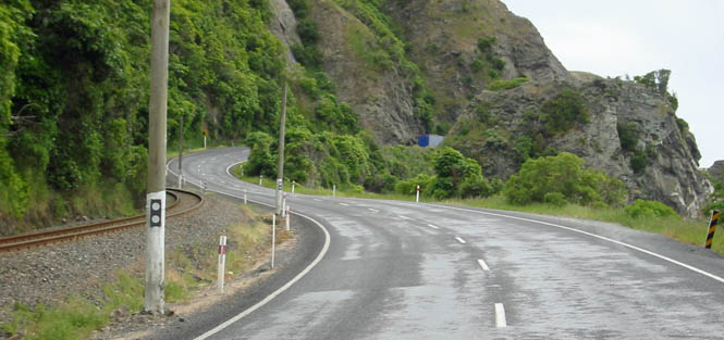
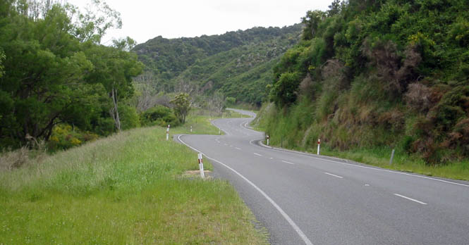
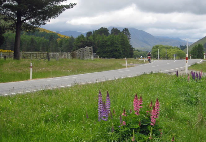
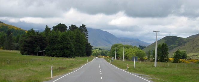
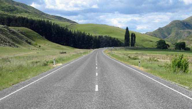
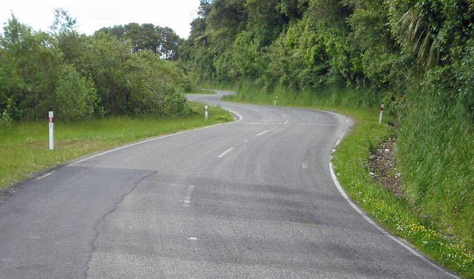
Now it was becoming really enjoyable. I'm beyond the larger towns north of Auckland, and it's just a winding road on a cool spring day. Just a little mist on occasion, but nothing worth bothering about.
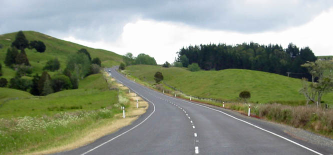
Staying on the left side is not a problem. For the first few hours it would be on my mind, but after that, it was natural enough. Only occasionally (such as leaving that service station) would I position myself as if I were driving on the right. But, that never happened on a road. I was more concerned about the occasional foreign tourist in a rental car who might not remember which side of the line he should be driving.
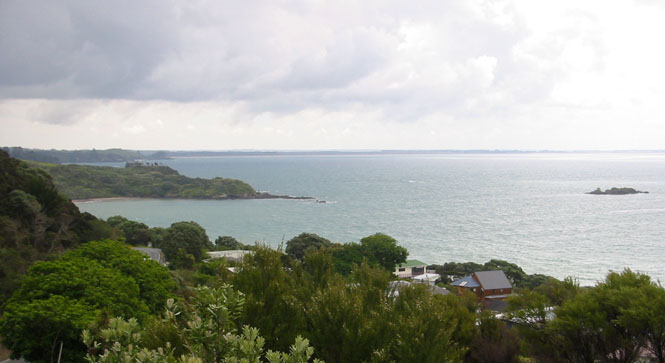
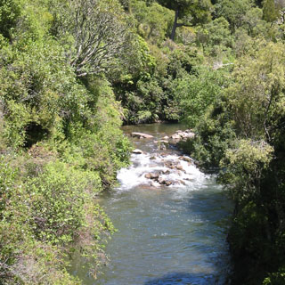
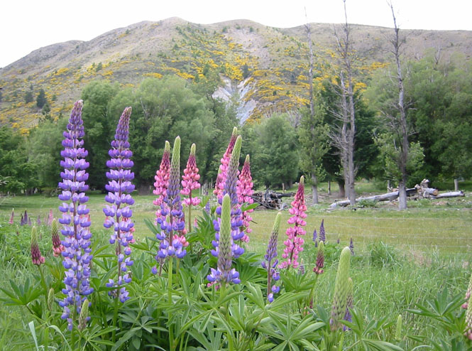
There were a number of points where the road ran right along the coast. Beautiful. I stopped a few times to take my helmet off, take my earplugs out, have a seat on the grass, and look out over the water.
At Awanui, I turned north to run up the Aupouri Peninsula, heading to Cape Reinga--the most northerly point you can reach by highway. By the time I reached Houhora (about halfway) it was clear that I could not expect to find a hotel if I went any further. And, frankly, except for the novelty of the thing, I really didn't need to be there, and the road wasn't anything all that special, either. So, not wanting to do any riding at night, I turned back.
Incidentally, my speedometer cable chose to break at about the same time, so I
figured that I'd best head in a direction that had fuel and had also better
start tracking my miles. I didn't really need the speedometer, but the
odometer was a useful thing (there is no fuel gauge on a Guzzi). So, I'd
be checking
 back in with Dave in
Auckland, after all.
back in with Dave in
Auckland, after all.
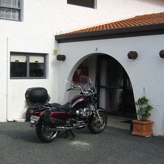
I stopped for the night in Kaitaia at the improbably named Laredo Motel. It had a quasi-southwestern theme, so I guess the name was appropriate.
This was my first night with the motorcycle, so it took me a bit longer to run through the routine of unpacking (and figuring out the latch mechanism on the trunk). After re-sorting where everything should go, it all went very quickly.
On any of my motorcycle trips, once I park the bike for the night, I never re-start it. I treat it like a horse--once it's put away in the stable with its oats and water, it'd just be too cruel to bring it out again. So, I replaced my boots with walking shoes, and hiked into town.
Kaitaia was not looking at its best. There was quite a bit of evidence that this sometime tourism town had seen better days. Or, perhaps I was just early in the season.
In any event, the only place to eat was a Subway, which wasn't what I came all
the way to New Zealand to do... Still, what was on the menu isn't
altogether what's on the menu at a U.S. Subway, so I guess that counts. I
had an interesting time just trying to place my order with the high school-age
girl behind the counter.
 I think neither one of us could quite catch what
the other was trying to say. Even so, my order came out more-or-less
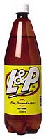
right, so that worked out. And, I had my first L&P here. It's not
very good with the first sip, but it grows on you, and it became my drink of
choice later in the trip.
I think neither one of us could quite catch what
the other was trying to say. Even so, my order came out more-or-less
right, so that worked out. And, I had my first L&P here. It's not
very good with the first sip, but it grows on you, and it became my drink of
choice later in the trip.
Next morning, I plotted out a route that would take me through some more remote areas with less traveled roads. I dropped down to Ahipara, and then picked up a number of secondary roads to Motukaraka. Here, I began to get a feel for how these roads were surveyed. There was very little effort made to straighten out the curves. For the most part, the road followed the contours of the hillside very closely. In many ways, the road construction reminded me of the western end of California 36--cut a roadway out of the hill with a bulldozer (probably following an older footpath), and lay down some asphalt. This was very nice going--the west side of the island--at least along this section--was much more lush than the east side.
The highway ends at Motukaraka. Or rather, the pavement ends at the ramp where the ferry takes you across the Hokianga Harbour.
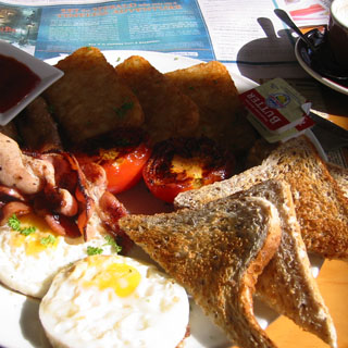
This would be a good place to have some breakfast at the Waterline Cafe.
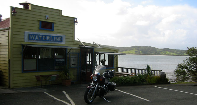
After sorting through the menu--"oh, just give me everything"--I settled back with the morning paper, a cup of fresh-ground coffee and a large plate of everything. That was an especially good meal.
 Funny; after eating, I walked around town (which was only a few buildings) and
went into the local general store when the lady behind the counter practically
shrieked. She then called to the back room for her friend to come out and
look at me (wha?). It wasn't my riding suit (which can be goofy enough to
some people), it was the fact that she thought I was a freakishly tall person!
I hadn't really paid any attention to it until then, but I did notice that the
few other people I met in that area were barely as tall as my shoulder.
All I can figure is that they don't get around much, or that not too many people
come by this way.
Funny; after eating, I walked around town (which was only a few buildings) and
went into the local general store when the lady behind the counter practically
shrieked. She then called to the back room for her friend to come out and
look at me (wha?). It wasn't my riding suit (which can be goofy enough to
some people), it was the fact that she thought I was a freakishly tall person!
I hadn't really paid any attention to it until then, but I did notice that the
few other people I met in that area were barely as tall as my shoulder.
All I can figure is that they don't get around much, or that not too many people
come by this way.
The ferry runs on a timetable, but I doubt that they're too particular about it. I was the first one on, and then we waited for a couple more cars to show. The cost for the trip across the harbour was nominal.
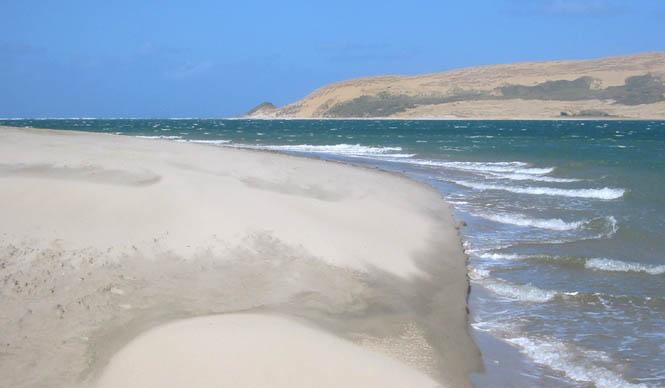
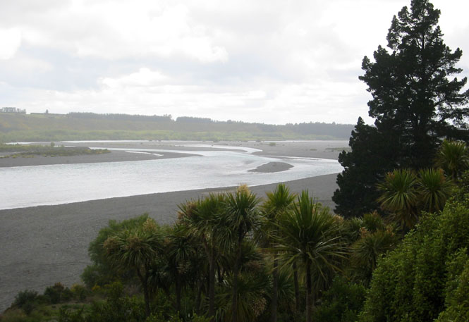
From Rawene the road generally follows the harbour all the way to its narrow exit into the Tasman Sea at Omapere. Sand dunes on both sides; an interesting place.
Not far south of Omapere I rode past an opening in the trees and saw this valley dropping off into the ocean. I had to stop and walk back for the picture.
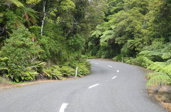
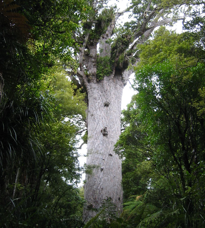
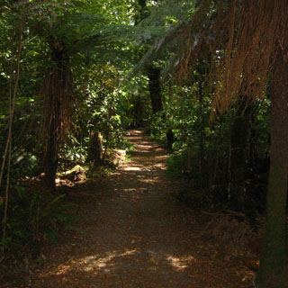
The Waipoua Kauri Forest is a smaller remnant of a much larger forest, that had largely been cut down in the last century. The road through the forest was spectacular--one of the best of my trip.
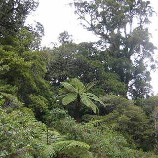
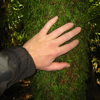
The largest Kauri tree in New Zealand isn't too far from the road, along a well groomed footpath. It is estimated to be some 1,200 years old. There's plenty of evidence that much larger trees used to be common in the area. Like the redwoods of California, just being around these big trees seems to make people start talking in a whisper.
Waipoua is just off the main highway, and has a terrific museum on the old logging industry that once depended on the Kauri.
Regardless of Redwood or Kauri, it took some special people and tools to bring these things down and to cut them. Kauri gum was dug from the earth from the remains of long dead and decayed Kauri trees (as you would a mineral). The gum may have been in the ground for thousands of years. These gum diggers were tough, and worked in unbelievable conditions. The gum was used for lacquer production as well as to make linoleum. The decline of the industry paralleled the decline of the gum reserves and the development of cheaper synthetic ingredients.
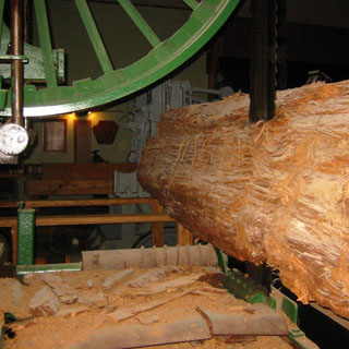
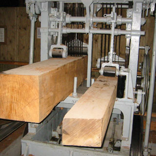
Kauri wood is amazing--you can't help but reach out to touch it. Beyond wood cut from live trees, quite a bit of good wood came from trees that had been preserved in the bogs. There was quite an industry to retrieve these ancient trees and cut them for their lumber.
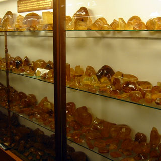
A single lump of Kauri Gum would be interesting. A half dozen lumps would be a nice enough collection. Thousands of the things is a bit overwhelming, but that's what we have here. My eyes glazed over. Not surprisingly, in addition to the more utilitarian purposes of the gum, it was also used as a substitute for amber.
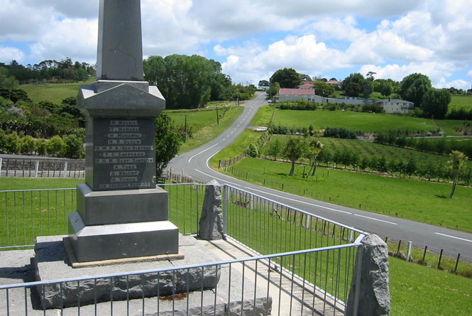
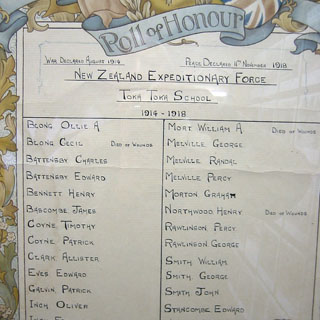
This Roll of Honour was from the old Waipoua school house; the sort of thing that could be found in every town museum or official building across the country.
I stayed on Highway 12 all the way back to Highway 1, and then followed that same road back down to Auckland.
(one of my favourite photographs--that water in the distance is connected to the ocean)
Dave did a transplant of the broken speedometer cable from one bike to the next. That fixed the problem, and I was back on my way, again.
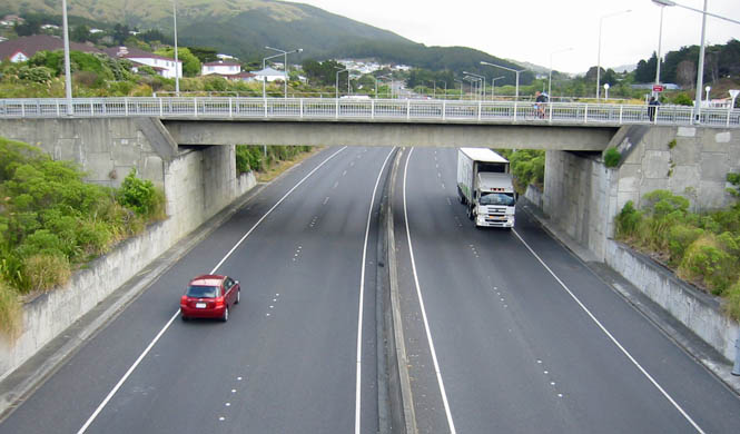
 There's not much to say
about riding through Auckland or the multiple cities that are strung together
south of it. It's a freeway, and I was on it during the evening rush.
Stop and go.
There's not much to say
about riding through Auckland or the multiple cities that are strung together
south of it. It's a freeway, and I was on it during the evening rush.
Stop and go.
At one point, I had my eye on a young blonde with a cell phone in her ear,
driving a small sporty car and looking particularly oblivious. Sure
enough, she merged into my lane, right next to me. I figured she'd do
something like that, so I was ready to move away from her as she glided towards
me. The real problem was when she finally noticed me and cranked her
steering wheel suddenly back into her own lane. It took a number of
swerves for her to stay in her own lane, but luckily she didn't hit anybody.
 Hang up and drive.
Please...
Hang up and drive.
Please...
Waikato
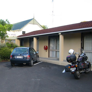
I was planning to ride to Hamilton (a fairly good sized place) before stopping for the night, but I happened to spot a sign for the Arrow Lodge in Ngaruawahia. It was well hidden from the highway, but it turned out to be a pretty nice little place.
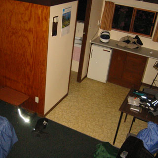
I've never been too good at keeping a neat motel room. Let things
drop where they are, they'll still be there in the morning. The blue
and green bags
you see held my clothes.
While the saddlebags do easily disconnect from the bike (as with my own
motorcycle), I have never bothered doing that. I
 keep everything in
these waterproof bags, which makes packing the saddlebags that much easier
(I've used these same bags for some twenty years). Sure, I look like
some vagrant carrying a couple of nylon bags to my room, but, it's simpler
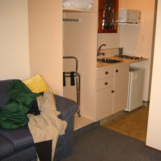
that way. Like all of the motel rooms I'd stay at, this one had a full
kitchen with all the flatware and dishes and pots and pans. In
addition there was a good sized refrigerator (I'm not really freakishly
tall--I took this photograph standing on a chair).
keep everything in
these waterproof bags, which makes packing the saddlebags that much easier
(I've used these same bags for some twenty years). Sure, I look like
some vagrant carrying a couple of nylon bags to my room, but, it's simpler
that way. Like all of the motel rooms I'd stay at, this one had a full
kitchen with all the flatware and dishes and pots and pans. In
addition there was a good sized refrigerator (I'm not really freakishly
tall--I took this photograph standing on a chair).
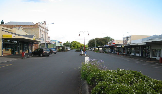
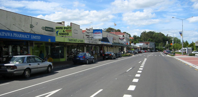
I still had plenty of daylight to explore Ngaruawahia (which I'll make no attempt to pronounce, even though I did ask). The town is a little tired, but they've done a nice job keeping it looking nice.
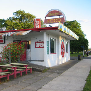 There were a couple of taverns still open, but I kept walking through
town until I came to the
Rainbow cafe. Or, the Rainbow FOOD, I guess it should be.
There were a couple of taverns still open, but I kept walking through
town until I came to the
Rainbow cafe. Or, the Rainbow FOOD, I guess it should be.
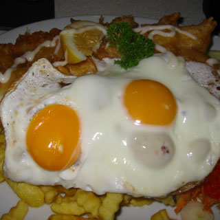
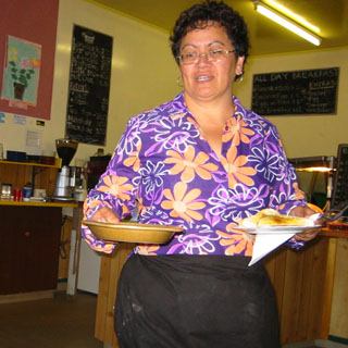
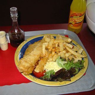
Truthfully, the menu bewildered me. I hardly knew what anything was. So, I went for the Fish and Eggs. And, that's what I got--fish and eggs. Fish and eggs, and onions and chips and coleslaw and shredded carrots and pineapple, and peas and who knows what else was under that pile. Well, I ate it all. Perhaps not the best meal I've had, but on a pound-per-dollar basis, it might have been the best deal going.
 I was on the road early the next morning heading towards Hamilton.
Hamilton was larger than I expected, and a couple of times I missed the
marker for the highway. Then, I had to think "Let's see; am I
following Highway 1, 3, or 5?" Eventually, I picked up the right
one--after cutting through a few residential areas to get on the right road.
I think New Zealand does an excellent job of using roundabouts where they
belong and controlled intersections where lights make more sense. But,
in Hamilton, there were a few multi-lane roundabouts and dual (joined)
roundabouts where I thought a simple traffic light would have done the
job more smoothly. When you have long lines of traffic backed up on all
four arms of a roundabout (where only the brave may enter), it's time to
rethink the concept.
I was on the road early the next morning heading towards Hamilton.
Hamilton was larger than I expected, and a couple of times I missed the
marker for the highway. Then, I had to think "Let's see; am I
following Highway 1, 3, or 5?" Eventually, I picked up the right
one--after cutting through a few residential areas to get on the right road.
I think New Zealand does an excellent job of using roundabouts where they
belong and controlled intersections where lights make more sense. But,
in Hamilton, there were a few multi-lane roundabouts and dual (joined)
roundabouts where I thought a simple traffic light would have done the
job more smoothly. When you have long lines of traffic backed up on all
four arms of a roundabout (where only the brave may enter), it's time to
rethink the concept.
I was really planning to take Highway 5 to Rotorua and then onward along Highway 38 to the coast. Well, I missed that intersection. I hate turning around for this sort of thing, so I stayed on Highway 1 to Taupo.
This is my favourite way to start the day: be on the road early, put in your miles, and then have breakfast. I stopped at Tokoroa at a cafe that looked likely.

 There is a difference between a cafe and a restaurant--I think. Anyway, it
seems that at cafes, you give your order at
the
counter (ordering off the black boards on the wall) and wait at your table for
the cook to bring your food out. Tipping (if done at all) seems to be at
the large jar next to the cash register--but, frankly, I don't know that I
really figured out how that's supposed to be done. In any event, nobody
seems to leave money on the table. Possibly the large jar is just for
Americans who feel the need to leave something.
There is a difference between a cafe and a restaurant--I think. Anyway, it
seems that at cafes, you give your order at
the
counter (ordering off the black boards on the wall) and wait at your table for
the cook to bring your food out. Tipping (if done at all) seems to be at
the large jar next to the cash register--but, frankly, I don't know that I
really figured out how that's supposed to be done. In any event, nobody
seems to leave money on the table. Possibly the large jar is just for
Americans who feel the need to leave something.
I had another excellent breakfast.
Somewhere along the way, my speedometer quit again. I figured that it had
probably broken at the same place as the other one (we only replaced the inner
cable that time). I really don't need a speedometer, and it wasn't likely
that I'd ever be too far without coming to some sort of gas station, so I didn't
worry much about it. I got in the habit of noting the miles on the highway
signs to a distant town, and then keeping a running total in my head as I
reached it. For the rest of the trip, I consistently put about 11 litres
of fuel in the tank at
 each stop, so that worked well enough.
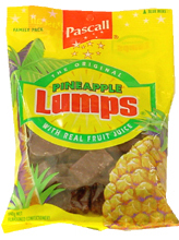
Note: It was along here that I discovered something with the unlikely name of Pineapple Lumps. I do not know that they're even available outside New Zealand (probably not), but they are very good.
Taupo/Ruapehu
The ride down to Taupo was very pleasant. This is fairly open country with long sweeping turns. When I hit Highway 5, I actually had to get my map out to figure what was going on (I'd been referring to my map less and less). Wasn't Highway 5 the one I missed, back when I missed my turn to Rotorua? Well, yes. It seems odd to have two separate highway numbers connecting two identical points on the map, but it happens.
Taupo is a more upscale place that caters to tourists and was really active. In fact, there wasn't even any available parking along the main street (I was looking for an Internet shop) so I swung into one of those triangles that are always formed at the end of a row of diagonal parking stalls. Shouldn't be a problem; I'm well clear of everything. Well, that wasn't what the meter maid thought...
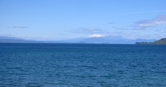
That's Mt. Ruahepu that you see across Lake Taupo. It's actually quite far away, but the air was so clear that morning.
I gave some thought about following the lakeshore around and staying on Highway 1, but instead, I turned south along Highway 5 towards Napier. It was something of a toss-up, and I don't think it would have much mattered which road I took.
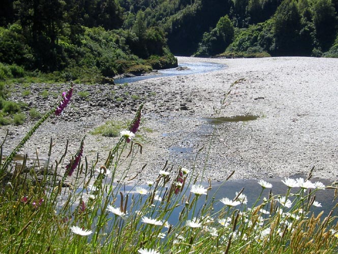
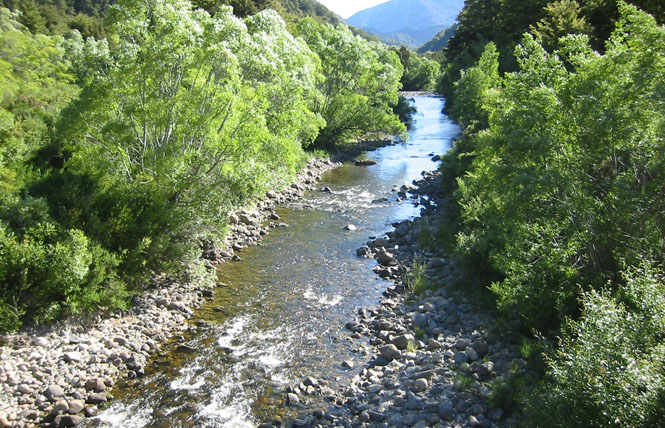
This road was a good one. It occasionally followed the Waipunge River, and then would cross over a lower range to pick up another river. River roads like this are always fun on a Guzzi.
A good rhythm on this one:
LEFT-two-three-four, RIGHT-two-three-four...
Hawke's Bay
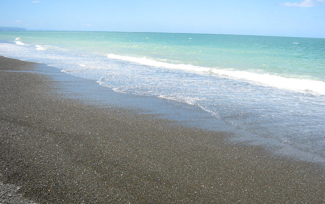
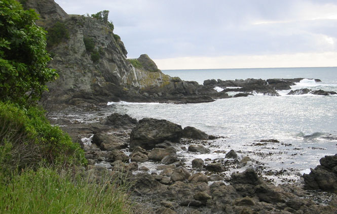
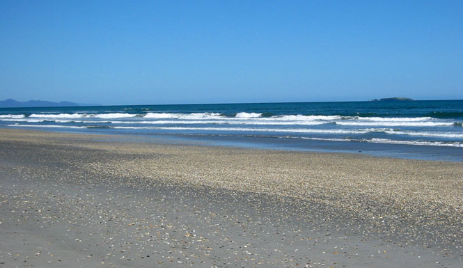
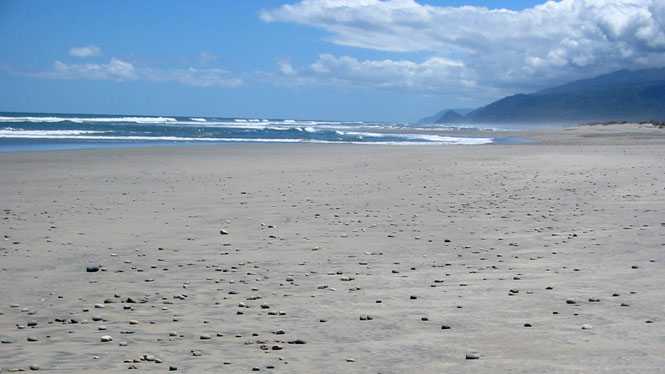
At Napier, I took the turnoff into downtown, and then just kept going until I hit the beach. It's a peculiar black rock beach, that wouldn't be at all comfortable to walk barefoot.
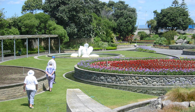
Between the town and the beach is a long public garden. The lady in the middle has the proper garden walking technique: arms behind, carrying a guidebook.
Well south of Napier and Hastings, I stopped at Waipawa for lunch.
Not the best fish and chips, but the bottle of malt vinegar is a nice touch. Though, there are limits to how much mayonnaise a person needs.
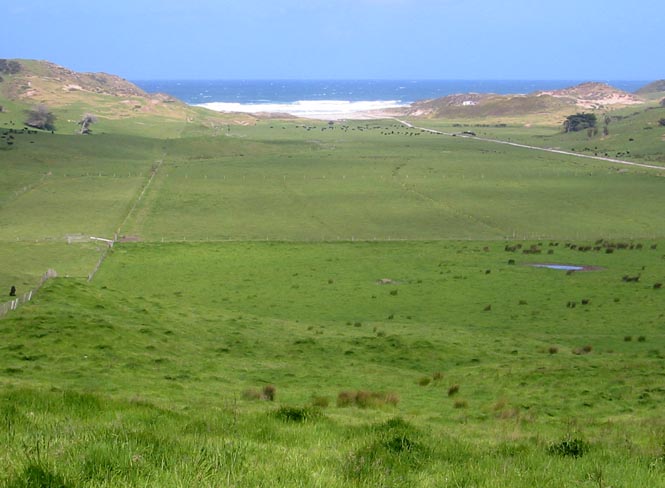
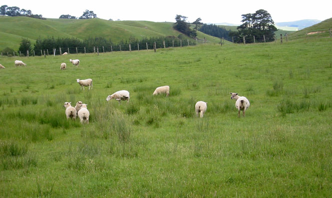
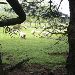
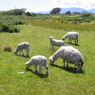
There's a forty mile wide stretch of land running all down the coast from Hastings that is mostly low, rolling green hills with plenty of sheep. For all the pictures I took of them, I never could get them to face me, or to at least look more picturesque. Usually, they ran away.
Wellington
I was aiming for Wellington, but it wasn't clear to me if there would be very many hotels along the way, or not. Most of the smaller towns I was passing through had nothing. Plus, I knew that there was some sort of mountain range to be crossed before I hit Wellington, and I didn't want to do that in the dark (for that matter, I didn't want to ride at night, anywhere).
So, Masterton looked like a good place to stop for the night, as there were actually plenty of good quality places to stay. I had time, so after checking in and dumping my stuff on the floor, I hiked up one side of town, and then back down the other. I found later that there's a Guzzi dealer in town, but I didn't come across it. No matter, as it wouldn't have been open, anyway.
I stopped for breakfast at Greytown. It occurs to me, that I was never asked how I wanted my eggs. They all come this way, I suppose. By the way, those are mushrooms on the left.
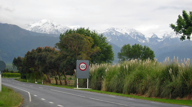
I expected some sort of mountain range to be crossed, but this was something more than I thought I'd be riding through. It didn't help that it was drizzling all that morning, but this was a winding and treacherous road. Treacherous in that there was just enough road construction to make the occasional dirt (now mud) sections more interesting than I really preferred.
 I entered the outskirts of Wellington
without checking the map. I was hoping that there'd be enough signs
leading me to the ferries that I wouldn't have any problem. And, nice
to say, that was mostly the case. At the last moment, just as the
route reached the docks, the ferry signs disappeared to be replaced by signs
for (what I assumed
to be) the individual ferry companies. I took a guess at one of them--picked
wrong--and then found my way to the one that would be sailing the soonest.
Apparently, the price is just a little less if you book ahead. I
didn't do that (and wouldn't have, anyway) so I bought my tickets (one for
me and one for the motorcycle) at the booth. The
I entered the outskirts of Wellington
without checking the map. I was hoping that there'd be enough signs
leading me to the ferries that I wouldn't have any problem. And, nice
to say, that was mostly the case. At the last moment, just as the
route reached the docks, the ferry signs disappeared to be replaced by signs
for (what I assumed
to be) the individual ferry companies. I took a guess at one of them--picked
wrong--and then found my way to the one that would be sailing the soonest.
Apparently, the price is just a little less if you book ahead. I
didn't do that (and wouldn't have, anyway) so I bought my tickets (one for
me and one for the motorcycle) at the booth. The
 total one-way cost
was $95NZ.
total one-way cost
was $95NZ.
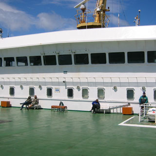
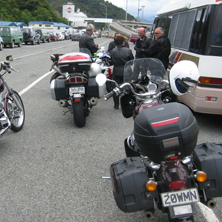
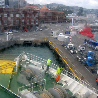
It turned out that I would have had plenty of time to walk around downtown Wellington. The parliament buildings are not that far from here, and there are any number of other things to see. But, not really knowing how their timetable was working, I hung around the docks waiting for the ship to arrive. Since motorcycles would be the first to load, I was asked to park up front, next to the gate.
And, here it comes.
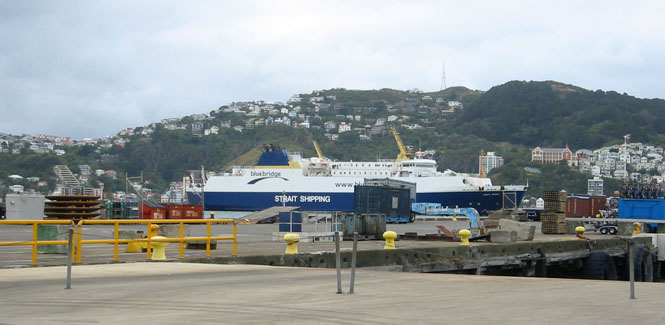
 The Blue Bridge line is, in some way, government run
(I was told), but that connection is not
clear to me. There is another line (the one I returned on) that is private
(I was told).
The Blue Bridge line is, in some way, government run
(I was told), but that connection is not
clear to me. There is another line (the one I returned on) that is private
(I was told).
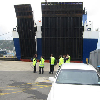
I've been on a
number of larger ferries. The easiest is to load through a bow door, and
exit through a stern door (or the other way around). In a similar way, the
ferry between Victoria B.C. and Port Angeles loads at the stern and exits out a
door on the side, near the bow. This ferry, on the other hand, loads at
the stern, and exits at the stern, through the same door. Consequently
there's a bit more maneuvering needed by cars and trucks to enter, and then turn
around within the ship. From a seaworthy standpoint, this is the safest as
there is then no chance that a damaged bow door
 will allow water to enter the
cargo hold (as has happened with disastrous results).
will allow water to enter the
cargo hold (as has happened with disastrous results).
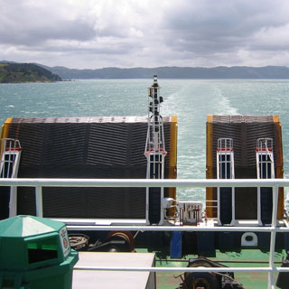
Somewhat surprisingly, I was the only motorcycle on the ship. The tie-downs that Dave gave me were quite helpful, as only loose ropes were otherwise available. I tied the crash-bar on the left, and part of the fork assembly on the right. With a bit of fore-aft angle to the straps, the bike was quite secure. I carried the helmet with me, although there was really no danger that anybody would take it.
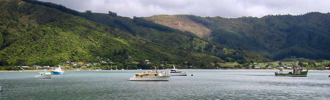
The crossing from the north island to the south island is really more of a lateral route than north-south. And actually, I think that the landing at the south island (Picton) is just a little bit north of Wellington.
Marlborough (South Island)
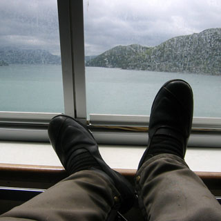
It was a smooth crossing, and I spent most of my time outside on one of the decks. In the photograph (below) we've just cleared the Wellington Harbour. Those are the two retracted auto ramps you see at the stern.
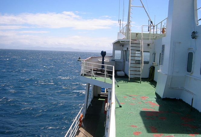
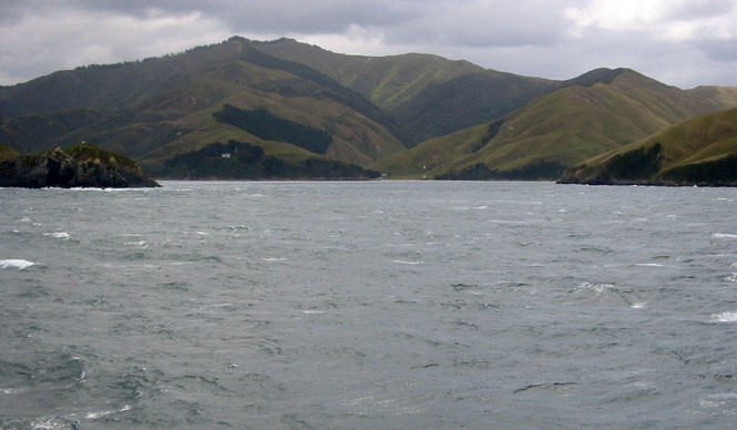
The entrance into the Queen Charlotte Sound was quite impressive. In the photograph (below) you can see both the left and right shores. If you look straight ahead, at the far shoreline, you can see two thin, vertical white lines. Those are structures on the land that are arranged such that if you are in the correct position to enter the channel, they will appear vertically aligned. So, we're in good shape. One assumes that there are also more modern methods to assure the same thing.
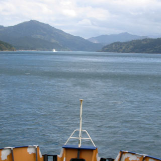
Running up the channel.
You can see one of the return ferries in the distance. We passed her on the right. The pilots of these ships must make arrangements to avoid ferries passing each other at the narrows--I doubt that there's enough room for two.
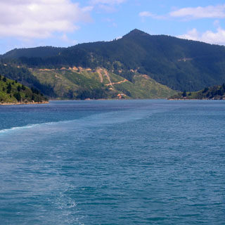
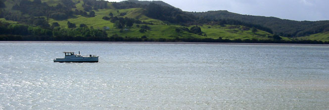
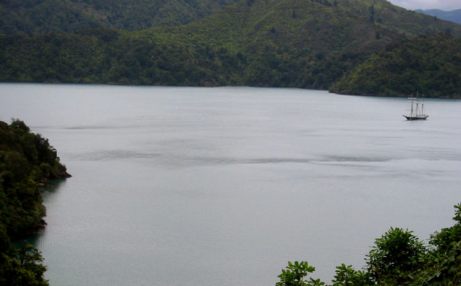
We've now entered Queen Charlotte Sound, proper, and are not too far from Picton.
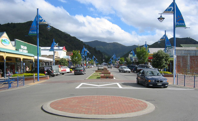
Picton is nestled in the hills, at a narrowing spear-point of the sound. The ferry did a neat little turn, and then backed into its slip. I was the first one down the ramp, and immediately turned left and rode into town to have a bit of lunch.
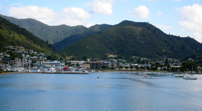

I studied my map while eating, and had made up my mind to head towards Nelson, which appeared to be the nearest town of any size. I'd then circle round the island counter-clockwise.
Not a bad plan.
But, when I reached the point where I'd turn right or left, I decided to instead turn left. I'd catch Nelson on the return; today I'd be heading to the east coast.
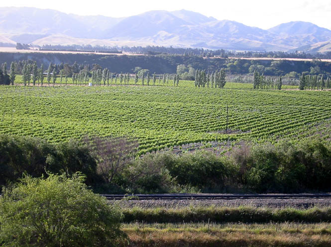
Marlborough is wine country. If you think of Napa Valley, you wouldn't feel too out of place (that is, if you didn't look too closely).
These were fun roads. The hairpin turns that I was riding earlier in the morning can be tiring, and besides they take so much concentration that it wears on you. I wanted to enjoy some Guzzi sweepers.
What became quickly clear is that the amount of traffic on these roads was considerably less than the north island. Of course, you'd expect the roads near the capital to be more used, but the highway through Marlborough was much like any highway through central Montana--don't worry about standing in the middle of the road to take a picture, you'll be safe.
The map shows quite a few little towns all down the coast. True enough, but none of them have motels, and few of them have service stations. After I filled the tank in Ward, the owner locked up the station. I was lucky.
One unexpected problem was that a strong wind was blowing from the ocean and carrying with it a heavy salt spray. My face shield was becoming crusted with salt! This wasn't a problem unless the road turned into the setting sun, when (wow!) I suddenly couldn't see anything without raising the shield. But, I didn't want to ride too long that way since it was getting to be rather cold, and because I didn't want my glasses to also be coated with the same salt crust. If I had only come across a creek (or carried a water bottle) I would have washed it off.
It wasn't until I reached Kaikoura that I found a motel. That's the Kaikoura Range you see in the background.
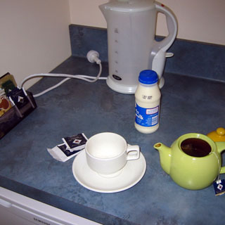 This was the case at every motel I stayed at. On checking in I was
asked if I wanted
"trim or ordinary." Excuse me? Oh. Milk. Every motel had
everything needed to make tea in the morning, and naturally I'd be wanting milk
with my tea.
This was the case at every motel I stayed at. On checking in I was
asked if I wanted
"trim or ordinary." Excuse me? Oh. Milk. Every motel had
everything needed to make tea in the morning, and naturally I'd be wanting milk
with my tea.
And, so I did.
I had forgotten completely about it, but I realized as I was walking into town (which was farther than I would have preferred) that this was Thanksgiving! Not surprisingly, Thanksgiving is not celebrated in New Zealand, nor is it given any thought. So instead of turkey with all the trimmings, I had a nice meal of fish with beer. Close enough.
Canterbury
It was quite cold the next morning, and so I had my Polar-tech jacket under my riding suit.
The road follows the coastline, but is actually far enough inland that you don't really see the ocean much. But, while still at the coast, I stopped for a couple of pictures.
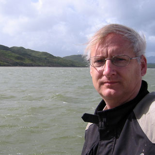
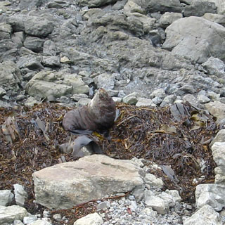
I didn't even notice this guy at first. Sea Lion? I suppose so. He had a nice bed of kelp.
Once the road turned inland, it wound through the hills from one river to the next--each time running up and over a ridgeline. I hardly saw any cars at all along this route, eventually stopping for breakfast at Waipara.
I had to decide if I wanted to ride into Christchurch or not. All the guidebooks put it in the must-see category for New Zealand, and everything I read about it said that it would be interesting.
But, still...
If I dropped into the city, I'd be spending at least a half day, there, and I'd likely spend the night. In other words, it'd be taking a day out of riding someplace else. I opted to go someplace else.
I took a whole variety of un-numbered back roads through the Canterbury Plains region. In a general sense, I was aiming for Highway 8, but to get there, I wasn't too particular.
Ranglora is a nice looking place.
Oxford. This is at a roadside rest, next to the library.
 I thought the signs for Men and Women clever, but it might have been
just a bit too subtle (there were signs--with letters and everything--at the
doors). Roosters to the right, Hens to the left. Either that, or
follow the pink or blue flowers...
I thought the signs for Men and Women clever, but it might have been
just a bit too subtle (there were signs--with letters and everything--at the
doors). Roosters to the right, Hens to the left. Either that, or
follow the pink or blue flowers...
I often stopped at libraries, since, just as in the U.S., you can expect to find Internet access. Unlike the U.S., where connections are always free, there was generally a $2.00 fee to use library computers here.
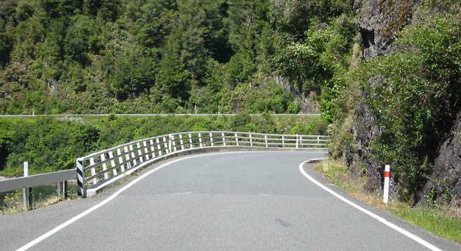
Crossing the Rokaia River. Note that the bridge is only a single lane wide. This was very common, and I think there were only a few multi-lane bridges away from populated areas.
A nice glamour shot of the Guzzi. The first day, I was a bit cramped by
the seating position. It's more forward than my own bike, and is not as
comfortable for hours at a time in the saddle. But, by the second day, I
changed my riding position to lean forward just a bit
 more, and I became
accustomed to it. Weather and wind protection was acceptable, but not
great. When riding, I would make note that I needed to adjust the mirrors
to put them much farther forward on the handlebars (so I wouldn't have to turn
my head to use them), but I never did it. Close enough. By the
second day, too, I was as totally at home with the venerable 5-speed
transmission as with my own bike. Up and down the gears with nary a click,
this one was adjusted nicely. Shifting smoothly on a 5-speed Guzzi is a
skill, but doing it right is so much more satisfying than the feather-light
snicking up and down with a Honda transmission that any fool can master.
more, and I became
accustomed to it. Weather and wind protection was acceptable, but not
great. When riding, I would make note that I needed to adjust the mirrors
to put them much farther forward on the handlebars (so I wouldn't have to turn
my head to use them), but I never did it. Close enough. By the
second day, too, I was as totally at home with the venerable 5-speed
transmission as with my own bike. Up and down the gears with nary a click,
this one was adjusted nicely. Shifting smoothly on a 5-speed Guzzi is a
skill, but doing it right is so much more satisfying than the feather-light
snicking up and down with a Honda transmission that any fool can master.
When you pop over a hill, it's good to pay attention to what's on the road.
It is my understanding that the Canterbury Plains was originally wide open and largely without trees. Of course, that's not the case today.
Always trying to catch the sheep, unawares, but they always spot me and turn away.
I hit Geraldine at lunchtime, and was surprised at the number of tour busses in town (with foreign speaking tourists--not, like me). That international flavour probably accounted for the parsley sprinkled on my sandwich. Things were not nearly so fussy in the less-visited smaller towns.
Mt Cook-Mackenzie
Highway 8 runs west towards the mountains, seems to make an attempt, and then turns south for an easier route to the west coast.
It was threatening to rain for most of the day, but except for the brief (but heavy) downpour in the plains, it wasn't anything but an occasional drizzle. Certainly nothing to worry about.
This was surprising country. High plains desert ringed by snow-peaks, and a straight running highway.
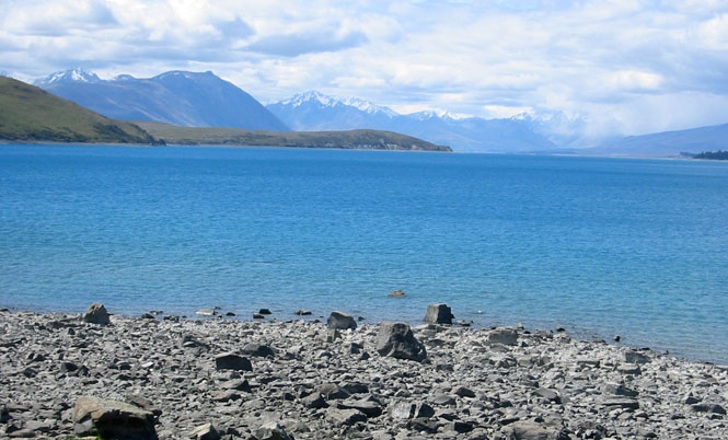
 I stopped at Lake Tekapo,
which has the frosty blue color that glacier lakes often have.
I stopped at Lake Tekapo,
which has the frosty blue color that glacier lakes often have.
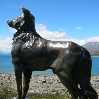
The statue of the dog commemorates all New Zealand dogs, and not just one in particular (it is remarkable how many statues have been erected to celebrate some faithful dog who waited forlornly for his master...who never returned).
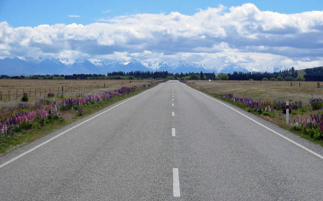
This was an interesting road. It'd dive into these narrow canyons and then exit into wide treeless valleys--each one different. It kept me wondering what I'd see around the next bend.
Mountains on one side, and mountains on the other. Neither Omarama nor Tarras is big enough to have anything much more than a service station. One thing I noted on these signposts (and others just like them) is that you could not possibly read the mileage to the next town without actually getting out of your car and walking up close to the sign.
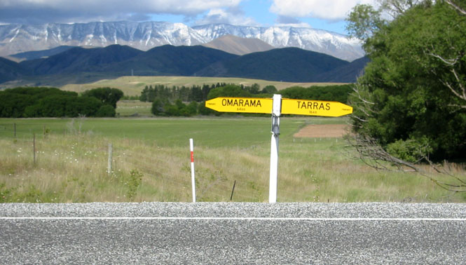
Wanaka
One thing noteworthy about Tarras, though, is that I'd have to make up my mind about which way I wanted to go when I reached it. If I stayed the course, I'd be in Queenstown. I wasn't that far away. Otherwise, I'd be going to the west coast. Queenstown was a town that I thought I'd like to see, but if I went that way I'd have to come back along the same route, or--if I continued--I'd be dropping down to Invercargill, and would risk running out of time to get back to Picton by Monday (my self-imposed deadline).
So, I turned right, to Wanaka, and checked in for the night.
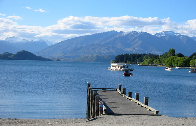
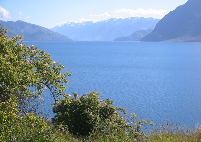
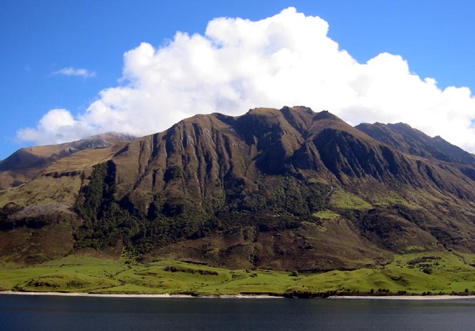
Lake Wanaka. This is an unbelievably beautiful place.
Downtown. Probably very few locals; we're all tourists here. I had a curry dinner at an Indian restaurant. Not bad. And, it was nice of the owner to come running after me, carrying my hat...
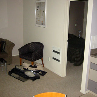
 Another well-equipped motel room (with my recovered hat).
My ritual every morning included removing the
face-shield and cleaning it thoroughly. The black strip at the top of the
shield is there as a sun block (and it works very well). The opened
black bag on the table holds my toothbrush and the like. The center
section of the bag is devoted to my first-aid kit, and I always pack the bag in the rear trunk such that I can get at it quickly (I've used this
same system with this very same bag for at least twenty years, now). My
"ordinary" has been put in the refrigerator.
Another well-equipped motel room (with my recovered hat).
My ritual every morning included removing the
face-shield and cleaning it thoroughly. The black strip at the top of the
shield is there as a sun block (and it works very well). The opened
black bag on the table holds my toothbrush and the like. The center
section of the bag is devoted to my first-aid kit, and I always pack the bag in the rear trunk such that I can get at it quickly (I've used this
same system with this very same bag for at least twenty years, now). My
"ordinary" has been put in the refrigerator.
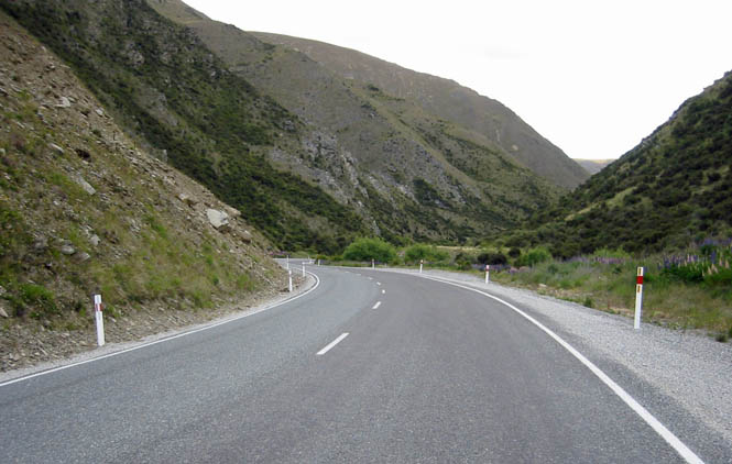
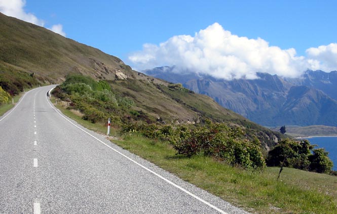
The road from Wanaka to the coast follows Lakes Hawea and Wanaka before topping at Haast Pass. It's not a particularly high pass, but the road does get pretty twisty in that area.
I saw those clouds and that range, and when they lined up, I stopped for the picture.
West Coast
Breakfast at Makarora.
After Haast Pass, riding down the valley.
I keep trying, and this time at least one of the guys looked my way.
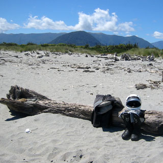
This was my first sighting of the west coast of the south island, just beyond the small town of Haast. All the rain and mist of the day before was gone, and it was actually a little warm. I was going to wade in the ocean.
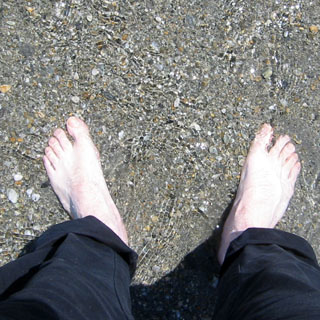
Proof of place...
The view of the mountains that I had just come over.
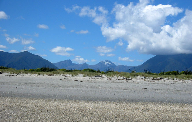
I now wouldn't have any choices about my route for the rest of the day. The only option was to ride north, following Highway 6 up the coastline.
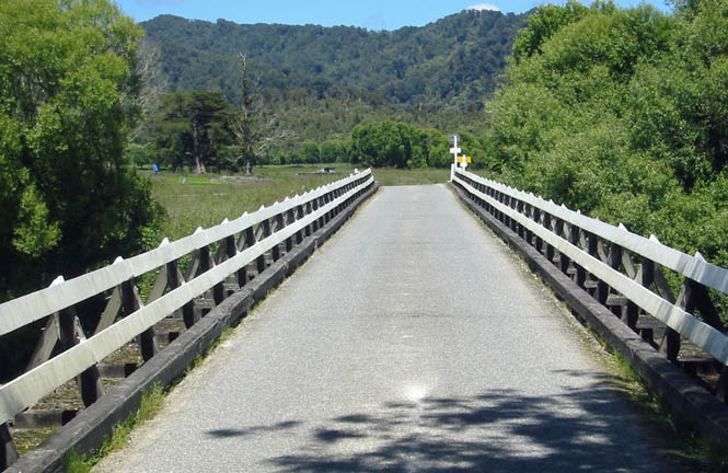
This isn't exactly a typical bridge, although there were a few other similar suspension bridges. Many bridges seemed to be converted rail bridges, but all were just a single lane wide. The traffic was light enough, that I only rarely had to wait for an oncoming car. Just a quick peek to the other end, and keep riding.
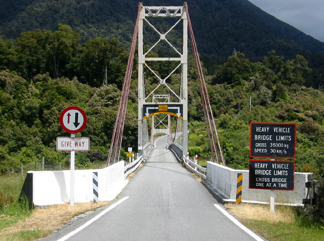
There were a few cases where the bridge was shared by the railroad. This was to be more of a problem. Not from the possibility of a train (I never saw one), but from the rails in the roadway. The top of the rail was flush with the bridge roadway, but there was a 4" wide gap on either side of the rail that was just waiting for your wheel to drop in. This gives you the choice of riding directly down the center of the lane, or crowding over to one side. Whichever your choice, you cannot change your mind. I always went down the center, but then had to slow to a crawl to cross over to the left side when invariably there'd be a car waiting on the other end. I talked to a rider later in the day who told me that the best way was to ride down the narrow strip to the left, to avoid that problem. However it's done, I would not want to cross a rail/auto bridge at night.
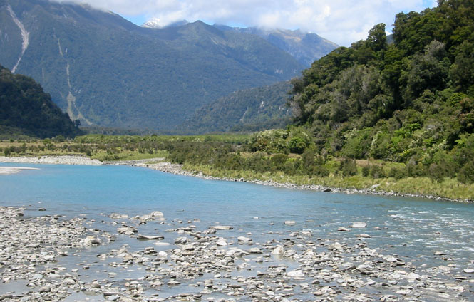
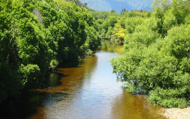
Glacier runoff from the mountains. You'll see that same vibrant color of turquoise-blue in Montana and Washington off some mountains.
The lead-in to another single-lane bridge. In this case, the blue sign shows that I have the right-of-way, but it's not a right that I ever stood on.
Could be any one of the smaller towns along the highway.
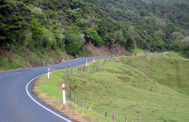
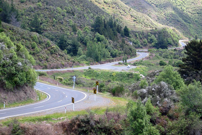
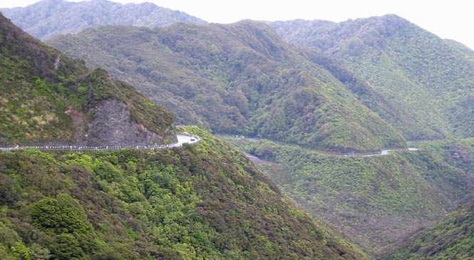
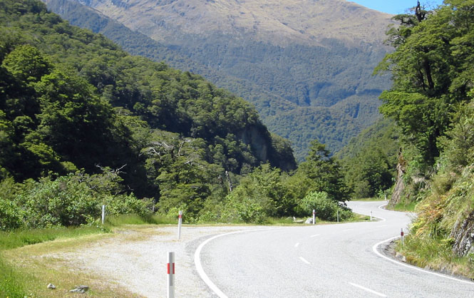
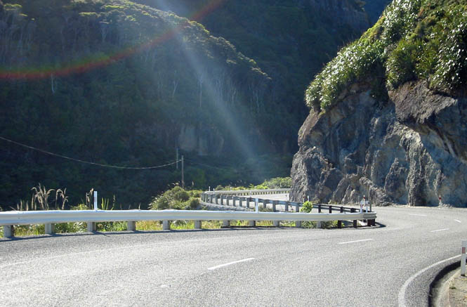
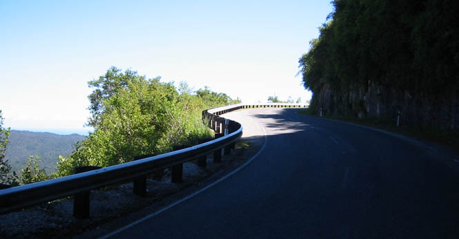
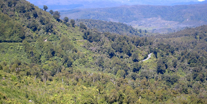
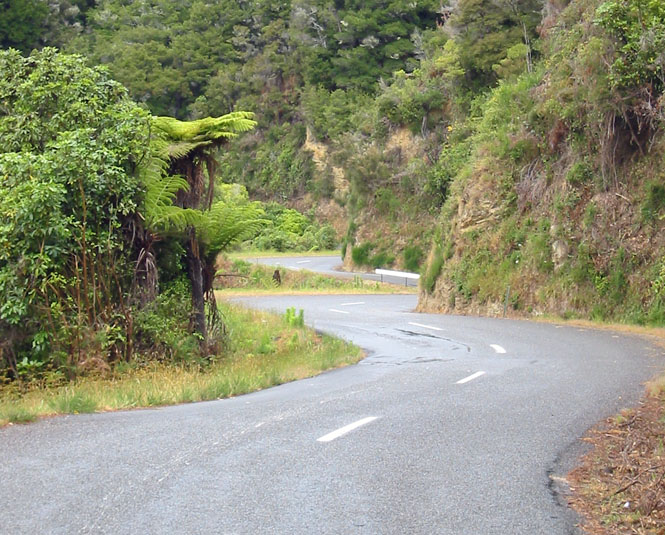
This was the single most impressive road of my trip; Highway 6. It had something of everything, from wide open stretches, to ocean runs, to multiple hairpin turns in the mountains. In some ways it is like California Highway 1 (south of Rockport and north of Point Arena) without all that motor-home traffic. But, because New Zealand Highway 6 spends much more time in the inland mountains, it's much more twisty than its California counterpart.
Miles and miles and miles...
The Hokitika Free Public Library.
OK. I suppose an explanation is in order.
I'M NOT GUILTY!
I didn't win that argument. I didn't even get a chance to have a discussion. See that speed limit sign on up ahead? It says 80 kph. That's only about 50 mph. I was ticketed for doing 69 kph (which--you will be alert to--is less than 80 kph). The catch is that the speed limit is not 80. Not yet, anyway. Where we are, the limit is only 50 kph. Sigh... Even though I didn't have a working speedometer, it would not have made a difference; I knew how fast I was going.
Greymouth was a good place to stop for the night. This was one of the
harder working days of the trip as you couldn't relax for
 long with a road like
this. I talked to a few other south-island motorcycle riders and they all
raved about the west coast highway.
long with a road like
this. I talked to a few other south-island motorcycle riders and they all
raved about the west coast highway.
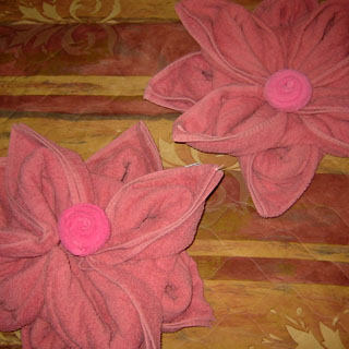
I must say, this is the fussiest, most elaborate way to fold a bath towel that I've ever seen. I almost hated to break one of the flowers up after taking a shower.
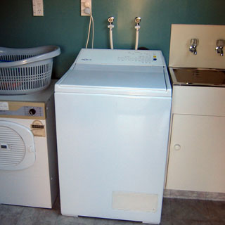
I'd been washing things in the motel sinks along the way, but since there was a washer-dryer set available for guests, I took the opportunity of washing everything.
I'd have to decide the next morning which way I wanted to go. Probably north on 6.
The Grey River empties at Greymouth...
That's a segment of the old town, to the right, but the town has grown far beyond just this.
Highway 6 it would be. The fun continues...
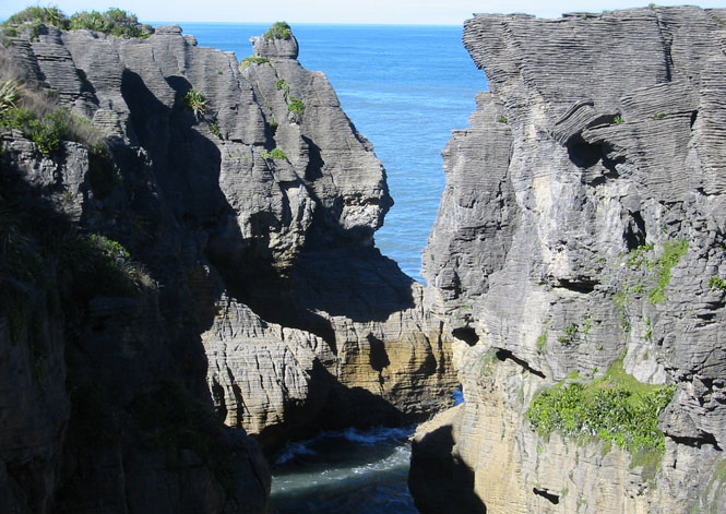
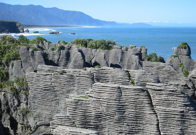
Pancake Rocks State Park is named for the peculiar rocks in the area. Over the ages, the ocean has worn them away and has left some very unusual shapes. One result is that underwater caverns have been created--caverns that are not always underwater. With incoming waves and with the tides, these caverns will trap air and water producing giant geysers (to use the wrong term) through blowholes that force water high in the air. It's an amazing place with strange noises.
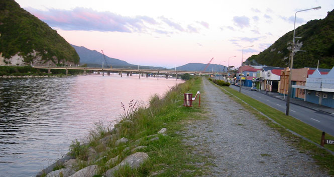
Nelson
Karamea is the most northerly point on the west coast that can be reached by pavement. I had allowed a half-day of buffer in my goal of being at Picton by Monday, so I'd use up that buffer by doing an out-and-back ride to Karamea.
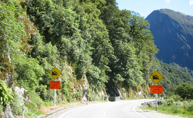
Oh my, what a road this was. I had no idea, by just looking at the map, what I'd be in for. At some point, the road could not follow the coastline due to the encroaching mountains. So, the only solution was to attack the mountains before descending again to the coast.
These were some of the steepest grades I'd encountered. But as if that weren't enough, the turns were often covered with water dripping off the hillside or with sand that had been driven onto the broken pavement. Time to take it easy. Although a couple of sportbike riders did rail through the curves (and around me) like it was the most normal thing to be doing in the world. Not for me!
You can just see segments of the road through the trees.
The orange color would indicate that this water isn't coming from a glacier.
 The beach at Karamea. I
had no
trouble finding a place to stand.
The beach at Karamea. I
had no
trouble finding a place to stand.
Back to Westport, I turned inland on Highway 6 towards Nelson. This was a nice change of pace as the highway followed a river for much of the distance, so there were no unexpected twists and turns.
Buller River
An interesting turn on Highway 6. The roadway is actually elevated over the river and is making a tight turn to the right around that rock. It's only a single lane wide, so you might not want to cruise too fast into that turn without being very, very sure that there is no oncoming traffic.
Lunch time? Yes, I think so.
A beautiful day for riding.
I saw the sign for this suspension foot bridge, and had to stop to have a look. It costs 50p (or something trivial) to make the crossing.
No doubt, some rascally child would try to set the bridge to swaying (I know I would have). I was more gentle. The bridge was well made, and it wasn't going to go anywhere.
Staying on the highway, passing through a number of smaller towns.
Following the red 6 to Nelson.
I rode all the way through Nelson before I realized that whatever motel I was looking for was not going to be coming up. So, I turned around and went into the middle of town. That's one change from what I am more used to doing. Generally, the motels in a town of Nelson's size will be on the outskirts of town--out by the Wal-Mart. That's not the case, here. At least not usually. You need to ride into town.
This hotel was quite a very nice place, and looked new.
My usual evening walk through and around town. I liked Nelson.
I talked to the owner of the '55 Chevy. As you can see, it is left-hand drive. I'm sure it's a kick to have, but compared with most of the much smaller cars I saw, it's a real monster.
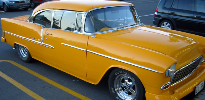
Then, too, to drive a left-hand drive car on the left side of the road must be interesting at best.
 From Nelson, I'd just be
making my way through the remainder of this amazing highway to Picton.
I stopped at the cafe at Pelorus Bridge and then walked through the ancient
forest. Much of the land in this area has long been forested, and it
has apparently been through many re-plantings. It appears
that Weyerhaeuser owns (or at least logs) quite a bit of it. One odd
note that really stood out is that the planted trees have all been put down
in a straight line. It makes the hills look like giant row-crops.
I don't know why they couldn't plant the trees in a more random "natural"
way.
From Nelson, I'd just be
making my way through the remainder of this amazing highway to Picton.
I stopped at the cafe at Pelorus Bridge and then walked through the ancient
forest. Much of the land in this area has long been forested, and it
has apparently been through many re-plantings. It appears
that Weyerhaeuser owns (or at least logs) quite a bit of it. One odd
note that really stood out is that the planted trees have all been put down
in a straight line. It makes the hills look like giant row-crops.
I don't know why they couldn't plant the trees in a more random "natural"
way.
Anyway, this part of the forest had not ever been cut, and so the trees were much more proper for the area. I loved walking through this area--I seemingly had the whole forest to myself.
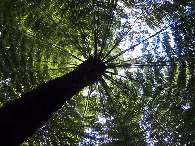
And, if there were anybody else in the forest, they would have come across a person wearing a strange black and grey suit, lying on his back at the foot of a tree... It took several different trees and multiple attempts, but I got the picture I was looking for. [Silver Tree Fern]
This is a 2/2 road. LEFT-RIGHT-LEFT-RIGHT...
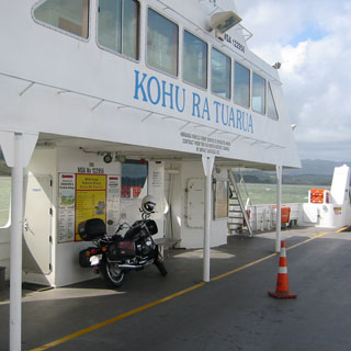
My timing was perfect at Picton (not that I planned it). I showed just as cars were preparing to board the waiting ferry. This would be on a different ferry line (The Interislander Line) than what I used coming down to the south island. I believe the cost was $115NZ, or just a bit higher than the other direction.
There was a good variety of motorcycles on this one.
...Twenty women waiting in line with the rest...
It was cold and raining on the return trip. I'd spend most of it front and center on one of the lounge decks. This ship was much larger than the one first one. Feet up on the rail, and get the book out.
The crossing was much rougher than the first one. I used three tie-downs on the motorcycle, and I was glad I had done it. At times the bow wave came completely over the window--and I am fairly high above the waterline.
Wellington (North Island)
We arrived at a different slip than the outgoing ferry, but the same general docks. The window could use a good wash by this point.
I had the worst time just getting out of Wellington, but eventually I found my road. The two longer tunnels under the city streets are what threw me ("where'd the highway go?").
Now, I was heading north on Highway 1, up the west coast. I really needed to stop to see what my options were before I went too far, so I stopped for the night at Porirua--far enough from Wellington so there'd be no difficulty in getting away the next morning.
From Willington to Porirua, the highway was a multilane freeway. Nothing too fun about that.
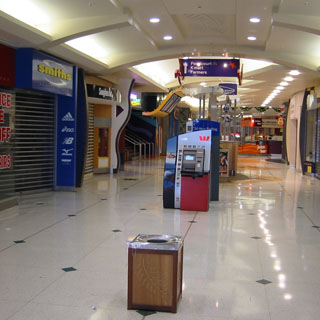
An empty shopping mall is a strange place. Not that I wanted to go shopping (I just wanted a pen to write a postcard), but I was surprised to find that the normal closing time for this large mall is 5:30PM. Doesn't that seem kind of early?
I had dinner at a Japanese restaurant, which was quite good. I'm still
sorting out the dining experience. I keep expecting the waitress to bring
the bill. They never do. If you stay at your table, they'll
eventually come by with a
 quizzical look on their face asking if there's
anything wrong or if there's anything extra you might want.
quizzical look on their face asking if there's
anything wrong or if there's anything extra you might want.
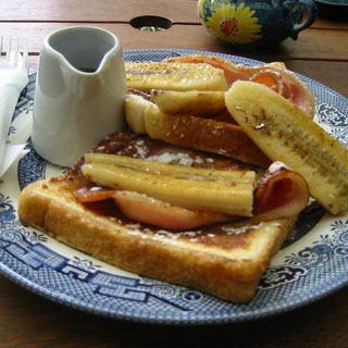
I had breakfast the next morning, about 30 miles up the road at a very nice outdoor cafe that featured a cat walking around greeting the customers. This is French Toast, which at this cafe also includes bananas and bacon. Nice.
Wanganui-Manawatu
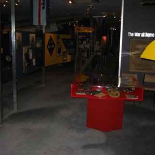
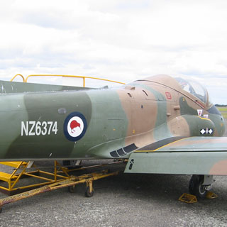
Ohakea has a smaller auxiliary branch of the main New Zealand Air Force Museum, which is down in Christchurch. The New Zealand Air Force has a history to be proud of--particularly their activity during WW2. That said, it must bring mixed emotions for the old veterans who visit, considering that the New Zealand Air Force--as a fighting force--is no more.

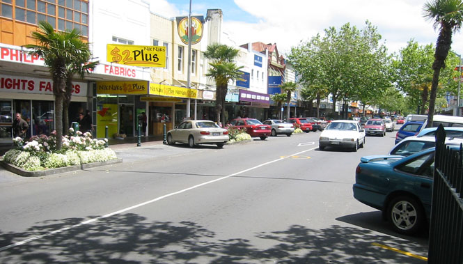
Wanganui is the largest city in the region, and has a particularly large downtown district. I needed to buy a small screwdriver to tighten the frame of my glasses.
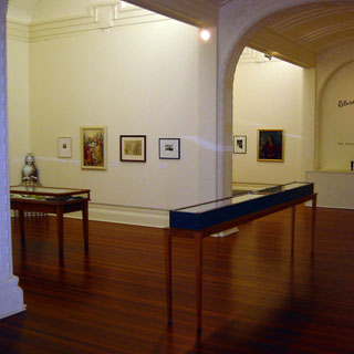
I visited the Sarjeant Gallery, which started with an endowment (from a man named Sarjeant--go figure) and a collection of European 19th century works. The Gallery has clearly shifted their focus to New Zealand works.
A nice building, well lighted, a good layout of the rooms. It just lacked for a little bit of... art.
Taranaki
The road around the Taranaki coastline was mainly rolling and sweeping. This was more relaxing than the day before.
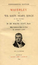
I had started reading Sir Walter Scott's "Waverley" on the flight to New Zealand (on my PDA), and had been reading it at breaks ever since, though I can't say that the Jacobite rebellion of '45 has much to do with New Zealand. Anyway, for that reason only, I stopped at the small town of Waverley just to see if the town's name had anything to do with the novel (not impossible considering that the name was invented by Scott).
The town is typical of several similar sized towns along the coast.

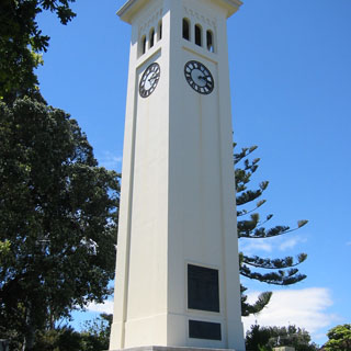
Note the memorial tower, below. The large plaque lists the dead from the first war. The smaller plaque below it lists the dead from the second war.
 but didn't see any notice
of where the town got its name, so I tried the Library. Surprisingly,
even the librarian didn't know how the town got its name (though she was a
native), but she could look it up (being a librarian and all).
but didn't see any notice
of where the town got its name, so I tried the Library. Surprisingly,
even the librarian didn't know how the town got its name (though she was a
native), but she could look it up (being a librarian and all).Answer? It is from the novel. The founders had some idea that it was a good name for the town (Waverley, himself, being a noble and honorable and true Englishman). We checked the card catalogue to see if they even had the book, but, disappointingly, they did not.
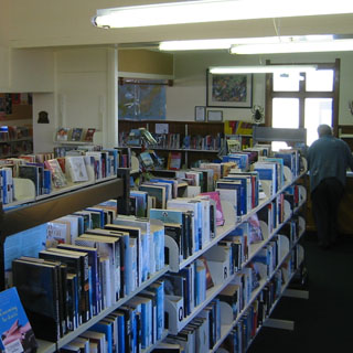 Well,
that's no good. She immediately began to fill out a request-for-book
form, but it was pretty clear that somebody living in Kansas was not going
to make much of an impression on the book purchasing committee (there is
such a thing). So the librarian put her own name down and listed as
the reason something to the effect of, "We really ought to have the book
that named our town." Exactly.
Well,
that's no good. She immediately began to fill out a request-for-book
form, but it was pretty clear that somebody living in Kansas was not going
to make much of an impression on the book purchasing committee (there is
such a thing). So the librarian put her own name down and listed as
the reason something to the effect of, "We really ought to have the book
that named our town." Exactly.
Incidentally, I did check the index of my map for any town named Olney. Considering that I made a special effort this year to ride to Olney, Oklahoma and Olney, Texas (for no other reason than the name), I was fully prepared to go to Olney, New Zealand ...but, it doesn't exist.
I stopped at the beach for an ice-cream cone and to watch the para-surfers. This was a very wide and flat beach and a number of folks eventually showed, playing touch rugby. I had a better chance at sorting the rules of that game than I did with cricket.
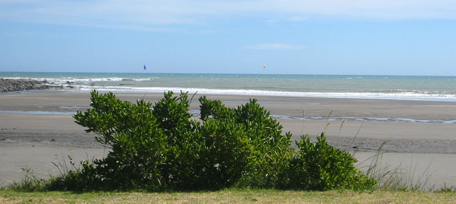
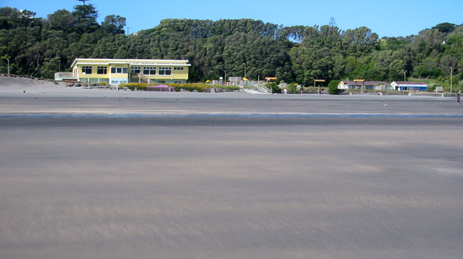
Mount Taranaki completely dominates the horizon for miles. On the left side of the highway is the Tasman Sea, while on the right side is Mount Taranaki.
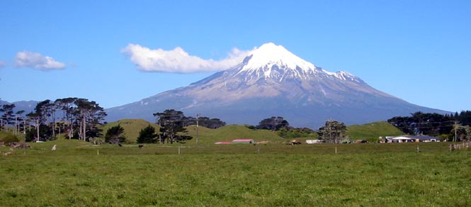
I expected to stop for the night in New Plymouth, but never did come across a hotel that looked worth stopping at. In any case, I was riding through town during what must have been rush-hour, and the traffic was a mess. Better to continue on for just a few miles and find a more restful place.
Urenui would work just fine. There were only five rooms to the motel, but it was neat and clean. At my landlady's suggestion, I walked over to the fish-and-chips place and ordered the right type of fish (Gounard). She was right. Very good.
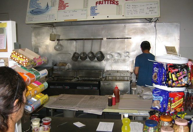
Actually I didn't eat at the takeaway place (which of course had no tables), but walked across town, carrying my fish and chips wrapped in newspaper, to find a seat in the old cemetery. The bowling club grounds of Urenui.
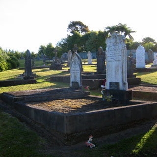
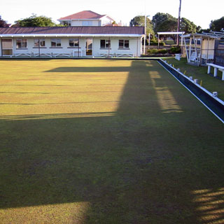
Looking to the north, not very far from my motel.
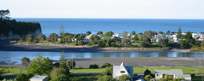
I'd continue the next morning on Highway 3, but I was really heading across the island to the other coast.
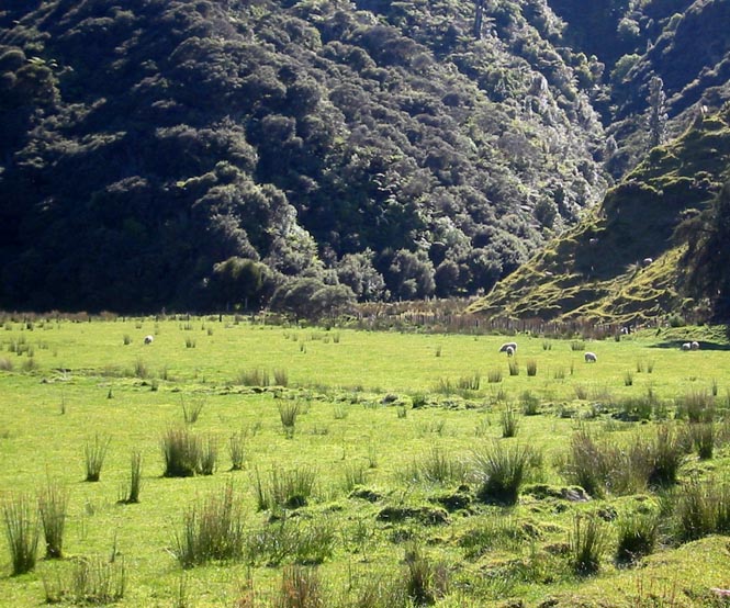
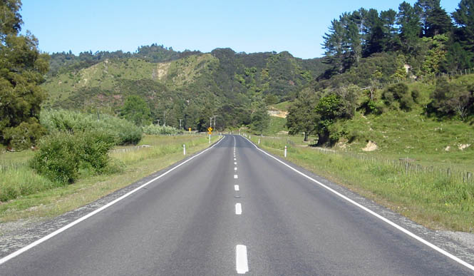
By this time, I'd accepted the fact that ALL the roads are great. You think this is a good one? Try turning on any other road and you'll probably see just as good or better.
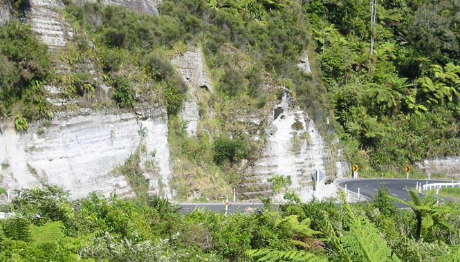
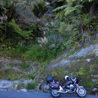
I really didn't see too many tunnels on the trip, but, this was an interesting one. The turn was so sharp that there was a mirror in place to help you keep an eye out for oncoming traffic. It's likely that the longer trucks would be out in your lane to make the turn, and it might be wise to stop before proceeding.
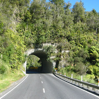
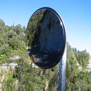
Mokau for breakfast.
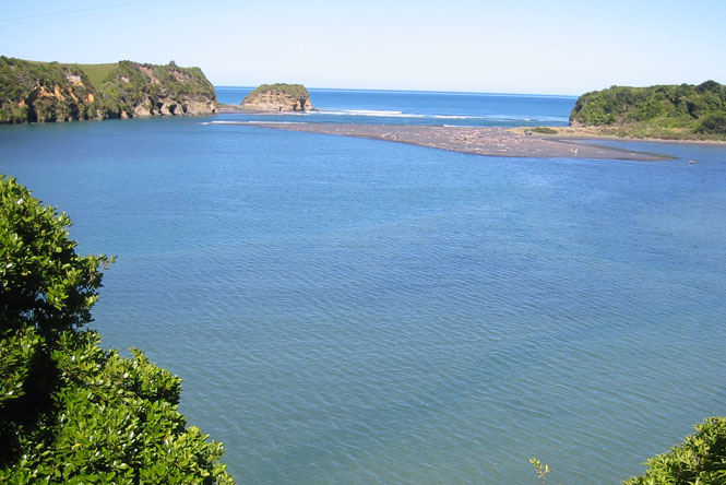
Just a few days earlier I was wearing my warmest clothing, and was riding in (occasional) rain. But, today is perfect.
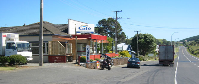
Te Kuiti is a fairly large place, and I took the time to walk around the place and have a milkshake before continuing on.
Something really seemed jarring, though, to have Lynyrd Skynyrd "Sweet Home Alabama" blaring from a clothing store...
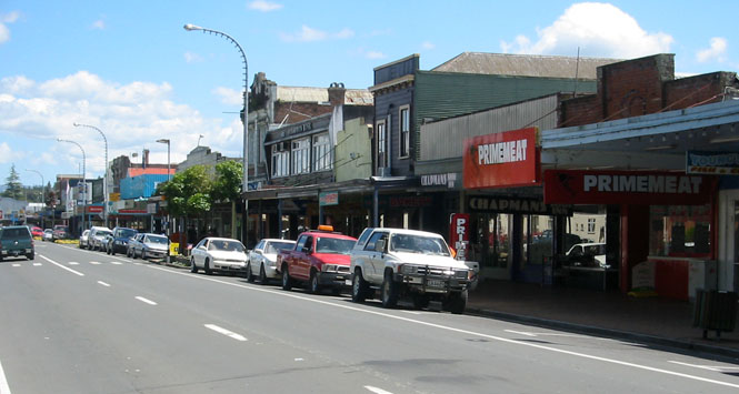
It didn't look as if passenger trains had been through here in many years. Nice iron detail, though.
The landscape really opens up in the interior. This felt more like the eastern slopes of the Rocky Mountains, in Montana.
The Guzzi really sounded good running down this road...
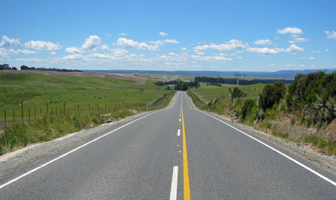
Rotorua
Considering that I expected to be through this town earlier in the trip (and I would have if not for the missing the turn), it was nice to be here, now. For most all of its history (certainly from before the turn of the century) this has been a tourist/spa destination. There is a great deal of thermal activity and hot springs are everywhere.
The attractive building you see was once a bath house, but is now a museum. The wing on the left is for the history of the spas and early Rotorua, while the wing on the right covers much more of the cultural history of what came before and of the Maori.
I sat on a covered porch in front of the bath house enjoying an over-built coffee concoction, watching all the other tourists walk by. Most seemed in an awful hurry.
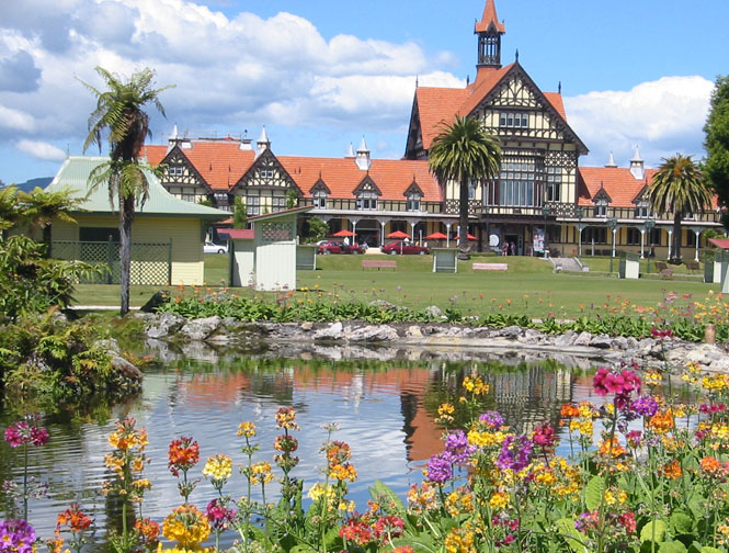
Bay of Plenty
The idea was to head over to the coast, and then to swing north towards Tauranga and then points north. I came across so much road construction, though, that it was apparent that I'd be stopping in Tauranga.
The beach at Mount Maunganui.
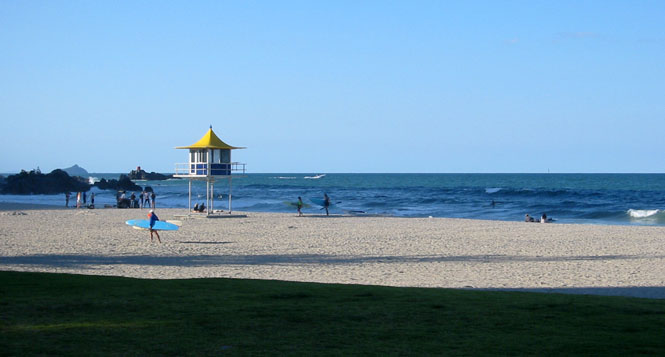
Downtown Tauranga. An active place.
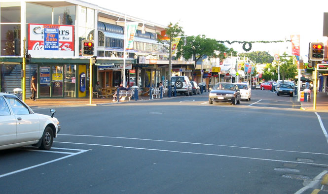
Tauranga Harbour, in front of my hotel room.
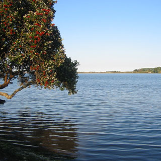
I wasn't expecting quite this much, but I ended up taking half of the top floor of the building to the left. That bay window, and everything to the back is mine. This wasn't a hotel room, this was an apartment.
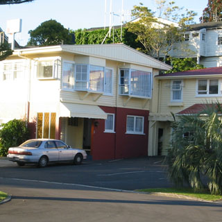
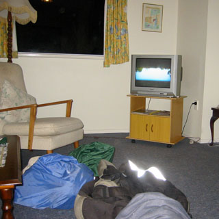
Classic 1950's frumpy, but comfortable.
The last day on the road? Is that possible? I could easily have continued on. The bike was running great, I was feeling good, did I really need to be back at work?
About 20 miles up the highway, I stopped for breakfast, and ate out on the balcony. I couldn't have asked for better weather.
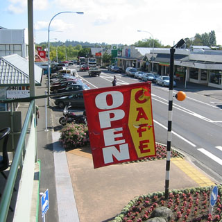
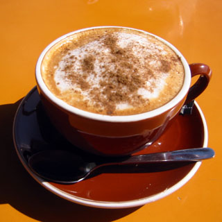
Coromandel
The Coromandel Peninsula extends out beyond Auckland, forming the Firth of Thames and the Hauraki Gulf. I'd be taking the road around its coastline.
All the beaches looked terrific.
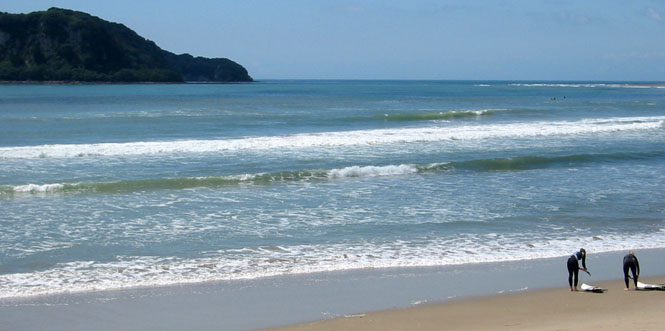
The coastline was full of inlets and harbours.
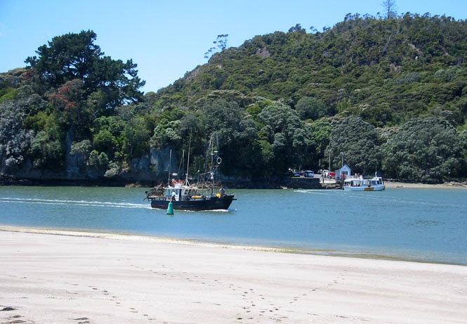
I crossed over the peninsula to the town of Coromandel, and then headed back south.
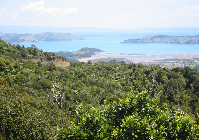
Frankly, this road just about wore me out. The ride around this peninsula was just about as intense as any. One particular problem, though, was that the surface was being renewed in many places, so I did more riding on gravel and tar than I like. Actually, I don't like riding on gravel and tar at all.
I stopped for lunch at Thames, and walked over to the local KTM dealer to talk about off-road riding. That's a whole 'nother thing, but it sure sounds like New Zealand would excel at that, just as it does for pavement riding.
For me, once I got back on the bike at Thames, the trip was just about over. I no longer had the freedom to pick my destinations at a whim. I had to be in Auckland, and there wasn't much question of the route. Straight on to Highway 2, catch the freeway at Highway 1 (more stop-and-go traffic), cross the bridge at Auckland, and then back to Dave's.
It was good to be able to return the bike in as good a shape (albeit a bit dirtier) as it was when I first saw it. Actually, considering the low miles on the motorcycle, it ran better after putting some 3,000 miles on it than it did on that first day I had it. But, I had to turn the keys back in...
Auckland
I stayed at the Copthorne Hotel, again, and on the same floor. By this time I was an old hand at downtown Auckland (and was even able to direct lost tourists). But, except for more local walking around, I didn't do much this last day except relax at the harbour. My flight wasn't until the evening, so I had time to look around just a bit more before catching the bus back to the airport (and I did remember my ticket).
A curious collection of juke boxes rather hidden away in the airport. Curious, only because you wouldn't expect to find such a thing here, but it was very comprehensive and had the whole history of the juke box on display.
Last words.
A terrific trip. Nothing went wrong (although that can often be fun), the motorcycle ran perfectly, the weather was as good as I could have hoped, the people were extraordinarily helpful, I took the right things and left the right things.
Thanks, Dave Gale.
Final last words.
- About 3,000 miles--the same distance as my earlier prairie ride, but twice the days for this one.
- Dave removed the speedometer cable, and it looked fine. So, he reinstalled it, and everything worked normally. Shrug...
- Auckland security confiscated my little screwdriver.
- Avoid Los Angeles International Airport.